{
"uuid": "d2a4f18b-7291-4a40-b3a3-fccbea7ebd83",
"type": "records",
"etag": "e676f20f329a3c83f0eccadb648d5de917a66845",
"data": {
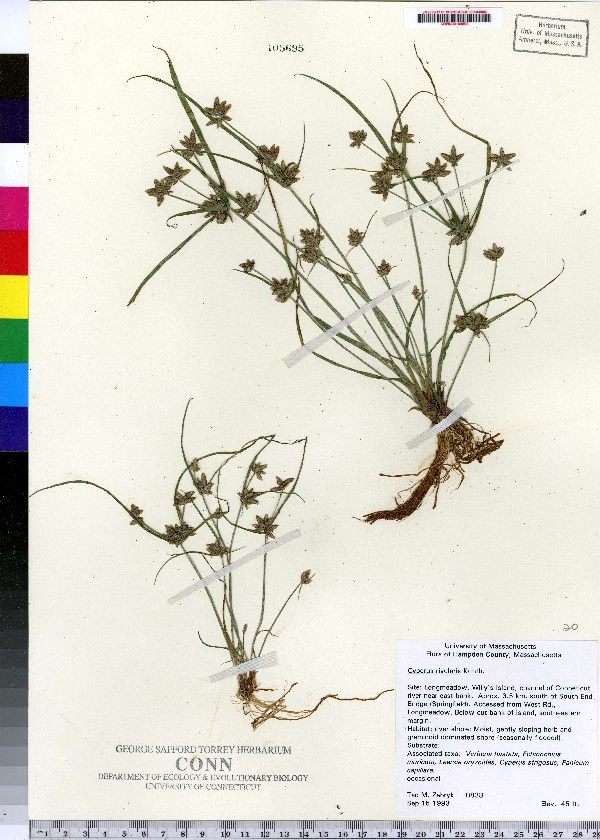
"dwc:specificEpithet": "rivularis",
"dwc:countryCode": "US",
"dwc:county": "Hampden County",
"dwc:recordedBy": "Tad M. Zebryk",
"dwc:georeferenceSources": "no date. Topozone. TopoZone.com © Maps a la carte, Inc. - All rights reserved.",
"dwc:order": "Cyperales",
"dwc:habitat": "Gently sloping, seasonally flooded, river shore",
"dwc:occurrenceID": "urn:catalog:UConn:CONN:CONN00104692",
"dwc:stateProvince": "Massachusetts",
"dwc:eventDate": "1993-09-15",
"dwc:country": "USA",
"dwc:collectionCode": "CONN",
"dwc:verbatimLatitude": "42°03' 00 N",
"dwc:kingdom": "Monocotyledonae",
"dwc:decimalLatitude": "42.05",
"dwc:basisOfRecord": "Preserved Specimen",
"dwc:genus": "Cyperus",
"dwc:family": "Cyperaceae",
"dwc:coordinateUncertaintyInMeters": "20000",
"dwc:municipality": "Longmeadow",
"dwc:previousIdentifications": "Cyperus rivularis Kunth",
"dwc:locationAccordingTo": "seconds added from gazetteer",
"dwc:locality": "Longmeadow, below cut bank of southeastern margin of Willy's Island, channel of Connecticut River near east bank. Approximately 3.5 km south of South End Bridge (Springfield). Accessed from West Road, Longmeadow.",
"dwc:institutionCode": "UConn",
"dwc:reproductiveCondition": "fruiting",
"dwc:higherClassification": "Plantae; Monocotyledonae; Cyperales; Cyperaceae",
"dwc:catalogNumber": "CONN00104692",
"dwc:higherGeography": "USA; Massachusetts; Hampden County; Longmeadow",
"dwc:month": "9",
"dwc:decimalLongitude": "-72.56666",
"dwc:verbatimLongitude": "72°34' 00 W",
"dwc:verbatimEventDate": "15-Sep-93",
"dwc:recordNumber": "828",
"dcterms:rights": "This work is licensed under a Creative Commons CCZero 1.0 License http://i.creativecommons.org/l/by-nc-sa/4.0/88x31.png",
"dcterms:modified": "2010-09-30T00:00-0500",
"dwc:scientificName": "Cyperus bipartitus Torr.",
"dwc:day": "15",
"dwc:datasetID": "98347",
"dwc:year": "1993"
},
"indexTerms": {
"geopoint": {
"lat": 42.05,
"lon": -72.56666
},
"family": "cyperaceae",
"recordset": "e70af26a-fb9e-43ab-96a0-d62a2df37e6d",
"dqs": 0.34782608695652173,
"stateprovince": "massachusetts",
"municipality": "longmeadow",
"county": "hampden county",
"catalognumber": "conn00104692",
"startdayofyear": 258,
"specificepithet": "rivularis",
"continent": "north america",
"uuid": "d2a4f18b-7291-4a40-b3a3-fccbea7ebd83",
"countrycode": "usa",
"basisofrecord": "preservedspecimen",
"collector": "tad m. zebryk",
"institutioncode": "uconn",
"mediarecords": [
"70716d75-dacf-4e06-b644-b46a0477c02e"
],
"datecollected": "1993-09-15T00:00:00+00:00",
"etag": "e676f20f329a3c83f0eccadb648d5de917a66845",
"recordnumber": "828",
"hasImage": true,
"kingdom": "monocotyledonae",
"highertaxon": "plantae; monocotyledonae; cyperales; cyperaceae",
"scientificname": "cyperus bipartitus torr.",
"indexData": {
"dwc:specificEpithet": "rivularis",
"dwc:countryCode": "US",
"dwc:county": "Hampden County",
"dwc:recordedBy": "Tad M. Zebryk",
"idigbio:uuid": "d2a4f18b-7291-4a40-b3a3-fccbea7ebd83",
"dwc:georeferenceSources": "no date. Topozone. TopoZone.com © Maps a la carte, Inc. - All rights reserved.",
"dwc:order": "Cyperales",
"dwc:habitat": "Gently sloping, seasonally flooded, river shore",
"idigbio:isocountrycode": "usa",
"dwc:locality": "Longmeadow, below cut bank of southeastern margin of Willy's Island, channel of Connecticut River near east bank. Approximately 3.5 km south of South End Bridge (Springfield). Accessed from West Road, Longmeadow.",
"idigbio:recordIds": [
"e70af26a-fb9e-43ab-96a0-d62a2df37e6d\\urn:catalog:uconn:conn:conn00104692"
],
"dwc:occurrenceID": "urn:catalog:UConn:CONN:CONN00104692",
"dwc:scientificName": "Cyperus bipartitus Torr.",
"idigbio:parent": "e70af26a-fb9e-43ab-96a0-d62a2df37e6d",
"dwc:stateProvince": "Massachusetts",
"dwc:eventDate": "1993-09-15",
"dwc:country": "united states",
"idigbio:etag": "e676f20f329a3c83f0eccadb648d5de917a66845",
"dwc:collectionCode": "CONN",
"dwc:verbatimLatitude": "42°03' 00 N",
"dwc:kingdom": "Monocotyledonae",
"dwc:decimalLatitude": "42.05",
"dwc:basisOfRecord": "Preserved Specimen",
"dwc:genus": "Cyperus",
"dwc:continent": "north america",
"dwc:family": "Cyperaceae",
"flag_dwc_continent_added": true,
"flag_dwc_country_replaced": true,
"dwc:municipality": "Longmeadow",
"dwc:previousIdentifications": "Cyperus rivularis Kunth",
"idigbio:siblings": {
"mediarecord": [
"70716d75-dacf-4e06-b644-b46a0477c02e"
]
},
"flag_idigbio_isocountrycode_added": true,
"idigbio:dateModified": "2014-09-09T02:57:02.023000",
"dwc:locationAccordingTo": "seconds added from gazetteer",
"dwc:institutionCode": "UConn",
"dwc:reproductiveCondition": "fruiting",
"dwc:higherClassification": "Plantae; Monocotyledonae; Cyperales; Cyperaceae",
"dwc:catalogNumber": "CONN00104692",
"dwc:higherGeography": "USA; Massachusetts; Hampden County; Longmeadow",
"dwc:month": "9",
"dwc:decimalLongitude": "-72.56666",
"dwc:verbatimLongitude": "72°34' 00 W",
"dwc:verbatimEventDate": "15-Sep-93",
"dwc:recordNumber": "828",
"dcterms:rights": "This work is licensed under a Creative Commons CCZero 1.0 License http://i.creativecommons.org/l/by-nc-sa/4.0/88x31.png",
"flag_taxon_match_failed": true,
"dcterms:modified": "2010-09-30T00:00-0500",
"dwc:coordinateUncertaintyInMeters": "20000",
"dwc:day": "15",
"dwc:datasetID": "98347",
"dwc:year": "1993"
},
"hasMedia": true,
"coordinateuncertainty": 20000,
"datemodified": "2014-09-09T02:57:02.023000+00:00",
"occurrenceid": "urn:catalog:uconn:conn:conn00104692",
"country": "united states",
"locality": "longmeadow, below cut bank of southeastern margin of willy's island, channel of connecticut river near east bank. approximately 3.5 km south of south end bridge (springfield). accessed from west road, longmeadow.",
"collectioncode": "conn",
"eventdate": "1993-09-15",
"flags": [
"geopoint_datum_missing",
"geopoint_low_precision",
"dwc_continent_added",
"dwc_country_replaced",
"idigbio_isocountrycode_added",
"taxon_match_failed"
],
"verbatimeventdate": "15-sep-93",
"recordids": [
"e70af26a-fb9e-43ab-96a0-d62a2df37e6d\\urn:catalog:uconn:conn:conn00104692"
],
"genus": "cyperus",
"order": "cyperales",
"datasetid": "98347"
},
"attribution": {
"uuid": "e70af26a-fb9e-43ab-96a0-d62a2df37e6d",
"name": "George Safford Torrey Herbarium (CONN)",
"description": "The George Safford Torrey Herbarium (CONN) at the University of Connecticut supports botanical research in all disciplines, including systematics, taxonomy, biodiversity, ecology, ethnobotany, palaeobotany, evolution and education. With a total of slightly more than 200,000 specimens, the collection has representative species from around the world but is particularly strong in species of northeastern North America.",
"url": "http://bgbaseserver.eeb.uconn.edu/",
"emllink": "http://gbifdata.eeb.uconn.edu:7001/ipt/eml.do?r=idigbio1",
"archivelink": "http://gbifdata.eeb.uconn.edu:7001/ipt/archive.do?r=idigbio1",
"contacts": [
{
"first_name": "Robert",
"last_name": "Capers",
"role": "Plant collections manager",
"email": "robert.capers@uconn.edu"
},
{
"first_name": "Robert",
"last_name": "Capers",
"role": "Plant collections manager",
"email": "robert.capers@uconn.edu"
}
],
"data_rights": "No license, assume Public Domain",
"publisher": "b6bd1367-180a-4a50-b86a-ae6f89c59f90",
"totalCount": 172098
}
}