{
"uuid": "1a17c90d-51b6-45b2-940d-322ba29ea1c0",
"type": "records",
"etag": "712fded8219a495b6a22ad5c9f81a8527836456e",
"data": {
"dwc:identificationRemarks": "Former nature_of_id: legacy.",
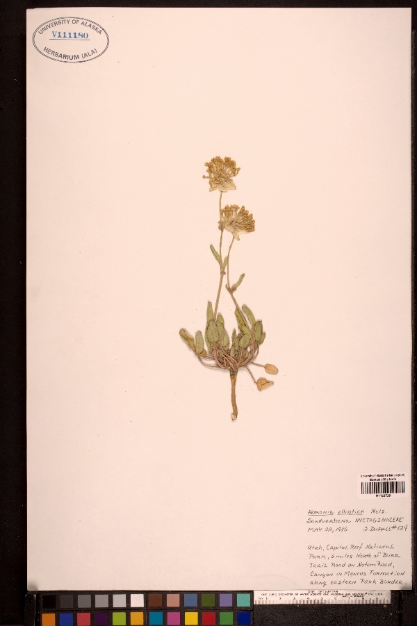
"dwc:specificEpithet": "elliptica",
"dwc:county": "Wayne County",
"dwc:recordedBy": "Collector(s): unknown",
"dwc:georeferencedDate": "2010-01-15 00:00:00",
"dwc:order": "Caryophyllales",
"dcterms:references": "http://arctos.database.museum/guid/UAM:Herb:113753",
"dcterms:accessRights": "http://vertnet.org/resources/norms.html",
"dwc:occurrenceID": "http://arctos.database.museum/guid/UAM:Herb:113753?seid=1555276",
"dwc:dateIdentified": "1986-05-22",
"dwc:verbatimCoordinates": "37.9417607/-111.0590744",
"dwc:verbatimEventDate": "22 May 1986",
"id": "http://arctos.database.museum/guid/UAM:Herb:113753?seid=1555276",
"dwc:establishmentMeans": "wild",
"dwc:stateProvince": "Utah",
"dwc:eventDate": "1986-05-22",
"dwc:collectionID": "6",
"dwc:institutionCode": "UAM",
"dwc:country": "United States",
"dwc:collectionCode": "Herb",
"dwc:higherClassification": "Plantae, Tracheophyta, Magnoliopsida, Caryophyllales, Nyctaginaceae, Abronia,",
"dwc:kingdom": "Plantae",
"dwc:decimalLatitude": "37.9417607000",
"dwc:georeferenceVerificationStatus": "unverified",
"dwc:basisOfRecord": "PreservedSpecimen",
"dwc:genus": "Abronia",
"dwc:family": "Nyctaginaceae",
"dwc:identificationQualifier": "A",
"dwc:identifiedBy": "unknown",
"dwc:identificationVerificationStatus": "unknown",
"dwc:georeferenceSources": "BioGeoMancer",
"dwc:previousIdentifications": "[{\"scientific_name\":\"Abronia elliptica\",\"nature_of_id\":\"unknown\",\"accepted_id_fg\":1,\"made_date\":\"1986-05-22\",\"short_citation\":null,\"publication_id\":null,\"identification_remarks\":\"Former nature_of_id: legacy.\",\"idby\":\"unknown\",\"concept_label\":null}]",
"dwc:organismID": "http://arctos.database.museum/guid/UAM:Herb:113753",
"dwc:phylum": "Tracheophyta",
"dwc:locationAccordingTo": "Gordon H. Jarrell",
"dwc:locality": "6 mi N. of BURR Trail Rd on Notom Rd, Canyon in Mancos Formation along E. park border, Capitol Reef National Park",
"dwc:institutionID": "UAM",
"dwc:associatedMedia": "http://arctos.database.museum/MediaSearch.cfm?collection_object_id=2685424",
"dwc:geodeticDatum": "World Geodetic System 1984",
"dwc:taxonRank": "species",
"dwc:class": "Magnoliopsida",
"dwc:catalogNumber": "UAM:Herb:113753",
"dwc:nomenclaturalCode": "ICBN",
"dwc:higherGeography": "United States, Utah, Wayne County",
"dwc:endDayOfYear": "142",
"dwc:decimalLongitude": "-111.0590744000",
"dwc:coordinateUncertaintyInMeters": "3375",
"dwc:month": "05",
"dwc:otherCatalogNumbers": "ALAAC=V111180",
"dwc:verbatimLocality": "Utah, Capitol Reef National Park, 6 mi North of BURR Trail Road on Notom Road, Canyon in Mancos Formation along eastern park border",
"dwc:georeferencedBy": "Gordon H. Jarrell",
"dwc:day": "22",
"dwc:eventTime": "1986-05-22",
"dwc:preparations": "whole organism",
"dwc:verbatimCoordinateSystem": "decimal degrees",
"dwc:georeferenceProtocol": "BioGeoMancer",
"dcterms:modified": "2022-10-26 09:48:04.91997",
"dwc:scientificName": "Abronia elliptica",
"dwc:footprintWKT": "POLYGON((-111.020663957413 37.9417737146864,-111.021400282696 37.935839158911,-111.023584059336 37.9301323682916,-111.027131073805 37.9248725754285,-111.03190482103 37.9202617971567,-111.037721779811 37.9164770885216,-111.044358475792 37.913663759115,-111.051560059031 37.9119298093589,-111.059050068128 37.9113417974487,-111.066541010203 37.9119222931671,-111.073745356836 37.9136490146619,-111.080386541334 37.9164556807419,-111.086209542615 37.9202345465355,-111.090990655705 37.9248405268055,-111.094546077934 37.9300967510718,-111.096738982476 37.935801340155,-111.097484805932 37.9417351468322,-111.0967545423 37.9476701657946,-111.094575910063 37.9533782915167,-111.091032339558 37.9586400881413,-111.086259811545 37.963253233779,-111.080441661611 37.9670403129747,-111.073801545452 37.9698556552401,-111.066594833701 37.9715909537133,-111.059098768527 37.9721794448686,-111.051601764796 37.9715984859627,-111.044392273759 37.9698704293638,-111.037747645298 37.967061759521,-111.03192342481 37.9632805263609,-111.027143502877 37.9586721755309,-111.023591500828 37.9534139384071,-111.021403724796 37.9477080006082,-111.020663957413 37.9417737146864))",
"dwc:year": "1986"
},
"indexTerms": {
"geopoint": {
"lat": 37.9417607,
"lon": -111.0590744
},
"family": "nyctaginaceae",
"recordset": "b6ec6203-09db-4d6e-8cba-ee4bebd2934c",
"dqs": 0.42028985507246375,
"stateprovince": "utah",
"county": "wayne county",
"phylum": "tracheophyta",
"catalognumber": "uam:herb:113753",
"startdayofyear": 142,
"taxonrank": "species",
"specificepithet": "elliptica",
"continent": "north america",
"datemodified": "2022-12-07T00:58:43.563713+00:00",
"uuid": "1a17c90d-51b6-45b2-940d-322ba29ea1c0",
"countrycode": "usa",
"basisofrecord": "preservedspecimen",
"collector": "collector(s): unknown",
"institutioncode": "uam",
"mediarecords": [
"aee2fd4b-2a60-4a3c-9a05-0d2f71a4ed12",
"9c51c068-4e04-4e5a-8f91-f93e158c1190",
"21228fb8-fade-4e19-9ac1-da76d012c262"
],
"verbatimlocality": "utah, capitol reef national park, 6 mi north of burr trail road on notom road, canyon in mancos formation along eastern park border",
"datecollected": "1986-05-22T00:00:00+00:00",
"etag": "712fded8219a495b6a22ad5c9f81a8527836456e",
"hasMedia": true,
"hasImage": true,
"kingdom": "plantae",
"highertaxon": "plantae, tracheophyta, magnoliopsida, caryophyllales, nyctaginaceae, abronia,",
"collectionid": "6",
"scientificname": "abronia elliptica",
"indexData": {
"dwc:identificationRemarks": "Former nature_of_id: legacy.",
"dwc:specificEpithet": "elliptica",
"idigbio:dateModified": "2022-12-07T00:58:43.563713",
"dwc:county": "Wayne County",
"dwc:recordedBy": "Collector(s): unknown",
"idigbio:uuid": "1a17c90d-51b6-45b2-940d-322ba29ea1c0",
"dwc:georeferencedDate": "2010-01-15 00:00:00",
"dwc:order": "Caryophyllales",
"dcterms:references": "http://arctos.database.museum/guid/UAM:Herb:113753",
"dwc:footprintWKT": "POLYGON((-111.020663957413 37.9417737146864,-111.021400282696 37.935839158911,-111.023584059336 37.9301323682916,-111.027131073805 37.9248725754285,-111.03190482103 37.9202617971567,-111.037721779811 37.9164770885216,-111.044358475792 37.913663759115,-111.051560059031 37.9119298093589,-111.059050068128 37.9113417974487,-111.066541010203 37.9119222931671,-111.073745356836 37.9136490146619,-111.080386541334 37.9164556807419,-111.086209542615 37.9202345465355,-111.090990655705 37.9248405268055,-111.094546077934 37.9300967510718,-111.096738982476 37.935801340155,-111.097484805932 37.9417351468322,-111.0967545423 37.9476701657946,-111.094575910063 37.9533782915167,-111.091032339558 37.9586400881413,-111.086259811545 37.963253233779,-111.080441661611 37.9670403129747,-111.073801545452 37.9698556552401,-111.066594833701 37.9715909537133,-111.059098768527 37.9721794448686,-111.051601764796 37.9715984859627,-111.044392273759 37.9698704293638,-111.037747645298 37.967061759521,-111.03192342481 37.9632805263609,-111.027143502877 37.9586721755309,-111.023591500828 37.9534139384071,-111.021403724796 37.9477080006082,-111.020663957413 37.9417737146864))",
"idigbio:isocountrycode": "usa",
"dcterms:accessRights": "http://vertnet.org/resources/norms.html",
"dwc:locality": "6 mi N. of BURR Trail Rd on Notom Rd, Canyon in Mancos Formation along E. park border, Capitol Reef National Park",
"idigbio:recordIds": [
"b6ec6203-09db-4d6e-8cba-ee4bebd2934c\\urn:occurrence:arctos:uam:herb:113753:1555276",
"b6ec6203-09db-4d6e-8cba-ee4bebd2934c\\http://arctos.database.museum/guid/uam:herb:113753?seid=1555276"
],
"dwc:occurrenceID": "http://arctos.database.museum/guid/UAM:Herb:113753?seid=1555276",
"dwc:dateIdentified": "1986-05-22",
"dwc:verbatimCoordinates": "37.9417607/-111.0590744",
"id": "http://arctos.database.museum/guid/UAM:Herb:113753?seid=1555276",
"dwc:establishmentMeans": "wild",
"idigbio:parent": "b6ec6203-09db-4d6e-8cba-ee4bebd2934c",
"dwc:stateProvince": "Utah",
"dwc:eventDate": "1986-05-22",
"dwc:collectionID": "6",
"dwc:country": "United States",
"idigbio:etag": "712fded8219a495b6a22ad5c9f81a8527836456e",
"dwc:collectionCode": "Herb",
"dwc:class": "Magnoliopsida",
"dwc:kingdom": "Plantae",
"dwc:decimalLatitude": "37.9417607000",
"dwc:georeferenceVerificationStatus": "unverified",
"dwc:basisOfRecord": "PreservedSpecimen",
"dwc:genus": "Abronia",
"dwc:continent": "north america",
"dwc:family": "Nyctaginaceae",
"flag_dwc_continent_added": true,
"dwc:identifiedBy": "unknown",
"dwc:identificationVerificationStatus": "unknown",
"dwc:preparations": "whole organism",
"dwc:previousIdentifications": "[{\"scientific_name\":\"Abronia elliptica\",\"nature_of_id\":\"unknown\",\"accepted_id_fg\":1,\"made_date\":\"1986-05-22\",\"short_citation\":null,\"publication_id\":null,\"identification_remarks\":\"Former nature_of_id: legacy.\",\"idby\":\"unknown\",\"concept_label\":null}]",
"dwc:geodeticDatum": "World Geodetic System 1984",
"idigbio:siblings": {
"mediarecord": [
"aee2fd4b-2a60-4a3c-9a05-0d2f71a4ed12",
"9c51c068-4e04-4e5a-8f91-f93e158c1190",
"21228fb8-fade-4e19-9ac1-da76d012c262"
]
},
"flag_idigbio_isocountrycode_added": true,
"dwc:organismID": "http://arctos.database.museum/guid/UAM:Herb:113753",
"dwc:phylum": "Tracheophyta",
"dwc:locationAccordingTo": "Gordon H. Jarrell",
"dwc:georeferenceSources": "BioGeoMancer",
"dwc:institutionID": "UAM",
"dwc:associatedMedia": "http://arctos.database.museum/MediaSearch.cfm?collection_object_id=2685424",
"dwc:institutionCode": "UAM",
"dwc:taxonRank": "species",
"dwc:higherClassification": "Plantae, Tracheophyta, Magnoliopsida, Caryophyllales, Nyctaginaceae, Abronia,",
"dwc:catalogNumber": "UAM:Herb:113753",
"dwc:nomenclaturalCode": "ICBN",
"dwc:higherGeography": "United States, Utah, Wayne County",
"dwc:endDayOfYear": "142",
"dwc:decimalLongitude": "-111.0590744000",
"dwc:scientificName": "Abronia elliptica",
"dwc:month": "05",
"dwc:otherCatalogNumbers": "ALAAC=V111180",
"dwc:verbatimLocality": "Utah, Capitol Reef National Park, 6 mi North of BURR Trail Road on Notom Road, Canyon in Mancos Formation along eastern park border",
"dwc:georeferencedBy": "Gordon H. Jarrell",
"dwc:verbatimEventDate": "22 May 1986",
"dwc:eventTime": "1986-05-22",
"dwc:identificationQualifier": "A",
"dwc:verbatimCoordinateSystem": "decimal degrees",
"flag_taxon_match_failed": true,
"dwc:georeferenceProtocol": "BioGeoMancer",
"dcterms:modified": "2022-10-26 09:48:04.91997",
"dwc:coordinateUncertaintyInMeters": "3375",
"dwc:day": "22",
"dwc:year": "1986"
},
"coordinateuncertainty": 3375,
"class": "magnoliopsida",
"occurrenceid": "http://arctos.database.museum/guid/uam:herb:113753?seid=1555276",
"institutionid": "uam",
"country": "united states",
"locality": "6 mi n. of burr trail rd on notom rd, canyon in mancos formation along e. park border, capitol reef national park",
"collectioncode": "herb",
"eventdate": "1986-05-22",
"flags": [
"geopoint_datum_error",
"dwc_continent_added",
"idigbio_isocountrycode_added",
"taxon_match_failed"
],
"verbatimeventdate": "22 may 1986",
"recordids": [
"b6ec6203-09db-4d6e-8cba-ee4bebd2934c\\urn:occurrence:arctos:uam:herb:113753:1555276",
"b6ec6203-09db-4d6e-8cba-ee4bebd2934c\\http://arctos.database.museum/guid/uam:herb:113753?seid=1555276"
],
"genus": "abronia",
"order": "caryophyllales"
},
"attribution": {
"uuid": "b6ec6203-09db-4d6e-8cba-ee4bebd2934c",
"name": "UAM Herbarium (ALA), Vascular Plant Collection (Arctos)",
"description": "The Herbarium (ALA) at the University of Alaska Museum is the major regional herbarium in Alaska and part of a network of similar collections with an interest in the origin and evolution of the circumpolar flora. ALA contains more than 260,000 specimens of vascular and non-vascular plants. Data for the Vascular Plant and Cryptogam collections are managed separately in Arctos. Much of our understanding of Ice Age Beringia is based on botanical specimens, the largest collection of which is housed at ALA. Our recent acquisition from Iowa State University of the J. P. Anderson Collection (32,000 specimens on permanent loan) forms a significant part of this story. This collection of arctic and boreal plants, which contains 67 nomenclatural type specimens, formed the basis for much of Anderson’s seminal work, The Flora of Alaska. The botanical collection also includes plants from other states, Canada, Greenland, Fennoscandia, Japan, and Russia and provides a basis for teaching and research. Our botanical collection can be viewed and searched through the Arctos database and includes high resolution images of 163,000 herbarium sheets, online representation of 190,000 holdings, and inclusion of all holdings in an object-tracking system (barcode labeling).",
"url": "http://www.uaf.edu/museum/collections/herb/",
"emllink": "http://ipt.vertnet.org:8080/ipt/eml.do?r=uam_herb_vascular",
"archivelink": "http://ipt.vertnet.org:8080/ipt/archive.do?r=uam_herb_vascular",
"contacts": [
{
"first_name": "Steffi",
"last_name": "Ickert-Bond",
"role": "Curator of the Herbarium (ALA)",
"email": "smickertbond@alaska.edu"
},
{
"first_name": "Steffi",
"last_name": "Ickert-Bond",
"role": "Curator of the Herbarium (ALA)",
"email": "smickertbond@alaska.edu"
},
{
"first_name": "Laura",
"last_name": "Russell",
"role": "VertNet Programmer",
"email": "larussell@vertnet.org"
},
{
"first_name": "David",
"last_name": "Bloom",
"role": "VertNet Coordinator",
"email": "dbloom@vertnet.org"
},
{
"first_name": "John",
"last_name": "Wieczorek",
"role": "Information Architect",
"email": "tuco@berkeley.edu"
},
{
"first_name": "Dusty",
"last_name": "McDonald",
"role": "Arctos Database Programmer",
"email": "dlmcdonald@alaska.edu"
},
{
"first_name": "Jordan",
"last_name": "Metzgar",
"role": "Collection Manager, Herbarium",
"email": "jsmetzgar@alaska.edu"
},
{
"first_name": "Alan",
"last_name": "Batten",
"role": "Research Associate, Herbarium",
"email": "fnarb@uaf.edu"
},
{
"first_name": "Steffi",
"last_name": "Ickert-Bond",
"role": "Curator of the Herbarium (ALA)",
"email": "smickertbond@alaska.edu"
}
],
"data_rights": "CC4 BY",
"publisher": "842a2bb5-d705-4d6c-8401-abf3ca28c05d",
"totalCount": 200630
}
}