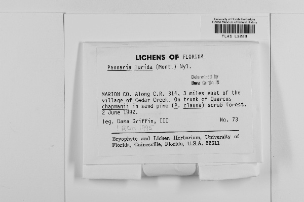
{
"uuid": "122dedce-41c0-4f57-bfcf-0eb609402bd1",
"type": "records",
"etag": "8678ee518f8a2e477b57edc1755a28e3636cae4b",
"data": {
"dwc:startDayOfYear": "154",
"dwc:specificEpithet": "lurida",
"dwc:county": "Marion",
"dwc:recordedBy": "Dana Griffin, III",
"dwc:georeferenceSources": "georef batch tool 2015-08-04; GeoLocate",
"dwc:order": "Peltigerales",
"dwc:habitat": "in sand pine, P. clausa, scrub forest; on trunk of Quercus chapmanii",
"dwc:scientificNameAuthorship": "(Mont.) Nyl.",
"dwc:occurrenceID": "1357974",
"dwc:dateIdentified": "1995",
"dwc:verbatimEventDate": "2 June 1992",
"symbiota:recordEnteredBy": "maysk12",
"dwc:stateProvince": "Florida",
"dwc:eventDate": "1992-06-02",
"dwc:collectionID": "2a40ef36-3117-4295-8c11-a672db19b4a0",
"dwc:country": "United States",
"idigbio:recordId": "urn:uuid:f38f572f-7b05-4cda-a015-cf6294b04bf7",
"dwc:georeferenceRemarks": "Google Maps and ESRI USGS Topo USA map have Cedar Creek and Dead River reversed; could find no evidence of a village on Cedar Creek",
"dwc:kingdom": "Fungi",
"dwc:decimalLatitude": "29.275302",
"dwc:georeferenceVerificationStatus": "reviewed - low confidence",
"dwc:basisOfRecord": "PreservedSpecimen",
"dwc:genus": "Pannaria",
"dwc:family": "Pannariaceae",
"dc:rights": "http://creativecommons.org/licenses/by-nc/3.0/",
"dwc:identifiedBy": "RCH",
"dwc:coordinateUncertaintyInMeters": "800",
"dwc:phylum": "Ascomycota",
"dcterms:references": "http://lichenportal.org/portal/collections/individual/index.php?occid=1357974",
"dwc:locality": "along C.R. 314, 3 miles east of the village of Cedar Creek",
"dwc:institutionCode": "FLAS",
"dwc:class": "Lecanoromycetes",
"dwc:catalogNumber": "FLAS L5223",
"dwc:month": "6",
"dwc:decimalLongitude": "-81.884072",
"dwc:scientificName": "Pannaria lurida",
"dwc:georeferencedBy": "nickirows (2015-08-04 17:26:56)",
"dwc:day": "2",
"dwc:recordNumber": "73",
"dcterms:modified": "2015-08-04 20:26:56",
"dwc:associatedTaxa": "P. clausa & Quercus chapmanii",
"dwc:footprintWKT": "29.274928,-81.900208,29.272906,-81.900466,29.27358,-81.890595,29.274479,-81.884072,29.276275,-81.870167,29.277848,-81.87094,29.274928,-81.900208",
"dwc:year": "1992"
},
"indexTerms": {
"geopoint": {
"lat": 29.275302,
"lon": -81.884072
},
"family": "pannariaceae",
"recordset": "b5e5c781-765f-4981-af2a-c19c250e2cf0",
"dqs": 0.2608695652173913,
"stateprovince": "florida",
"county": "marion",
"phylum": "ascomycota",
"catalognumber": "flas l5223",
"startdayofyear": 154,
"taxonrank": "species",
"specificepithet": "lurida",
"continent": "north america",
"uuid": "122dedce-41c0-4f57-bfcf-0eb609402bd1",
"countrycode": "usa",
"basisofrecord": "preservedspecimen",
"collector": "dana griffin, iii",
"institutioncode": "flas",
"mediarecords": [
"5d7d404e-c90c-449c-b94b-8f515eef6048"
],
"datemodified": "2016-04-07T16:58:19.070485+00:00",
"datecollected": "1992-06-02T00:00:00+00:00",
"etag": "8678ee518f8a2e477b57edc1755a28e3636cae4b",
"recordnumber": "73",
"hasImage": true,
"kingdom": "fungi",
"collectionid": "2a40ef36-3117-4295-8c11-a672db19b4a0",
"taxonid": "2601215",
"scientificname": "pannaria lurida",
"indexData": {
"dwc:startDayOfYear": "154",
"flag_dwc_taxonrank_added": true,
"dwc:specificEpithet": "lurida",
"idigbio:dateModified": "2016-04-07T16:58:19.070485",
"dwc:county": "Marion",
"dwc:recordedBy": "Dana Griffin, III",
"flag_dwc_parentnameusageid_added": true,
"dwc:locality": "along C.R. 314, 3 miles east of the village of Cedar Creek",
"dwc:order": "Peltigerales",
"dwc:habitat": "in sand pine, P. clausa, scrub forest; on trunk of Quercus chapmanii",
"flag_gbif_reference_added": true,
"dwc:scientificNameAuthorship": "nyl. (mont.)",
"idigbio:recordIds": [
"urn:uuid:f38f572f-7b05-4cda-a015-cf6294b04bf7",
"b5e5c781-765f-4981-af2a-c19c250e2cf0\\1357974"
],
"dwc:occurrenceID": "1357974",
"dwc:dateIdentified": "1995",
"flag_gbif_canonicalname_added": true,
"gbif:vernacularname": [
{
"dwc:countrycode": "ca",
"dwc:country": "canada",
"dwc:vernacularname": "pannaire jaune pâle",
"coreid": "2601215",
"dcterms:source": "catalogue of life",
"dcterms:language": "fr"
},
{
"dwc:countrycode": "ca",
"dwc:country": "canada",
"dwc:vernacularname": "veined shingle lichen",
"coreid": "2601215",
"dcterms:source": "catalogue of life",
"dcterms:language": "en"
}
],
"flag_dwc_taxonomicstatus_added": true,
"flag_gbif_genericname_added": true,
"symbiota:recordEnteredBy": "maysk12",
"flag_dwc_datasetid_added": true,
"idigbio:parent": "b5e5c781-765f-4981-af2a-c19c250e2cf0",
"dwc:stateProvince": "Florida",
"flag_gbif_taxon_corrected": true,
"dwc:datasetid": "7ddf754f-d193-4cc9-b351-99906754a03b",
"dwc:eventDate": "1992-06-02",
"flag_dwc_scientificnameauthorship_replaced": true,
"dwc:collectionID": "2a40ef36-3117-4295-8c11-a672db19b4a0",
"dwc:country": "United States",
"idigbio:recordId": "urn:uuid:f38f572f-7b05-4cda-a015-cf6294b04bf7",
"idigbio:etag": "8678ee518f8a2e477b57edc1755a28e3636cae4b",
"dwc:decimalLatitude": "29.275302",
"gbif:reference": [
{
"coreid": "2601215",
"dcterms:source": "catalogue of life",
"dcterms:bibliographiccitation": "nyl. in nylander (1857) in: mém. soc. sci. nat. cherbourg vol.: 5 p. 109"
}
],
"dwc:kingdom": "Fungi",
"dwc:georeferenceRemarks": "Google Maps and ESRI USGS Topo USA map have Cedar Creek and Dead River reversed; could find no evidence of a village on Cedar Creek",
"dwc:georeferenceVerificationStatus": "reviewed - low confidence",
"dwc:originalnameusageid": "5478322",
"idigbio:uuid": "122dedce-41c0-4f57-bfcf-0eb609402bd1",
"dwc:basisOfRecord": "PreservedSpecimen",
"dwc:taxonomicstatus": "accepted",
"dwc:genus": "Pannaria",
"dwc:continent": "north america",
"dwc:family": "Pannariaceae",
"dc:rights": "http://creativecommons.org/licenses/by-nc/3.0/",
"dwc:identifiedBy": "RCH",
"dwc:associatedTaxa": "P. clausa & Quercus chapmanii",
"flag_dwc_taxonid_added": true,
"idigbio:siblings": {
"mediarecord": [
"5d7d404e-c90c-449c-b94b-8f515eef6048"
]
},
"flag_idigbio_isocountrycode_added": true,
"gbif:canonicalname": "pannaria lurida",
"dwc:phylum": "Ascomycota",
"dcterms:references": "http://lichenportal.org/portal/collections/individual/index.php?occid=1357974",
"gbif:genericname": "pannaria",
"dwc:georeferenceSources": "georef batch tool 2015-08-04; GeoLocate",
"flag_gbif_vernacularname_added": true,
"dwc:institutionCode": "FLAS",
"dwc:footprintWKT": "29.274928,-81.900208,29.272906,-81.900466,29.27358,-81.890595,29.274479,-81.884072,29.276275,-81.870167,29.277848,-81.87094,29.274928,-81.900208",
"dwc:parentnameusageid": "7444868",
"dwc:class": "Lecanoromycetes",
"dwc:catalogNumber": "FLAS L5223",
"dwc:taxonid": "2601215",
"dwc:taxonrank": "species",
"dwc:month": "6",
"dwc:decimalLongitude": "-81.884072",
"dwc:scientificName": "Pannaria lurida",
"dwc:georeferencedBy": "nickirows (2015-08-04 17:26:56)",
"dwc:verbatimEventDate": "2 June 1992",
"flag_dwc_continent_added": true,
"dwc:recordNumber": "73",
"idigbio:isocountrycode": "usa",
"flag_dwc_originalnameusageid_added": true,
"flag_taxon_match_failed": true,
"dcterms:modified": "2015-08-04 20:26:56",
"dwc:coordinateUncertaintyInMeters": "800",
"dwc:day": "2",
"dwc:year": "1992"
},
"hasMedia": true,
"coordinateuncertainty": 800,
"class": "lecanoromycetes",
"occurrenceid": "1357974",
"country": "united states",
"locality": "along c.r. 314, 3 miles east of the village of cedar creek",
"canonicalname": "pannaria lurida",
"eventdate": "1992-06-02",
"flags": [
"geopoint_datum_missing",
"dwc_taxonrank_added",
"dwc_parentnameusageid_added",
"gbif_reference_added",
"gbif_canonicalname_added",
"dwc_taxonomicstatus_added",
"gbif_genericname_added",
"dwc_datasetid_added",
"gbif_taxon_corrected",
"dwc_scientificnameauthorship_replaced",
"dwc_taxonid_added",
"idigbio_isocountrycode_added",
"gbif_vernacularname_added",
"dwc_continent_added",
"dwc_originalnameusageid_added",
"taxon_match_failed"
],
"verbatimeventdate": "2 june 1992",
"taxonomicstatus": "accepted",
"recordids": [
"urn:uuid:f38f572f-7b05-4cda-a015-cf6294b04bf7",
"b5e5c781-765f-4981-af2a-c19c250e2cf0\\1357974"
],
"genus": "pannaria",
"order": "peltigerales",
"datasetid": "7ddf754f-d193-4cc9-b351-99906754a03b"
},
"attribution": {
"uuid": "b5e5c781-765f-4981-af2a-c19c250e2cf0",
"name": "University of Florida Herbarium",
"description": "The University of Florida Herbarium is a unit of the Department of Natural History of the Florida Museum of Natural History. The herbarium is affiliated with the Institute of Food and Agricultural Sciences, Florida Agricultural Experiment Station, Florida Cooperative Extension Service, Department of Biology and the Department of Plant Pathology. The FLAS acronym is the standard international abbreviation for the University of Florida Herbarium. It is derived from the herbarium's early association with the Florida Agricultural Experiment Station. Our mission focuses in plant collections acquisition and care, research based on the collections, education and public service.",
"logo": "http://lichenportal.org/portal/images/collicons/flas.jpg",
"url": "http://www.flmnh.ufl.edu/herbarium/",
"emllink": "http://lichenportal.org/portal/collections/datasets/dwc/flas_dwc-a.eml",
"archivelink": "http://lichenportal.org/portal/collections/datasets/dwc/flas_dwc-a.zip",
"contacts": [
{
"email": "CNALHadmin@asu.edu"
},
{
"first_name": "Kent Perkins, Collection Manager",
"email": "herb@flmnh.ufl.edu"
}
],
"data_rights": "CC3 BY-NC",
"publisher": "efd00b2c-5ade-4a90-a95a-3f9188fcfa71",
"totalCount": 10820
}
}
 The University of Florida Herbarium is a unit of the Department of Natural History of the Florida Museum of Natural History. The herbarium is affiliated with the Institute of Food and Agricultural Sciences, Florida Agricultural Experiment Station, Florida Cooperative Extension Service, Department of Biology and the Department of Plant Pathology. The FLAS acronym is the standard international abbreviation for the University of Florida Herbarium. It is derived from the herbarium's early association with the Florida Agricultural Experiment Station. Our mission focuses in plant collections acquisition and care, research based on the collections, education and public service.