{
"uuid": "e8b7038c-2b88-44cc-881c-8cfd80a5af39",
"type": "records",
"etag": "363c1bc4c39116d44f71f4895d96a0bdf6e24887",
"data": {
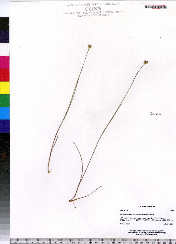
"dwc:specificEpithet": "stygius var. americanus",
"dwc:countryCode": "US",
"dwc:county": "Somerset County",
"dwc:recordedBy": "Arthur Haines",
"dwc:georeferenceSources": "no date. USGS Geographic Names Information System (GNIS). U. S. Geological Survey.",
"dwc:order": "Juncales",
"dwc:occurrenceID": "urn:catalog:UConn:CONN:CONN00155218",
"dwc:verbatimElevation": "1204 FT",
"dwc:stateProvince": "Maine",
"dwc:eventDate": "2001-08-16",
"dwc:country": "USA",
"dwc:collectionCode": "CONN",
"dwc:verbatimLatitude": "45°37' 17\" N",
"dwc:kingdom": "Monocotyledonae",
"dwc:decimalLatitude": "45.62138",
"dwc:maximumElevationInMeters": "366",
"dwc:basisOfRecord": "Preserved Specimen",
"dwc:genus": "Juncus",
"dwc:family": "Juncaceae",
"dwc:coordinateUncertaintyInMeters": "20000",
"dwc:municipality": "Long Pond",
"dwc:previousIdentifications": "Juncus stygius var. americanus Buchenau",
"dwc:vernacularName": "moor rush",
"dwc:locationAccordingTo": "seconds added from gazetteer",
"dwc:locality": "Long Pond Township | 12 Mile Bog",
"dwc:institutionCode": "UConn",
"dwc:reproductiveCondition": "fruiting",
"dwc:higherClassification": "Plantae; Monocotyledonae; Juncales; Juncaceae",
"dwc:catalogNumber": "CONN00155218",
"dwc:higherGeography": "USA; Maine; Somerset County; Long Pond",
"dwc:month": "8",
"dwc:decimalLongitude": "-70.08638",
"dwc:verbatimLongitude": "70°05' 11\" W",
"dwc:verbatimEventDate": "16-Aug-01",
"dcterms:rights": "This work is licensed under a Creative Commons CCZero 1.0 License http://i.creativecommons.org/l/by-nc-sa/4.0/88x31.png",
"dwc:minimumElevationInMeters": "366",
"dcterms:modified": "2012-06-01T00:00-0500",
"dwc:scientificName": "Juncus stygius var. americanus Buchenau",
"dwc:day": "16",
"dwc:datasetID": "143638",
"dwc:year": "2001"
},
"indexTerms": {
"family": "juncaceae",
"recordset": "e70af26a-fb9e-43ab-96a0-d62a2df37e6d",
"dqs": 0.391304347826087,
"stateprovince": "maine",
"institutioncode": "uconn",
"municipality": "long pond",
"county": "somerset county",
"catalognumber": "conn00155218",
"startdayofyear": 228,
"specificepithet": "stygius var. americanus",
"continent": "north america",
"uuid": "e8b7038c-2b88-44cc-881c-8cfd80a5af39",
"countrycode": "usa",
"basisofrecord": "preservedspecimen",
"collector": "arthur haines",
"commonnames": [
"moor rush"
],
"mediarecords": [
"35b0bda8-2704-4ea6-995b-4e1c4085be57"
],
"datecollected": "2001-08-16T00:00:00+00:00",
"etag": "363c1bc4c39116d44f71f4895d96a0bdf6e24887",
"hasMedia": true,
"minelevation": 366,
"hasImage": true,
"kingdom": "monocotyledonae",
"maxelevation": 366,
"highertaxon": "plantae; monocotyledonae; juncales; juncaceae",
"commonname": "moor rush",
"scientificname": "juncus stygius var. americanus buchenau",
"locality": "long pond township | 12 mile bog",
"coordinateuncertainty": 20000,
"datemodified": "2014-09-12T19:36:11.040000+00:00",
"occurrenceid": "urn:catalog:uconn:conn:conn00155218",
"country": "united states",
"geopoint": {
"lat": 45.62138,
"lon": -70.08638
},
"collectioncode": "conn",
"eventdate": "2001-08-16",
"flags": [
"geopoint_datum_missing",
"dwc_continent_added",
"dwc_country_replaced",
"idigbio_isocountrycode_added",
"taxon_match_failed"
],
"verbatimeventdate": "16-aug-01",
"recordids": [
"e70af26a-fb9e-43ab-96a0-d62a2df37e6d\\urn:catalog:uconn:conn:conn00155218"
],
"genus": "juncus",
"order": "juncales",
"datasetid": "143638",
"indexData": {
"dwc:specificEpithet": "stygius var. americanus",
"dwc:countryCode": "US",
"dwc:county": "Somerset County",
"dwc:recordedBy": "Arthur Haines",
"idigbio:uuid": "e8b7038c-2b88-44cc-881c-8cfd80a5af39",
"dwc:locationAccordingTo": "seconds added from gazetteer",
"dwc:order": "Juncales",
"idigbio:isocountrycode": "usa",
"dwc:locality": "Long Pond Township | 12 Mile Bog",
"idigbio:recordIds": [
"e70af26a-fb9e-43ab-96a0-d62a2df37e6d\\urn:catalog:uconn:conn:conn00155218"
],
"dwc:occurrenceID": "urn:catalog:UConn:CONN:CONN00155218",
"dwc:scientificName": "Juncus stygius var. americanus Buchenau",
"dwc:verbatimElevation": "1204 FT",
"idigbio:parent": "e70af26a-fb9e-43ab-96a0-d62a2df37e6d",
"dwc:stateProvince": "Maine",
"dwc:eventDate": "2001-08-16",
"dwc:country": "united states",
"idigbio:etag": "363c1bc4c39116d44f71f4895d96a0bdf6e24887",
"dwc:collectionCode": "CONN",
"dwc:verbatimLatitude": "45°37' 17\" N",
"dwc:kingdom": "Monocotyledonae",
"dwc:decimalLatitude": "45.62138",
"dwc:maximumElevationInMeters": "366",
"dwc:basisOfRecord": "Preserved Specimen",
"dwc:genus": "Juncus",
"dwc:continent": "north america",
"dwc:family": "Juncaceae",
"flag_dwc_continent_added": true,
"flag_dwc_country_replaced": true,
"dwc:municipality": "Long Pond",
"dwc:previousIdentifications": "Juncus stygius var. americanus Buchenau",
"idigbio:siblings": {
"mediarecord": [
"35b0bda8-2704-4ea6-995b-4e1c4085be57"
]
},
"flag_idigbio_isocountrycode_added": true,
"dwc:vernacularName": "moor rush",
"idigbio:dateModified": "2014-09-12T19:36:11.040000",
"dwc:georeferenceSources": "no date. USGS Geographic Names Information System (GNIS). U. S. Geological Survey.",
"dwc:institutionCode": "UConn",
"dwc:reproductiveCondition": "fruiting",
"dwc:higherClassification": "Plantae; Monocotyledonae; Juncales; Juncaceae",
"dwc:catalogNumber": "CONN00155218",
"dwc:higherGeography": "USA; Maine; Somerset County; Long Pond",
"dwc:month": "8",
"dwc:decimalLongitude": "-70.08638",
"dwc:verbatimLongitude": "70°05' 11\" W",
"dwc:verbatimEventDate": "16-Aug-01",
"dcterms:rights": "This work is licensed under a Creative Commons CCZero 1.0 License http://i.creativecommons.org/l/by-nc-sa/4.0/88x31.png",
"flag_taxon_match_failed": true,
"dwc:minimumElevationInMeters": "366",
"dcterms:modified": "2012-06-01T00:00-0500",
"dwc:coordinateUncertaintyInMeters": "20000",
"dwc:day": "16",
"dwc:datasetID": "143638",
"dwc:year": "2001"
}
},
"attribution": {
"totalCount": 172098
}
}