{
"uuid": "e25e79cc-8b11-4141-91b9-b34cce32b29f",
"type": "records",
"etag": "c773ee853e6943632136c3ffcbb55408765607a6",
"data": {
"dwc:identificationRemarks": "Former nature_of_id: student.",
"dwc:verbatimCoordinates": "64d 3m 0s N/141d 53m 0s W",
"dwc:kingdom": "Animalia",
"dwc:recordedBy": "Collector(s): William Barker, John Cook, Gary Selinger",
"dwc:georeferencedDate": "1983-06-01 00:00:00",
"dcterms:references": "http://arctos.database.museum/guid/UAM:ES:11381",
"dcterms:accessRights": "http://vertnet.org/resources/norms.html",
"dwc:occurrenceID": "http://arctos.database.museum/guid/UAM:ES:11381?seid=1243663",
"id": "http://arctos.database.museum/guid/UAM:ES:11381?seid=1243663",
"dwc:establishmentMeans": "wild",
"dwc:stateProvince": "Alaska",
"dwc:locationRemarks": "Lost Chicken Creek flows SE 1 mile to South fork of Fortymile River, 55 miles SW of Eagle, Yukon Tanana Highland",
"dwc:eventDate": "1983-05-01/1986-08-31",
"dwc:collectionID": "21",
"dwc:institutionCode": "UAM",
"dwc:country": "United States",
"dwc:earliestPeriodOrLowestSystem": "Quaternary",
"dwc:collectionCode": "ES",
"dwc:higherClassification": "; Animalia, Chordata,",
"dwc:decimalLatitude": "64.0644940000",
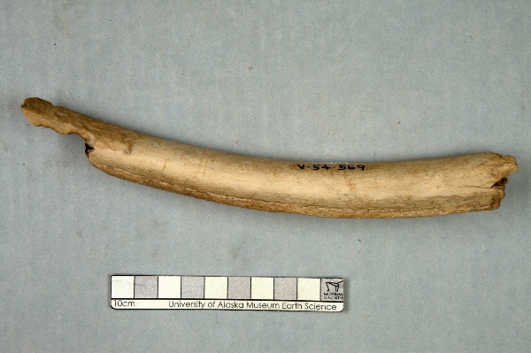
"dwc:occurrenceRemarks": "Indeterminate rib fragment.",
"dwc:georeferenceVerificationStatus": "unverified",
"dwc:basisOfRecord": "PreservedSpecimen",
"dwc:preparations": "rib",
"dwc:identifiedBy": "Eliza Rorabaugh",
"dwc:identificationVerificationStatus": "features",
"dwc:georeferenceSources": "GeoLocate",
"dwc:previousIdentifications": "[{\"scientific_name\":\"Vertebrata\",\"nature_of_id\":\"features\",\"accepted_id_fg\":1,\"made_date\":null,\"short_citation\":null,\"publication_id\":null,\"identification_remarks\":\"Former nature_of_id: student.\",\"idby\":\"Eliza Rorabaugh\",\"concept_label\":null}]",
"dwc:organismID": "http://arctos.database.museum/guid/UAM:ES:11381",
"dwc:phylum": "Chordata",
"dwc:locationAccordingTo": "William Barker",
"dwc:locality": "Lost Chicken Creek, Eagle Quad",
"dwc:institutionID": "UAM",
"dwc:associatedMedia": "http://arctos.database.museum/MediaSearch.cfm?collection_object_id=21738838",
"dwc:geodeticDatum": "unknown",
"dwc:taxonRank": "class",
"dwc:class": "Vertebrata",
"dwc:catalogNumber": "UAM:ES:11381",
"dwc:nomenclaturalCode": "ICZN; ICZN",
"dwc:higherGeography": "United States, Alaska",
"dwc:decimalLongitude": "-141.8999840000",
"dwc:coordinateUncertaintyInMeters": "400",
"dwc:otherCatalogNumbers": "other identifier=AK-54-V-596",
"dwc:verbatimLocality": "Lost Chicken Creek",
"dwc:georeferencedBy": "William Barker",
"dwc:verbatimEventDate": "01 May 1983",
"dwc:eventTime": "1983-05-01/1986-08-31",
"dwc:identificationQualifier": "A",
"dwc:verbatimCoordinateSystem": "deg. min. sec.",
"dwc:georeferenceProtocol": "GeoLocate",
"dcterms:modified": "2022-10-26 09:07:20.297302",
"dwc:scientificName": "Vertebrata",
"dwc:footprintWKT": "POLYGON((-141.891788172711 64.0645444724156,-141.891923268061 64.0638433001093,-141.892368111605 64.0631671416409,-141.893105588389 64.062541978713,-141.894107343988 64.0619918318409,-141.895334876212 64.0615378378899,-141.89674101553 64.0611974385531,-141.898271737184 64.0609837108444,-141.899868235441 64.0609048652168,-141.901469180571 64.0609639304932,-141.903013072238 64.0611586376483,-141.904440599416 64.0614815068816,-141.905696916652 64.0619201346528,-141.906733749674 64.0624576697127,-141.907511249738 64.0630734599306,-141.907999525574 64.0637438451772,-141.908179793974 64.0644430659085,-141.908045104519 64.0651442526366,-141.907600610149 64.0658204583294,-141.906863372657 64.0664456940952,-141.90586171004 64.0669959283295,-141.904634110332 64.067450010867,-141.903227753338 64.0677904865282,-141.901696696954 64.0680042666793,-141.900099797874 64.0680831328836,-141.898498446849 64.0680240531855,-141.896954206008 64.0678292988059,-141.895526439538 64.0675063567347,-141.894270029319 64.0670676416012,-141.893233263781 64.0665300179548,-141.892455981394 64.0659141514126,-141.891968040288 64.0652437137236,-141.891788172711 64.0645444724156))"
},
"indexTerms": {
"datemodified": "2022-12-07T00:43:16.130603+00:00",
"recordset": "2ec3b31e-c86b-4ce9-b265-77c8c3f9643c",
"dqs": 0.34782608695652173,
"stateprovince": "alaska",
"earliestperiodorlowestsystem": "quaternary",
"phylum": "chordata",
"catalognumber": "uam:es:11381",
"taxonrank": "class",
"collector": "collector(s): william barker, john cook, gary selinger",
"verbatimlocality": "lost chicken creek",
"uuid": "e25e79cc-8b11-4141-91b9-b34cce32b29f",
"countrycode": "usa",
"basisofrecord": "preservedspecimen",
"institutioncode": "uam",
"mediarecords": [
"620ab693-7ff6-4dc0-ae65-075239ac978b"
],
"continent": "north america",
"etag": "c773ee853e6943632136c3ffcbb55408765607a6",
"hasMedia": true,
"hasImage": true,
"kingdom": "animalia",
"highertaxon": "; animalia, chordata,",
"collectionid": "21",
"scientificname": "vertebrata",
"locality": "lost chicken creek, eagle quad",
"coordinateuncertainty": 400,
"class": "vertebrata",
"occurrenceid": "http://arctos.database.museum/guid/uam:es:11381?seid=1243663",
"institutionid": "uam",
"country": "united states",
"geopoint": {
"lat": 64.064494,
"lon": -141.899984
},
"collectioncode": "es",
"flags": [
"geopoint_datum_error",
"dwc_continent_added",
"idigbio_isocountrycode_added"
],
"verbatimeventdate": "01 may 1983",
"recordids": [
"2ec3b31e-c86b-4ce9-b265-77c8c3f9643c\\urn:occurrence:arctos:uam:es:11381:1243663",
"2ec3b31e-c86b-4ce9-b265-77c8c3f9643c\\http://arctos.database.museum/guid/uam:es:11381?seid=1243663"
],
"eventdate": "1983-05-01/1986-08-31",
"indexData": {
"dwc:identificationRemarks": "Former nature_of_id: student.",
"dwc:verbatimCoordinates": "64d 3m 0s N/141d 53m 0s W",
"idigbio:dateModified": "2022-12-07T00:43:16.130603",
"dwc:kingdom": "Animalia",
"dwc:recordedBy": "Collector(s): William Barker, John Cook, Gary Selinger",
"idigbio:uuid": "e25e79cc-8b11-4141-91b9-b34cce32b29f",
"dwc:georeferencedDate": "1983-06-01 00:00:00",
"dcterms:references": "http://arctos.database.museum/guid/UAM:ES:11381",
"idigbio:isocountrycode": "usa",
"dcterms:accessRights": "http://vertnet.org/resources/norms.html",
"dwc:locality": "Lost Chicken Creek, Eagle Quad",
"idigbio:recordIds": [
"2ec3b31e-c86b-4ce9-b265-77c8c3f9643c\\urn:occurrence:arctos:uam:es:11381:1243663",
"2ec3b31e-c86b-4ce9-b265-77c8c3f9643c\\http://arctos.database.museum/guid/uam:es:11381?seid=1243663"
],
"dwc:occurrenceID": "http://arctos.database.museum/guid/UAM:ES:11381?seid=1243663",
"id": "http://arctos.database.museum/guid/UAM:ES:11381?seid=1243663",
"dwc:establishmentMeans": "wild",
"idigbio:parent": "2ec3b31e-c86b-4ce9-b265-77c8c3f9643c",
"dwc:stateProvince": "Alaska",
"dwc:taxonRank": "class",
"dwc:eventDate": "1983-05-01/1986-08-31",
"dwc:collectionID": "21",
"dwc:country": "United States",
"dwc:earliestPeriodOrLowestSystem": "Quaternary",
"idigbio:etag": "c773ee853e6943632136c3ffcbb55408765607a6",
"dwc:collectionCode": "ES",
"dwc:class": "Vertebrata",
"dwc:decimalLatitude": "64.0644940000",
"dwc:occurrenceRemarks": "Indeterminate rib fragment.",
"dwc:basisOfRecord": "PreservedSpecimen",
"dwc:continent": "north america",
"dwc:preparations": "rib",
"flag_dwc_continent_added": true,
"dwc:identifiedBy": "Eliza Rorabaugh",
"dwc:identificationVerificationStatus": "features",
"dwc:previousIdentifications": "[{\"scientific_name\":\"Vertebrata\",\"nature_of_id\":\"features\",\"accepted_id_fg\":1,\"made_date\":null,\"short_citation\":null,\"publication_id\":null,\"identification_remarks\":\"Former nature_of_id: student.\",\"idby\":\"Eliza Rorabaugh\",\"concept_label\":null}]",
"dwc:geodeticDatum": "unknown",
"idigbio:siblings": {
"mediarecord": [
"620ab693-7ff6-4dc0-ae65-075239ac978b"
]
},
"flag_idigbio_isocountrycode_added": true,
"dwc:organismID": "http://arctos.database.museum/guid/UAM:ES:11381",
"dwc:phylum": "Chordata",
"dwc:locationAccordingTo": "William Barker",
"dwc:georeferenceSources": "GeoLocate",
"dwc:georeferenceVerificationStatus": "unverified",
"dwc:associatedMedia": "http://arctos.database.museum/MediaSearch.cfm?collection_object_id=21738838",
"dwc:institutionCode": "UAM",
"dwc:locationRemarks": "Lost Chicken Creek flows SE 1 mile to South fork of Fortymile River, 55 miles SW of Eagle, Yukon Tanana Highland",
"dwc:higherClassification": "; Animalia, Chordata,",
"dwc:catalogNumber": "UAM:ES:11381",
"dwc:nomenclaturalCode": "ICZN; ICZN",
"dwc:higherGeography": "United States, Alaska",
"dwc:decimalLongitude": "-141.8999840000",
"dwc:scientificName": "Vertebrata",
"dwc:otherCatalogNumbers": "other identifier=AK-54-V-596",
"dwc:verbatimLocality": "Lost Chicken Creek",
"dwc:georeferencedBy": "William Barker",
"dwc:verbatimEventDate": "01 May 1983",
"dwc:eventTime": "1983-05-01/1986-08-31",
"dwc:institutionID": "UAM",
"dwc:identificationQualifier": "A",
"dwc:verbatimCoordinateSystem": "deg. min. sec.",
"dwc:georeferenceProtocol": "GeoLocate",
"dcterms:modified": "2022-10-26 09:07:20.297302",
"dwc:coordinateUncertaintyInMeters": "400",
"dwc:footprintWKT": "POLYGON((-141.891788172711 64.0645444724156,-141.891923268061 64.0638433001093,-141.892368111605 64.0631671416409,-141.893105588389 64.062541978713,-141.894107343988 64.0619918318409,-141.895334876212 64.0615378378899,-141.89674101553 64.0611974385531,-141.898271737184 64.0609837108444,-141.899868235441 64.0609048652168,-141.901469180571 64.0609639304932,-141.903013072238 64.0611586376483,-141.904440599416 64.0614815068816,-141.905696916652 64.0619201346528,-141.906733749674 64.0624576697127,-141.907511249738 64.0630734599306,-141.907999525574 64.0637438451772,-141.908179793974 64.0644430659085,-141.908045104519 64.0651442526366,-141.907600610149 64.0658204583294,-141.906863372657 64.0664456940952,-141.90586171004 64.0669959283295,-141.904634110332 64.067450010867,-141.903227753338 64.0677904865282,-141.901696696954 64.0680042666793,-141.900099797874 64.0680831328836,-141.898498446849 64.0680240531855,-141.896954206008 64.0678292988059,-141.895526439538 64.0675063567347,-141.894270029319 64.0670676416012,-141.893233263781 64.0665300179548,-141.892455981394 64.0659141514126,-141.891968040288 64.0652437137236,-141.891788172711 64.0645444724156))"
}
},
"attribution": {
"totalCount": 51496
}
}