{
"uuid": "c7bfd2de-0da9-4dc6-8117-900a460fdd4c",
"type": "records",
"etag": "04d80e92d025e560f63e201b8786e553ca400fa6",
"data": {
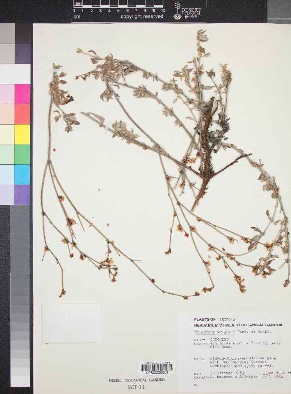
"dwc:startDayOfYear": "288",
"dwc:county": "Coconino County",
"dwc:recordedBy": "W. Hodgson; S. Priebe",
"dcterms:references": "https://swbiodiversity.org/seinet/collections/individual/index.php?occid=3087239",
"dwc:occurrenceID": "f7129a20-b785-4489-95ac-3c48aa560d4e",
"dwc:verbatimElevation": "6500ft.",
"id": "3087239",
"dwc:stateProvince": "Arizona",
"dwc:eventDate": "1983-10-15",
"dwc:collectionID": "edb9860c-c481-4d19-88cc-224a536ebcd4",
"dwc:country": "USA",
"symbiota:recordEnteredBy": "eleanoreros",
"dwc:decimalLatitude": "34.88436",
"dwc:basisOfRecord": "PreservedSpecimen",
"dc:rights": "http://creativecommons.org/licenses/by-nc/3.0/",
"symbiota:recordID": "f7129a20-b785-4489-95ac-3c48aa560d4e",
"dwc:habitat": "in Pinyon-juniper-ponderosa pine area",
"dwc:locality": "Schnebly Hill Road, 4.5 miles west of I-17",
"dwc:institutionCode": "DES",
"dwc:reproductiveCondition": "flowers",
"dwc:catalogNumber": "DES00026801",
"dwc:decimalLongitude": "-111.6914",
"dwc:recordNumber": "H-2674",
"dwc:minimumElevationInMeters": "1981",
"dcterms:modified": "2017-09-04 09:11:28",
"dwc:associatedTaxa": "Pinus edulis, Pinus ponderosa, Cercocarpus, Quercus turbinella, Agave parryi"
},
"indexTerms": {
"recordset": "c569e530-7322-40b8-9b66-1e0ed96fefcb",
"dqs": 0.2318840579710145,
"stateprovince": "arizona",
"county": "coconino county",
"catalognumber": "des00026801",
"startdayofyear": 288,
"collector": "w. hodgson; s. priebe",
"continent": "north america",
"uuid": "c7bfd2de-0da9-4dc6-8117-900a460fdd4c",
"countrycode": "usa",
"basisofrecord": "preservedspecimen",
"institutioncode": "des",
"mediarecords": [
"f04b1cfb-0c11-494b-989a-ec0097fcebb2"
],
"datecollected": "1983-10-15T00:00:00+00:00",
"etag": "04d80e92d025e560f63e201b8786e553ca400fa6",
"recordnumber": "h-2674",
"minelevation": 1981,
"hasImage": true,
"collectionid": "edb9860c-c481-4d19-88cc-224a536ebcd4",
"locality": "schnebly hill road, 4.5 miles west of i-17",
"hasMedia": true,
"datemodified": "2022-12-06T22:03:37.426550+00:00",
"occurrenceid": "f7129a20-b785-4489-95ac-3c48aa560d4e",
"country": "united states",
"geopoint": {
"lat": 34.88436,
"lon": -111.6914
},
"flags": [
"geopoint_datum_missing",
"dwc_country_replaced",
"idigbio_isocountrycode_added",
"dwc_continent_added"
],
"recordids": [
"urn:uuid:f7129a20-b785-4489-95ac-3c48aa560d4e",
"c569e530-7322-40b8-9b66-1e0ed96fefcb\\urn:uuid:f7129a20-b785-4489-95ac-3c48aa560d4e",
"c569e530-7322-40b8-9b66-1e0ed96fefcb\\3087239",
"c569e530-7322-40b8-9b66-1e0ed96fefcb\\f7129a20-b785-4489-95ac-3c48aa560d4e"
],
"eventdate": "1983-10-15",
"indexData": {
"dwc:startDayOfYear": "288",
"dwc:county": "Coconino County",
"dwc:recordedBy": "W. Hodgson; S. Priebe",
"idigbio:uuid": "c7bfd2de-0da9-4dc6-8117-900a460fdd4c",
"dcterms:references": "https://swbiodiversity.org/seinet/collections/individual/index.php?occid=3087239",
"idigbio:recordIds": [
"urn:uuid:f7129a20-b785-4489-95ac-3c48aa560d4e",
"c569e530-7322-40b8-9b66-1e0ed96fefcb\\urn:uuid:f7129a20-b785-4489-95ac-3c48aa560d4e",
"c569e530-7322-40b8-9b66-1e0ed96fefcb\\3087239",
"c569e530-7322-40b8-9b66-1e0ed96fefcb\\f7129a20-b785-4489-95ac-3c48aa560d4e"
],
"dwc:occurrenceID": "f7129a20-b785-4489-95ac-3c48aa560d4e",
"dwc:verbatimElevation": "6500ft.",
"symbiota:recordEnteredBy": "eleanoreros",
"idigbio:parent": "c569e530-7322-40b8-9b66-1e0ed96fefcb",
"dwc:stateProvince": "Arizona",
"dwc:eventDate": "1983-10-15",
"dwc:collectionID": "edb9860c-c481-4d19-88cc-224a536ebcd4",
"dwc:country": "united states",
"idigbio:etag": "04d80e92d025e560f63e201b8786e553ca400fa6",
"id": "3087239",
"dwc:decimalLatitude": "34.88436",
"dwc:basisOfRecord": "PreservedSpecimen",
"dwc:continent": "north america",
"dc:rights": "http://creativecommons.org/licenses/by-nc/3.0/",
"flag_dwc_country_replaced": true,
"idigbio:siblings": {
"mediarecord": [
"f04b1cfb-0c11-494b-989a-ec0097fcebb2"
]
},
"symbiota:recordID": "f7129a20-b785-4489-95ac-3c48aa560d4e",
"flag_idigbio_isocountrycode_added": true,
"dwc:habitat": "in Pinyon-juniper-ponderosa pine area",
"idigbio:dateModified": "2022-12-06T22:03:37.426550",
"dwc:locality": "Schnebly Hill Road, 4.5 miles west of I-17",
"dwc:institutionCode": "DES",
"dwc:reproductiveCondition": "flowers",
"dwc:catalogNumber": "DES00026801",
"dwc:decimalLongitude": "-111.6914",
"flag_dwc_continent_added": true,
"dwc:recordNumber": "H-2674",
"idigbio:isocountrycode": "usa",
"dwc:minimumElevationInMeters": "1981",
"dcterms:modified": "2017-09-04 09:11:28",
"dwc:associatedTaxa": "Pinus edulis, Pinus ponderosa, Cercocarpus, Quercus turbinella, Agave parryi"
}
},
"attribution": {
"totalCount": 94693
}
}