{
"uuid": "b416127c-66d2-4bef-872c-b1e3d9bcc884",
"type": "records",
"etag": "23d5cb7f574721a2e90866ea1208348900448e68",
"data": {
"dwc:identificationRemarks": "Former nature_of_id: field.",
"dwc:kingdom": "Animalia",
"dwc:recordedBy": "Collector(s): Tracy Harbour",
"dwc:georeferencedDate": "2012-06-04 00:00:00",
"dcterms:references": "http://arctos.database.museum/guid/UAM:ES:26637",
"dcterms:accessRights": "http://vertnet.org/resources/norms.html",
"dwc:occurrenceID": "http://arctos.database.museum/guid/UAM:ES:26637?seid=1123377",
"id": "http://arctos.database.museum/guid/UAM:ES:26637?seid=1123377",
"dwc:establishmentMeans": "wild",
"dwc:stateProvince": "Alaska",
"dwc:eventDate": "1800-01-01/1988-12-31",
"dwc:collectionID": "21",
"dwc:institutionCode": "UAM",
"dwc:country": "United States",
"dwc:earliestPeriodOrLowestSystem": "Quaternary",
"dwc:collectionCode": "ES",
"dwc:higherClassification": "Animalia, Chordata,",
"dwc:decimalLatitude": "65.2059040000",
"dwc:georeferenceVerificationStatus": "unverified",
"dwc:basisOfRecord": "PreservedSpecimen",
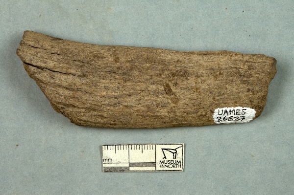
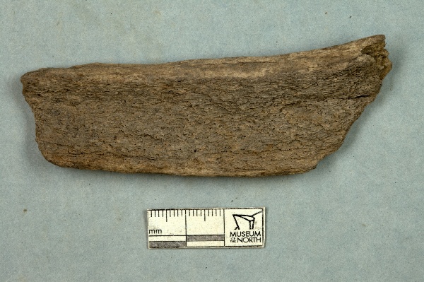
"dwc:preparations": "bone",
"dwc:identifiedBy": "unknown",
"dwc:identificationVerificationStatus": "features",
"dwc:georeferenceSources": "GeoLocate",
"dwc:previousIdentifications": "[{\"scientific_name\":\"Mammalia\",\"nature_of_id\":\"features\",\"accepted_id_fg\":1,\"made_date\":null,\"short_citation\":null,\"publication_id\":null,\"identification_remarks\":\"Former nature_of_id: field.\",\"idby\":\"unknown\",\"concept_label\":null}]",
"dwc:organismID": "http://arctos.database.museum/guid/UAM:ES:26637",
"dwc:phylum": "Chordata",
"dwc:locationAccordingTo": "unknown",
"dwc:locality": "Skookum Creek, Yukon Tanana Upland, Tanana Quad",
"dwc:institutionID": "UAM",
"dwc:associatedMedia": "http://arctos.database.museum/MediaSearch.cfm?collection_object_id=22461522",
"dwc:geodeticDatum": "unknown",
"dwc:taxonRank": "class",
"dwc:class": "Mammalia",
"dwc:catalogNumber": "UAM:ES:26637",
"dwc:nomenclaturalCode": "ICZN",
"dwc:higherGeography": "United States, Alaska",
"dwc:decimalLongitude": "-150.1448500000",
"dwc:coordinateUncertaintyInMeters": "1040",
"dwc:otherCatalogNumbers": "Locality ID=AK-116-V-, other identifier=AK-116-V-",
"dwc:verbatimLocality": "Skookum Creek, flows South 1.3 miles to Pioneer Creek, 2.4. miles North-East of Eureka and 21 miles South of Rampart, Yukon Tanana Upland",
"dwc:georeferencedBy": "unknown",
"dwc:verbatimEventDate": "before 1988",
"dwc:eventTime": "1800-01-01/1988-12-31",
"dwc:identificationQualifier": "A",
"dwc:georeferenceProtocol": "GeoLocate",
"dcterms:modified": "2022-10-25 11:04:27.376775",
"dwc:scientificName": "Mammalia",
"dwc:footprintWKT": "POLYGON((-150.122652614733 65.2054803974567,-150.123276669067 65.2036703872515,-150.124729563453 65.2019462635245,-150.126955330003 65.2003742599658,-150.129868352311 65.1990147555147,-150.13335666801 65.1979199589445,-150.13728627392 65.1971319080196,-150.141506267958 65.1966808592783,-150.145854631418 65.1965841295199,-150.150164431939 65.1968454328769,-150.154270212351 65.1974547385594,-150.158014323846 65.198388654668,-150.161252963949 65.199611323577,-150.163861690336 65.2010757950199,-150.165740200506 65.2027258248521,-150.166816194026 65.2044980312063,-150.167048167758 65.2063243259796,-150.166427034125 65.2081345288607,-150.164976496666 65.2098590638312,-150.162752164447 65.2114316345929,-150.159839435511 65.2127917758551,-150.156350227561 65.2138871818956,-150.152418679615 65.2146757221637,-150.148195989411 65.2151270656232,-150.143844586125 65.2152238506064,-150.139531864901 65.2149623545734,-150.135423727562 65.2143526376473,-150.131678181736 65.2134181543356,-150.128439248262 65.2121948486155,-150.125831414127 65.2107297677024,-150.123954845994 65.209079248527,-150.122881548639 65.2073067474548,-150.122652614733 65.2054803974567))"
},
"indexTerms": {
"datemodified": "2022-12-07T00:43:16.130603+00:00",
"recordset": "2ec3b31e-c86b-4ce9-b265-77c8c3f9643c",
"dqs": 0.3333333333333333,
"stateprovince": "alaska",
"earliestperiodorlowestsystem": "quaternary",
"phylum": "chordata",
"catalognumber": "uam:es:26637",
"taxonrank": "class",
"collector": "collector(s): tracy harbour",
"verbatimlocality": "skookum creek, flows south 1.3 miles to pioneer creek, 2.4. miles north-east of eureka and 21 miles south of rampart, yukon tanana upland",
"uuid": "b416127c-66d2-4bef-872c-b1e3d9bcc884",
"countrycode": "usa",
"basisofrecord": "preservedspecimen",
"institutioncode": "uam",
"mediarecords": [
"04281dea-3bb4-4d44-bee0-d3ad1af7f248",
"4c4a870c-bd8a-4210-a325-38a468c34b30"
],
"continent": "north america",
"etag": "23d5cb7f574721a2e90866ea1208348900448e68",
"hasMedia": true,
"hasImage": true,
"kingdom": "animalia",
"highertaxon": "animalia, chordata,",
"collectionid": "21",
"scientificname": "mammalia",
"locality": "skookum creek, yukon tanana upland, tanana quad",
"coordinateuncertainty": 1040,
"class": "mammalia",
"occurrenceid": "http://arctos.database.museum/guid/uam:es:26637?seid=1123377",
"institutionid": "uam",
"country": "united states",
"geopoint": {
"lat": 65.205904,
"lon": -150.14485
},
"collectioncode": "es",
"flags": [
"geopoint_datum_error",
"dwc_continent_added",
"idigbio_isocountrycode_added",
"taxon_match_failed"
],
"verbatimeventdate": "before 1988",
"recordids": [
"2ec3b31e-c86b-4ce9-b265-77c8c3f9643c\\urn:occurrence:arctos:uam:es:26637:1123377",
"2ec3b31e-c86b-4ce9-b265-77c8c3f9643c\\http://arctos.database.museum/guid/uam:es:26637?seid=1123377"
],
"eventdate": "1800-01-01/1988-12-31",
"indexData": {
"dwc:identificationRemarks": "Former nature_of_id: field.",
"dwc:geodeticDatum": "unknown",
"idigbio:dateModified": "2022-12-07T00:43:16.130603",
"dwc:kingdom": "Animalia",
"dwc:recordedBy": "Collector(s): Tracy Harbour",
"idigbio:uuid": "b416127c-66d2-4bef-872c-b1e3d9bcc884",
"dwc:georeferencedDate": "2012-06-04 00:00:00",
"dcterms:references": "http://arctos.database.museum/guid/UAM:ES:26637",
"idigbio:isocountrycode": "usa",
"dcterms:accessRights": "http://vertnet.org/resources/norms.html",
"dwc:locality": "Skookum Creek, Yukon Tanana Upland, Tanana Quad",
"idigbio:recordIds": [
"2ec3b31e-c86b-4ce9-b265-77c8c3f9643c\\urn:occurrence:arctos:uam:es:26637:1123377",
"2ec3b31e-c86b-4ce9-b265-77c8c3f9643c\\http://arctos.database.museum/guid/uam:es:26637?seid=1123377"
],
"dwc:occurrenceID": "http://arctos.database.museum/guid/UAM:ES:26637?seid=1123377",
"id": "http://arctos.database.museum/guid/UAM:ES:26637?seid=1123377",
"dwc:establishmentMeans": "wild",
"idigbio:parent": "2ec3b31e-c86b-4ce9-b265-77c8c3f9643c",
"dwc:stateProvince": "Alaska",
"dwc:eventDate": "1800-01-01/1988-12-31",
"dwc:collectionID": "21",
"dwc:country": "United States",
"dwc:earliestPeriodOrLowestSystem": "Quaternary",
"idigbio:etag": "23d5cb7f574721a2e90866ea1208348900448e68",
"dwc:collectionCode": "ES",
"dwc:class": "Mammalia",
"dwc:decimalLatitude": "65.2059040000",
"dwc:georeferenceVerificationStatus": "unverified",
"dwc:basisOfRecord": "PreservedSpecimen",
"dwc:continent": "north america",
"dwc:preparations": "bone",
"flag_dwc_continent_added": true,
"dwc:identifiedBy": "unknown",
"dwc:identificationVerificationStatus": "features",
"dwc:previousIdentifications": "[{\"scientific_name\":\"Mammalia\",\"nature_of_id\":\"features\",\"accepted_id_fg\":1,\"made_date\":null,\"short_citation\":null,\"publication_id\":null,\"identification_remarks\":\"Former nature_of_id: field.\",\"idby\":\"unknown\",\"concept_label\":null}]",
"idigbio:siblings": {
"mediarecord": [
"04281dea-3bb4-4d44-bee0-d3ad1af7f248",
"4c4a870c-bd8a-4210-a325-38a468c34b30"
]
},
"flag_idigbio_isocountrycode_added": true,
"dwc:organismID": "http://arctos.database.museum/guid/UAM:ES:26637",
"dwc:phylum": "Chordata",
"dwc:locationAccordingTo": "unknown",
"dwc:georeferenceSources": "GeoLocate",
"dwc:institutionID": "UAM",
"dwc:associatedMedia": "http://arctos.database.museum/MediaSearch.cfm?collection_object_id=22461522",
"dwc:institutionCode": "UAM",
"dwc:taxonRank": "class",
"dwc:higherClassification": "Animalia, Chordata,",
"dwc:catalogNumber": "UAM:ES:26637",
"dwc:nomenclaturalCode": "ICZN",
"dwc:higherGeography": "United States, Alaska",
"dwc:decimalLongitude": "-150.1448500000",
"dwc:scientificName": "Mammalia",
"dwc:otherCatalogNumbers": "Locality ID=AK-116-V-, other identifier=AK-116-V-",
"dwc:verbatimLocality": "Skookum Creek, flows South 1.3 miles to Pioneer Creek, 2.4. miles North-East of Eureka and 21 miles South of Rampart, Yukon Tanana Upland",
"dwc:georeferencedBy": "unknown",
"dwc:verbatimEventDate": "before 1988",
"dwc:eventTime": "1800-01-01/1988-12-31",
"dwc:identificationQualifier": "A",
"flag_taxon_match_failed": true,
"dwc:georeferenceProtocol": "GeoLocate",
"dcterms:modified": "2022-10-25 11:04:27.376775",
"dwc:coordinateUncertaintyInMeters": "1040",
"dwc:footprintWKT": "POLYGON((-150.122652614733 65.2054803974567,-150.123276669067 65.2036703872515,-150.124729563453 65.2019462635245,-150.126955330003 65.2003742599658,-150.129868352311 65.1990147555147,-150.13335666801 65.1979199589445,-150.13728627392 65.1971319080196,-150.141506267958 65.1966808592783,-150.145854631418 65.1965841295199,-150.150164431939 65.1968454328769,-150.154270212351 65.1974547385594,-150.158014323846 65.198388654668,-150.161252963949 65.199611323577,-150.163861690336 65.2010757950199,-150.165740200506 65.2027258248521,-150.166816194026 65.2044980312063,-150.167048167758 65.2063243259796,-150.166427034125 65.2081345288607,-150.164976496666 65.2098590638312,-150.162752164447 65.2114316345929,-150.159839435511 65.2127917758551,-150.156350227561 65.2138871818956,-150.152418679615 65.2146757221637,-150.148195989411 65.2151270656232,-150.143844586125 65.2152238506064,-150.139531864901 65.2149623545734,-150.135423727562 65.2143526376473,-150.131678181736 65.2134181543356,-150.128439248262 65.2121948486155,-150.125831414127 65.2107297677024,-150.123954845994 65.209079248527,-150.122881548639 65.2073067474548,-150.122652614733 65.2054803974567))"
}
},
"attribution": {
"totalCount": 51496
}
}