{
"uuid": "a84e64ce-a4e1-4b96-8629-0d76fb21be3e",
"type": "records",
"etag": "13be55edd3f2428e9d92387dc7775ea22d677081",
"data": {
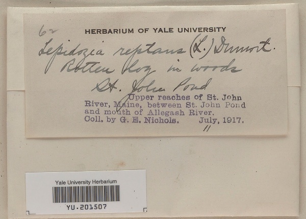
"dwc:startDayOfYear": "192",
"dwc:county": "Somerset",
"dwc:recordedBy": "George Elwood Nichols",
"dwc:georeferenceSources": "GADM (Database of Global Administrative Areas) database (www.gadm.org), version 2.8, November 2015",
"dwc:order": "Jungermanniales",
"dwc:habitat": "Rotten log in woods",
"dcterms:accessRights": "Open Access, http://creativecommons.org/publicdomain/zero/1.0/; see Yale Peabody policies at: http://hdl.handle.net/10079/8931zqj",
"dwc:occurrenceID": "urn:uuid:5a518648-50f1-4588-9610-e6c7bf16e88a",
"dwc:scientificNameAuthorship": "(L.) Dumort.",
"id": "2472505",
"symbiota:recordEnteredBy": "jlsanesdoc",
"dwc:stateProvince": "Maine",
"dwc:eventDate": "1917-07-11",
"dwc:collectionID": "7e5a557c-759e-478d-b571-e17c4a09eb62",
"dwc:institutionCode": "YPM",
"dwc:country": "United States",
"dwc:collectionCode": "YU",
"dcterms:rightsHolder": "Yale Peabody Museum of Natural History",
"dwc:kingdom": "Plantae",
"dwc:decimalLatitude": "45.51348",
"dwc:basisOfRecord": "PreservedSpecimen",
"dwc:georeferenceRemarks": "Coordinates are for the centroid of the county polygon. The uncertainty is the largest possible distance between the centroid and the polygon edge.",
"dwc:family": "Lepidoziaceae",
"dc:rights": "http://creativecommons.org/publicdomain/zero/1.0/",
"dwc:higherClassification": "Plantae|Bryobiotina|Marchantiophyta|Jungermanniopsida|Jungermanniidae|Jungermanniales",
"symbiota:recordID": "urn:uuid:d1c57340-33ea-4fc8-b813-545055cefd8a",
"dwc:phylum": "Marchantiophyta",
"dcterms:references": "https://bryophyteportal.org/portal/collections/individual/index.php?occid=2472505",
"dwc:locality": "Upper reaches of St. John River, between St. John Pond and mouth of Allegash River, St. John Pond",
"dwc:geodeticDatum": "WGS84",
"dwc:class": "Jungermanniopsida",
"dwc:catalogNumber": "YU.201507",
"dwc:month": "7",
"dwc:decimalLongitude": "-69.96",
"dwc:coordinateUncertaintyInMeters": "170885",
"dwc:verbatimEventDate": "1917-7-11",
"dwc:recordNumber": "62",
"dcterms:modified": "2021-04-19 07:05:20",
"dwc:scientificName": "Lepidoza reptans",
"dwc:day": "11",
"dwc:year": "1917"
},
"indexTerms": {
"geopoint": {
"lat": 45.51348,
"lon": -69.96
},
"family": "lepidoziaceae",
"recordset": "e1b03497-7632-4ba4-a9e0-dd230d06638c",
"dqs": 0.37681159420289856,
"stateprovince": "maine",
"county": "somerset",
"phylum": "marchantiophyta",
"catalognumber": "yu.201507",
"startdayofyear": 192,
"collector": "george elwood nichols",
"continent": "north america",
"uuid": "a84e64ce-a4e1-4b96-8629-0d76fb21be3e",
"countrycode": "usa",
"basisofrecord": "preservedspecimen",
"institutioncode": "ypm",
"mediarecords": [
"25e3b10c-7c28-4a5e-964c-6505fdff1e0c"
],
"datemodified": "2022-03-11T04:07:17.482277+00:00",
"datecollected": "1917-07-11T00:00:00+00:00",
"etag": "13be55edd3f2428e9d92387dc7775ea22d677081",
"recordnumber": "62",
"hasImage": true,
"kingdom": "plantae",
"highertaxon": "plantae|bryobiotina|marchantiophyta|jungermanniopsida|jungermanniidae|jungermanniales",
"collectionid": "7e5a557c-759e-478d-b571-e17c4a09eb62",
"scientificname": "lepidoza reptans",
"indexData": {
"dwc:startDayOfYear": "192",
"dwc:geodeticDatum": "WGS84",
"dwc:county": "Somerset",
"dwc:recordedBy": "George Elwood Nichols",
"idigbio:uuid": "a84e64ce-a4e1-4b96-8629-0d76fb21be3e",
"dwc:locality": "Upper reaches of St. John River, between St. John Pond and mouth of Allegash River, St. John Pond",
"dwc:order": "Jungermanniales",
"dwc:habitat": "Rotten log in woods",
"dwc:collectionCode": "YU",
"dwc:scientificNameAuthorship": "(L.) Dumort.",
"idigbio:recordIds": [
"urn:uuid:d1c57340-33ea-4fc8-b813-545055cefd8a",
"e1b03497-7632-4ba4-a9e0-dd230d06638c\\2472505",
"e1b03497-7632-4ba4-a9e0-dd230d06638c\\urn:uuid:5a518648-50f1-4588-9610-e6c7bf16e88a"
],
"dwc:occurrenceID": "urn:uuid:5a518648-50f1-4588-9610-e6c7bf16e88a",
"id": "2472505",
"symbiota:recordEnteredBy": "jlsanesdoc",
"idigbio:parent": "e1b03497-7632-4ba4-a9e0-dd230d06638c",
"dwc:stateProvince": "Maine",
"dwc:eventDate": "1917-07-11",
"dwc:collectionID": "7e5a557c-759e-478d-b571-e17c4a09eb62",
"dwc:country": "United States",
"idigbio:etag": "13be55edd3f2428e9d92387dc7775ea22d677081",
"dwc:decimalLatitude": "45.51348",
"dcterms:rightsHolder": "Yale Peabody Museum of Natural History",
"dwc:kingdom": "Plantae",
"dwc:georeferenceRemarks": "Coordinates are for the centroid of the county polygon. The uncertainty is the largest possible distance between the centroid and the polygon edge.",
"dwc:basisOfRecord": "PreservedSpecimen",
"dwc:continent": "north america",
"dwc:family": "Lepidoziaceae",
"dc:rights": "http://creativecommons.org/publicdomain/zero/1.0/",
"dwc:class": "Jungermanniopsida",
"idigbio:siblings": {
"mediarecord": [
"25e3b10c-7c28-4a5e-964c-6505fdff1e0c"
]
},
"symbiota:recordID": "urn:uuid:d1c57340-33ea-4fc8-b813-545055cefd8a",
"flag_idigbio_isocountrycode_added": true,
"dwc:phylum": "Marchantiophyta",
"dcterms:references": "https://bryophyteportal.org/portal/collections/individual/index.php?occid=2472505",
"idigbio:dateModified": "2022-03-11T04:07:17.482277",
"dwc:georeferenceSources": "GADM (Database of Global Administrative Areas) database (www.gadm.org), version 2.8, November 2015",
"dwc:institutionCode": "YPM",
"dwc:higherClassification": "Plantae|Bryobiotina|Marchantiophyta|Jungermanniopsida|Jungermanniidae|Jungermanniales",
"dwc:catalogNumber": "YU.201507",
"dcterms:accessRights": "Open Access, http://creativecommons.org/publicdomain/zero/1.0/; see Yale Peabody policies at: http://hdl.handle.net/10079/8931zqj",
"dwc:decimalLongitude": "-69.96",
"dwc:scientificName": "Lepidoza reptans",
"dwc:month": "7",
"dwc:verbatimEventDate": "1917-7-11",
"flag_dwc_continent_added": true,
"dwc:recordNumber": "62",
"idigbio:isocountrycode": "usa",
"dcterms:modified": "2021-04-19 07:05:20",
"dwc:coordinateUncertaintyInMeters": "170885",
"dwc:day": "11",
"dwc:year": "1917"
},
"hasMedia": true,
"coordinateuncertainty": 170885,
"class": "jungermanniopsida",
"occurrenceid": "urn:uuid:5a518648-50f1-4588-9610-e6c7bf16e88a",
"country": "united states",
"locality": "upper reaches of st. john river, between st. john pond and mouth of allegash river, st. john pond",
"collectioncode": "yu",
"eventdate": "1917-07-11",
"flags": [
"geopoint_low_precision",
"idigbio_isocountrycode_added",
"dwc_continent_added"
],
"verbatimeventdate": "1917-7-11",
"recordids": [
"urn:uuid:d1c57340-33ea-4fc8-b813-545055cefd8a",
"e1b03497-7632-4ba4-a9e0-dd230d06638c\\2472505",
"e1b03497-7632-4ba4-a9e0-dd230d06638c\\urn:uuid:5a518648-50f1-4588-9610-e6c7bf16e88a"
],
"order": "jungermanniales"
},
"attribution": {
"totalCount": 37054
}
}