{
"uuid": "a7bc331a-07d5-483f-ad8e-88b068a0f0a7",
"type": "records",
"etag": "1946e16964c1b0185767dd375bbf6b225a458bef",
"data": {
"dwc:countryCode": "US",
"dwc:county": "Middlesex County",
"dwc:recordedBy": "Leslie J. Mehrhoff",
"dwc:georeferenceSources": "no date. USGS Geographic Names Information System (GNIS). U. S. Geological Survey.",
"dwc:order": "Rosales",
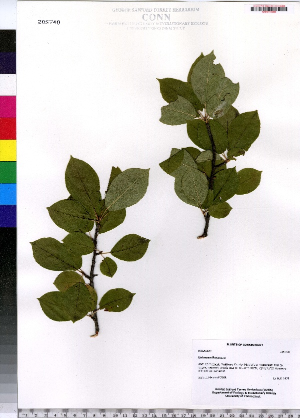
"dwc:habitat": "Woods",
"dwc:occurrenceID": "urn:catalog:UConn:CONN:CONN00136495",
"dwc:stateProvince": "Connecticut",
"dwc:eventDate": "1979-08-15",
"dwc:country": "USA",
"dwc:collectionCode": "CONN",
"dwc:verbatimLatitude": "41°31' 02\" N",
"dwc:kingdom": "Dicotyledonae",
"dwc:decimalLatitude": "41.51722",
"dwc:occurrenceRemarks": "low shrub",
"dwc:basisOfRecord": "Preserved Specimen",
"dwc:genus": "Unk.rosaceae",
"dwc:family": "Rosaceae",
"dwc:coordinateUncertaintyInMeters": "5000",
"dwc:municipality": "Middlefield",
"dwc:previousIdentifications": "Unknown Rosaceae",
"dwc:locationAccordingTo": "seconds added from gazetteer",
"dwc:locality": "Middlefield; Trail to ledges, trap rock, woods near Rt 66",
"dwc:institutionCode": "UConn",
"dwc:reproductiveCondition": "sterile/vegetative",
"dwc:higherClassification": "Plantae; Dicotyledonae; Rosales; Rosaceae",
"dwc:catalogNumber": "CONN00136495",
"dwc:higherGeography": "USA; Connecticut; Middlesex County; Middlefield",
"dwc:month": "8",
"dwc:decimalLongitude": "-72.71194",
"dwc:verbatimLongitude": "72°42' 43\" W",
"dwc:verbatimEventDate": "15-Aug-79",
"dwc:recordNumber": "2688",
"dcterms:rights": "This work is licensed under a Creative Commons CCZero 1.0 License http://i.creativecommons.org/l/by-nc-sa/4.0/88x31.png",
"dcterms:modified": "2012-10-02T00:00-0500",
"dwc:scientificName": "Unknown Rosaceae",
"dwc:day": "15",
"dwc:datasetID": "123507",
"dwc:year": "1979"
},
"indexTerms": {
"geopoint": {
"lat": 41.51722,
"lon": -72.71194
},
"family": "rosaceae",
"recordset": "e70af26a-fb9e-43ab-96a0-d62a2df37e6d",
"dqs": 0.34782608695652173,
"stateprovince": "connecticut",
"municipality": "middlefield",
"county": "middlesex county",
"catalognumber": "conn00136495",
"startdayofyear": 227,
"collector": "leslie j. mehrhoff",
"continent": "north america",
"uuid": "a7bc331a-07d5-483f-ad8e-88b068a0f0a7",
"countrycode": "usa",
"basisofrecord": "preservedspecimen",
"institutioncode": "uconn",
"mediarecords": [
"7a958d6c-b337-466d-8070-edee61756eee"
],
"datecollected": "1979-08-15T00:00:00+00:00",
"etag": "1946e16964c1b0185767dd375bbf6b225a458bef",
"recordnumber": "2688",
"hasImage": true,
"kingdom": "dicotyledonae",
"highertaxon": "plantae; dicotyledonae; rosales; rosaceae",
"scientificname": "unknown rosaceae",
"indexData": {
"dwc:countryCode": "US",
"dwc:county": "Middlesex County",
"dwc:recordedBy": "Leslie J. Mehrhoff",
"idigbio:uuid": "a7bc331a-07d5-483f-ad8e-88b068a0f0a7",
"dwc:georeferenceSources": "no date. USGS Geographic Names Information System (GNIS). U. S. Geological Survey.",
"dwc:order": "Rosales",
"dwc:habitat": "Woods",
"idigbio:isocountrycode": "usa",
"dwc:locality": "Middlefield; Trail to ledges, trap rock, woods near Rt 66",
"idigbio:recordIds": [
"e70af26a-fb9e-43ab-96a0-d62a2df37e6d\\urn:catalog:uconn:conn:conn00136495"
],
"dwc:occurrenceID": "urn:catalog:UConn:CONN:CONN00136495",
"dwc:scientificName": "Unknown Rosaceae",
"idigbio:parent": "e70af26a-fb9e-43ab-96a0-d62a2df37e6d",
"dwc:stateProvince": "Connecticut",
"dwc:eventDate": "1979-08-15",
"dwc:country": "united states",
"idigbio:etag": "1946e16964c1b0185767dd375bbf6b225a458bef",
"dwc:collectionCode": "CONN",
"dwc:verbatimLatitude": "41°31' 02\" N",
"dwc:kingdom": "Dicotyledonae",
"dwc:decimalLatitude": "41.51722",
"dwc:occurrenceRemarks": "low shrub",
"dwc:basisOfRecord": "Preserved Specimen",
"dwc:genus": "Unk.rosaceae",
"dwc:continent": "north america",
"dwc:family": "Rosaceae",
"flag_dwc_continent_added": true,
"flag_dwc_country_replaced": true,
"dwc:municipality": "Middlefield",
"dwc:previousIdentifications": "Unknown Rosaceae",
"idigbio:siblings": {
"mediarecord": [
"7a958d6c-b337-466d-8070-edee61756eee"
]
},
"flag_idigbio_isocountrycode_added": true,
"idigbio:dateModified": "2014-09-09T03:14:37.709000",
"dwc:locationAccordingTo": "seconds added from gazetteer",
"dwc:institutionCode": "UConn",
"dwc:reproductiveCondition": "sterile/vegetative",
"dwc:higherClassification": "Plantae; Dicotyledonae; Rosales; Rosaceae",
"dwc:catalogNumber": "CONN00136495",
"dwc:higherGeography": "USA; Connecticut; Middlesex County; Middlefield",
"dwc:month": "8",
"dwc:decimalLongitude": "-72.71194",
"dwc:verbatimLongitude": "72°42' 43\" W",
"dwc:verbatimEventDate": "15-Aug-79",
"dwc:recordNumber": "2688",
"dcterms:rights": "This work is licensed under a Creative Commons CCZero 1.0 License http://i.creativecommons.org/l/by-nc-sa/4.0/88x31.png",
"flag_taxon_match_failed": true,
"dcterms:modified": "2012-10-02T00:00-0500",
"dwc:coordinateUncertaintyInMeters": "5000",
"dwc:day": "15",
"dwc:datasetID": "123507",
"dwc:year": "1979"
},
"hasMedia": true,
"coordinateuncertainty": 5000,
"datemodified": "2014-09-09T03:14:37.709000+00:00",
"occurrenceid": "urn:catalog:uconn:conn:conn00136495",
"country": "united states",
"locality": "middlefield; trail to ledges, trap rock, woods near rt 66",
"collectioncode": "conn",
"eventdate": "1979-08-15",
"flags": [
"geopoint_datum_missing",
"dwc_continent_added",
"dwc_country_replaced",
"idigbio_isocountrycode_added",
"taxon_match_failed"
],
"verbatimeventdate": "15-aug-79",
"recordids": [
"e70af26a-fb9e-43ab-96a0-d62a2df37e6d\\urn:catalog:uconn:conn:conn00136495"
],
"genus": "unk.rosaceae",
"order": "rosales",
"datasetid": "123507"
},
"attribution": {
"totalCount": 172098
}
}