{
"uuid": "91a6e479-cb97-4780-90ef-b798c6f292db",
"type": "records",
"etag": "094752aeee039816a09b077e7d495f369879ab4f",
"data": {
"dwc:countryCode": "HN",
"dwc:county": "San Antonio de Oriente",
"dwc:recordedBy": "H.W. Pfeifer",
"dwc:georeferenceSources": "2006. Google Earth. © Google Earth.",
"dwc:order": "Rubiales",
"dwc:occurrenceID": "urn:catalog:UConn:CONN:CONN00161364",
"dwc:stateProvince": "Francisco Morazán",
"dwc:eventDate": "1960-Aug",
"dwc:country": "Honduras",
"dwc:collectionCode": "CONN",
"dwc:verbatimLatitude": "14°02' 43\" N",
"dwc:kingdom": "Dicotyledonae",
"dwc:decimalLatitude": "14.04527",
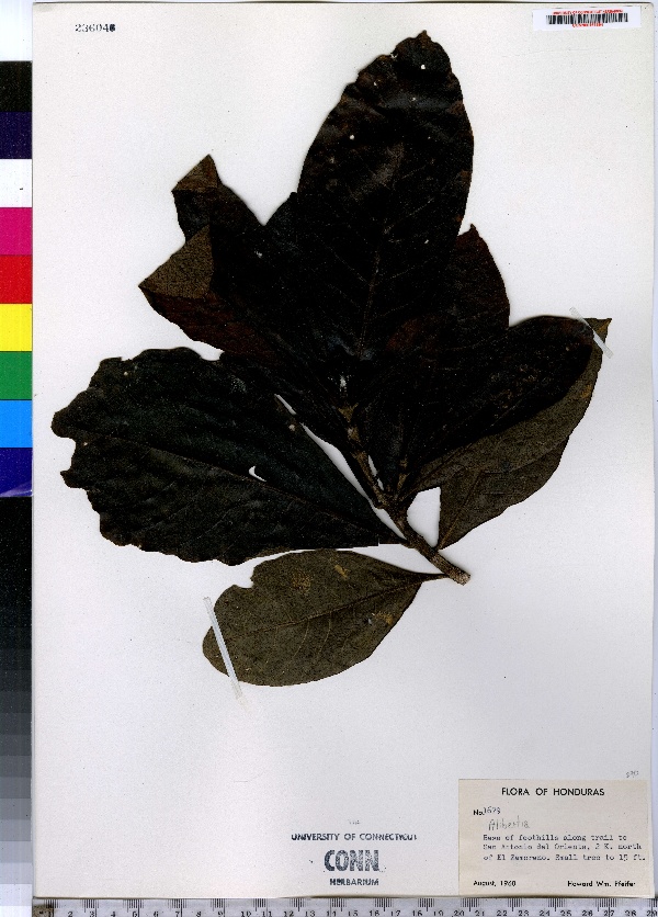
"dwc:occurrenceRemarks": "Small tree to 15 ft.",
"dwc:basisOfRecord": "Preserved Specimen",
"dwc:genus": "Alibertia",
"dwc:family": "Rubiaceae",
"dwc:coordinateUncertaintyInMeters": "5000",
"dwc:previousIdentifications": "Alibertia A. Rich. ex. DC.",
"dwc:locationAccordingTo": "seconds added from gazetteer",
"dwc:locality": "Base of foothills along trail to San Antonio de Oriente, 2 K. north of El Zamorano.",
"dwc:institutionCode": "UConn",
"dwc:reproductiveCondition": "uncertain",
"dwc:higherClassification": "Plantae; Dicotyledonae; Rubiales; Rubiaceae",
"dwc:catalogNumber": "CONN00161364",
"dwc:higherGeography": "Honduras; Francisco Morazán; San Antonio de Oriente;",
"dwc:month": "8",
"dwc:decimalLongitude": "-87.00055",
"dwc:verbatimLongitude": "87°00 02\" W",
"dwc:verbatimEventDate": "Aug 1960",
"dwc:recordNumber": "1679",
"dcterms:rights": "This work is licensed under a Creative Commons CCZero 1.0 License http://i.creativecommons.org/l/by-nc-sa/4.0/88x31.png",
"dcterms:modified": "2012-11-20T00:00-0500",
"dwc:scientificName": "Alibertia A. Rich. ex. DC.",
"dwc:datasetID": "166459",
"dwc:year": "1960"
},
"indexTerms": {
"geopoint": {
"lat": 14.04527,
"lon": -87.00055
},
"family": "rubiaceae",
"recordset": "e70af26a-fb9e-43ab-96a0-d62a2df37e6d",
"dqs": 0.34782608695652173,
"stateprovince": "francisco morazán",
"county": "san antonio de oriente",
"catalognumber": "conn00161364",
"startdayofyear": 219,
"collector": "h.w. pfeifer",
"continent": "north america",
"uuid": "91a6e479-cb97-4780-90ef-b798c6f292db",
"countrycode": "hnd",
"basisofrecord": "preservedspecimen",
"institutioncode": "uconn",
"mediarecords": [
"5b9ec8ff-13ac-4541-90ee-199d04342e27"
],
"datecollected": "1960-08-06T00:00:00+00:00",
"etag": "094752aeee039816a09b077e7d495f369879ab4f",
"recordnumber": "1679",
"hasImage": true,
"kingdom": "dicotyledonae",
"highertaxon": "plantae; dicotyledonae; rubiales; rubiaceae",
"scientificname": "alibertia a. rich. ex. dc.",
"indexData": {
"dwc:countryCode": "HN",
"dwc:county": "San Antonio de Oriente",
"dwc:recordedBy": "H.W. Pfeifer",
"idigbio:uuid": "91a6e479-cb97-4780-90ef-b798c6f292db",
"dwc:georeferenceSources": "2006. Google Earth. © Google Earth.",
"dwc:order": "Rubiales",
"idigbio:isocountrycode": "hnd",
"dwc:locality": "Base of foothills along trail to San Antonio de Oriente, 2 K. north of El Zamorano.",
"idigbio:recordIds": [
"e70af26a-fb9e-43ab-96a0-d62a2df37e6d\\urn:catalog:uconn:conn:conn00161364"
],
"dwc:occurrenceID": "urn:catalog:UConn:CONN:CONN00161364",
"dwc:scientificName": "Alibertia A. Rich. ex. DC.",
"idigbio:parent": "e70af26a-fb9e-43ab-96a0-d62a2df37e6d",
"dwc:stateProvince": "Francisco Morazán",
"dwc:eventDate": "1960-Aug",
"dwc:country": "Honduras",
"idigbio:etag": "094752aeee039816a09b077e7d495f369879ab4f",
"dwc:collectionCode": "CONN",
"dwc:verbatimLatitude": "14°02' 43\" N",
"dwc:kingdom": "Dicotyledonae",
"dwc:decimalLatitude": "14.04527",
"dwc:occurrenceRemarks": "Small tree to 15 ft.",
"dwc:basisOfRecord": "Preserved Specimen",
"dwc:genus": "Alibertia",
"dwc:continent": "north america",
"dwc:family": "Rubiaceae",
"flag_dwc_continent_added": true,
"dwc:previousIdentifications": "Alibertia A. Rich. ex. DC.",
"idigbio:siblings": {
"mediarecord": [
"5b9ec8ff-13ac-4541-90ee-199d04342e27"
]
},
"flag_idigbio_isocountrycode_added": true,
"idigbio:dateModified": "2014-09-09T03:11:16.580000",
"dwc:locationAccordingTo": "seconds added from gazetteer",
"dwc:institutionCode": "UConn",
"dwc:reproductiveCondition": "uncertain",
"dwc:higherClassification": "Plantae; Dicotyledonae; Rubiales; Rubiaceae",
"dwc:catalogNumber": "CONN00161364",
"dwc:higherGeography": "Honduras; Francisco Morazán; San Antonio de Oriente;",
"dwc:month": "8",
"dwc:decimalLongitude": "-87.00055",
"dwc:verbatimLongitude": "87°00 02\" W",
"dwc:verbatimEventDate": "Aug 1960",
"dwc:recordNumber": "1679",
"dcterms:rights": "This work is licensed under a Creative Commons CCZero 1.0 License http://i.creativecommons.org/l/by-nc-sa/4.0/88x31.png",
"flag_taxon_match_failed": true,
"dcterms:modified": "2012-11-20T00:00-0500",
"dwc:coordinateUncertaintyInMeters": "5000",
"dwc:datasetID": "166459",
"dwc:year": "1960"
},
"hasMedia": true,
"coordinateuncertainty": 5000,
"datemodified": "2014-09-09T03:11:16.580000+00:00",
"occurrenceid": "urn:catalog:uconn:conn:conn00161364",
"country": "honduras",
"locality": "base of foothills along trail to san antonio de oriente, 2 k. north of el zamorano.",
"collectioncode": "conn",
"eventdate": "1960-aug",
"flags": [
"geopoint_datum_missing",
"dwc_continent_added",
"idigbio_isocountrycode_added",
"taxon_match_failed"
],
"verbatimeventdate": "aug 1960",
"recordids": [
"e70af26a-fb9e-43ab-96a0-d62a2df37e6d\\urn:catalog:uconn:conn:conn00161364"
],
"genus": "alibertia",
"order": "rubiales",
"datasetid": "166459"
},
"attribution": {
"totalCount": 172098
}
}