{
"uuid": "8147adcd-d4c4-44e7-8086-3f874ed129fc",
"type": "records",
"etag": "87101621ce8f93bd17aba7fe76d95cee01278b3b",
"data": {
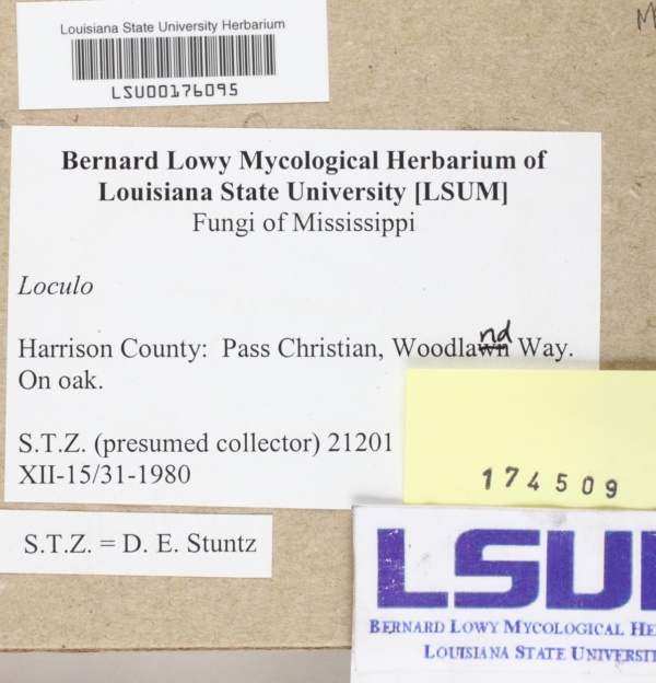
"dwc:county": "Harrison",
"dwc:recordedBy": "Daniel E. Stuntz",
"dwc:georeferenceSources": "2015-07-08; Google Maps",
"dcterms:references": "https://mycoportal.org/portal/collections/individual/index.php?occid=1997850",
"dwc:occurrenceID": "185784e2-b8cc-4683-9b35-f34558f39789",
"id": "1997850",
"dwc:stateProvince": "Mississippi",
"dwc:eventDate": "1980-07-00",
"dwc:collectionID": "8f3d5b53-acea-4e2a-89de-0162fd1ffadb",
"dwc:institutionCode": "LSUM",
"dwc:country": "United States",
"idigbio:recordId": "urn:uuid:185784e2-b8cc-4683-9b35-f34558f39789",
"dwc:collectionCode": "Fungi",
"symbiota:recordEnteredBy": "haoxuan",
"dwc:decimalLatitude": "30.356442",
"dwc:basisOfRecord": "PreservedSpecimen",
"dwc:georeferenceRemarks": "lat/long = midpoint of Woodland Way; uncertainty = extent of Woodland Way; lat/long = midpoint of Woodland Way; uncertainty = extent of Woodland Way",
"dc:rights": "http://creativecommons.org/publicdomain/zero/1.0/",
"dwc:habitat": "On oak",
"dwc:locality": "Pass Christian, Woodland Way",
"dwc:geodeticDatum": "WGS84",
"dwc:catalogNumber": "LSU00176095",
"dwc:month": "7",
"dwc:decimalLongitude": "-89.226388",
"dwc:coordinateUncertaintyInMeters": "836",
"dwc:otherCatalogNumbers": "174509",
"dwc:georeferencedBy": "cmozzicato (2015-07-08 14:27:32)",
"dwc:verbatimEventDate": "XII-15/31-1980",
"dwc:recordNumber": "21201",
"dcterms:modified": "2019-01-01 15:00:38",
"dwc:scientificName": "Loculo",
"dwc:year": "1980"
},
"indexTerms": {
"recordset": "7ad07cff-f782-4ddf-b780-3a757cdb77e0",
"dqs": 0.30434782608695654,
"stateprovince": "mississippi",
"county": "harrison",
"catalognumber": "lsu00176095",
"startdayofyear": 188,
"collector": "daniel e. stuntz",
"continent": "north america",
"uuid": "8147adcd-d4c4-44e7-8086-3f874ed129fc",
"countrycode": "usa",
"basisofrecord": "preservedspecimen",
"institutioncode": "lsum",
"mediarecords": [
"d98b01f3-3afc-44c7-9100-303da3712410"
],
"datecollected": "1980-07-06",
"etag": "87101621ce8f93bd17aba7fe76d95cee01278b3b",
"recordnumber": "21201",
"hasImage": true,
"collectionid": "8f3d5b53-acea-4e2a-89de-0162fd1ffadb",
"scientificname": "loculo",
"locality": "pass christian, woodland way",
"hasMedia": true,
"coordinateuncertainty": 836,
"datemodified": "2021-04-19T22:39:30.902311+00:00",
"occurrenceid": "185784e2-b8cc-4683-9b35-f34558f39789",
"country": "united states",
"geopoint": {
"lat": 30.356442,
"lon": -89.226388
},
"collectioncode": "fungi",
"flags": [
"idigbio_isocountrycode_added",
"dwc_continent_added"
],
"verbatimeventdate": "xii-15/31-1980",
"recordids": [
"urn:uuid:185784e2-b8cc-4683-9b35-f34558f39789",
"7ad07cff-f782-4ddf-b780-3a757cdb77e0\\1997850",
"7ad07cff-f782-4ddf-b780-3a757cdb77e0\\185784e2-b8cc-4683-9b35-f34558f39789"
],
"eventdate": "1980-07-00",
"indexData": {
"dwc:county": "Harrison",
"dwc:recordedBy": "Daniel E. Stuntz",
"idigbio:uuid": "8147adcd-d4c4-44e7-8086-3f874ed129fc",
"dwc:georeferenceSources": "2015-07-08; Google Maps",
"dwc:habitat": "On oak",
"idigbio:recordIds": [
"urn:uuid:185784e2-b8cc-4683-9b35-f34558f39789",
"7ad07cff-f782-4ddf-b780-3a757cdb77e0\\1997850",
"7ad07cff-f782-4ddf-b780-3a757cdb77e0\\185784e2-b8cc-4683-9b35-f34558f39789"
],
"dwc:occurrenceID": "185784e2-b8cc-4683-9b35-f34558f39789",
"dwc:decimalLatitude": "30.356442",
"symbiota:recordEnteredBy": "haoxuan",
"idigbio:parent": "7ad07cff-f782-4ddf-b780-3a757cdb77e0",
"dwc:stateProvince": "Mississippi",
"dwc:eventDate": "1980-07-00",
"dwc:collectionID": "8f3d5b53-acea-4e2a-89de-0162fd1ffadb",
"dwc:institutionCode": "LSUM",
"dwc:country": "United States",
"idigbio:recordId": "urn:uuid:185784e2-b8cc-4683-9b35-f34558f39789",
"idigbio:etag": "87101621ce8f93bd17aba7fe76d95cee01278b3b",
"dwc:collectionCode": "Fungi",
"id": "1997850",
"dwc:georeferenceRemarks": "lat/long = midpoint of Woodland Way; uncertainty = extent of Woodland Way; lat/long = midpoint of Woodland Way; uncertainty = extent of Woodland Way",
"dwc:basisOfRecord": "PreservedSpecimen",
"dwc:continent": "north america",
"dc:rights": "http://creativecommons.org/publicdomain/zero/1.0/",
"idigbio:siblings": {
"mediarecord": [
"d98b01f3-3afc-44c7-9100-303da3712410"
]
},
"flag_idigbio_isocountrycode_added": true,
"dcterms:references": "https://mycoportal.org/portal/collections/individual/index.php?occid=1997850",
"idigbio:dateModified": "2021-04-19T22:39:30.902311",
"dwc:locality": "Pass Christian, Woodland Way",
"dwc:geodeticDatum": "WGS84",
"dwc:catalogNumber": "LSU00176095",
"dwc:month": "7",
"dwc:decimalLongitude": "-89.226388",
"dwc:scientificName": "Loculo",
"dwc:otherCatalogNumbers": "174509",
"dwc:georeferencedBy": "cmozzicato (2015-07-08 14:27:32)",
"dwc:verbatimEventDate": "XII-15/31-1980",
"flag_dwc_continent_added": true,
"dwc:recordNumber": "21201",
"idigbio:isocountrycode": "usa",
"dcterms:modified": "2019-01-01 15:00:38",
"dwc:coordinateUncertaintyInMeters": "836",
"dwc:year": "1980"
}
},
"attribution": {
"uuid": "7ad07cff-f782-4ddf-b780-3a757cdb77e0",
"name": "Louisiana State University, Bernard Lowy Mycological Herbarium",
"description": "Louisiana State University Bernard Lowy Mycological Herbarium (LSUM) was founded in 1954 and houses ca. 20,000 higher fungi from tropical America and U.S.A.",
"logo": "https://www.mycoportal.org/portal/self/images/collicons/LSU.jpg",
"url": "http://www.herbarium.lsu.edu/",
"emllink": "https://www.mycoportal.org/portal/collections/datasets/emlhandler.php?collid=15",
"archivelink": "https://www.mycoportal.org/portal/content/dwca/lsum-fungi_dwc-a.zip",
"contacts": [
{
"email": "help@mycoportal.org"
},
{
"email": "help@mycoportal.org"
},
{
"email": "jkluse@lsu.edu"
},
{
"first_name": null,
"last_name": "Jennifer S. Kluse, Collections Manager",
"email": "jkluse@lsu.edu"
},
{
"first_name": null,
"last_name": "Jennifer S. Kluse, Collections Manager",
"email": "jkluse@lsu.edu"
}
],
"data_rights": "CC0",
"publisher": "e9c875f0-d9c9-426b-bdc8-0999eb1b6deb",
"totalCount": 18363
}
}
 Louisiana State University Bernard Lowy Mycological Herbarium (LSUM) was founded in 1954 and houses ca. 20,000 higher fungi from tropical America and U.S.A.