{
"uuid": "7caa073f-7410-4e4d-a093-68ee3df4a292",
"type": "records",
"etag": "00faf1e4bcafc71ceeb8338e3a65117a798f09c5",
"data": {
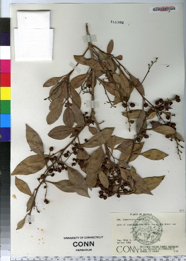
"dwc:specificEpithet": "erectus",
"dwc:countryCode": "US",
"dwc:county": "Monroe County",
"dwc:recordedBy": "Eric A. Christenson",
"dwc:georeferenceSources": "no date. Topozone. TopoZone.com © Maps a la carte, Inc. - All rights reserved.",
"dwc:order": "Myrtales",
"dwc:occurrenceID": "urn:catalog:UConn:CONN:CONN00098881",
"dwc:stateProvince": "Florida",
"dwc:eventDate": "1982-03-18",
"dwc:country": "USA",
"dwc:collectionCode": "CONN",
"dwc:verbatimLatitude": "24°43' 06\" N",
"dwc:kingdom": "Dicotyledonae",
"dwc:decimalLatitude": "24.71833",
"dwc:basisOfRecord": "Preserved Specimen",
"dwc:genus": "Conocarpus",
"dwc:family": "Combretaceae",
"dwc:coordinateUncertaintyInMeters": "5000",
"dwc:municipality": "Big Torch Key",
"dwc:previousIdentifications": "Conocarpus erectus L.",
"dwc:locationAccordingTo": "seconds added from gazetteer",
"dwc:locality": "Big Torch Key, side of road/mangrove salt flats",
"dwc:institutionCode": "UConn",
"dwc:higherClassification": "Plantae; Dicotyledonae; Myrtales; Combretaceae",
"dwc:catalogNumber": "CONN00098881",
"dwc:higherGeography": "USA; Florida; Monroe County; Big Torch Key",
"dwc:month": "3",
"dwc:decimalLongitude": "-81.44",
"dwc:verbatimLongitude": "081°26' 24\" W",
"dwc:verbatimEventDate": "18-Mar-82",
"dwc:recordNumber": "286",
"dcterms:rights": "This work is licensed under a Creative Commons CCZero 1.0 License http://i.creativecommons.org/l/by-nc-sa/4.0/88x31.png",
"dcterms:modified": "2010-05-10T00:00-0500",
"dwc:scientificName": "Conocarpus erectus L.",
"dwc:day": "18",
"dwc:datasetID": "87729",
"dwc:year": "1982"
},
"indexTerms": {
"geopoint": {
"lat": 24.71833,
"lon": -81.44
},
"family": "combretaceae",
"recordset": "e70af26a-fb9e-43ab-96a0-d62a2df37e6d",
"dqs": 0.3333333333333333,
"stateprovince": "florida",
"municipality": "big torch key",
"county": "monroe county",
"catalognumber": "conn00098881",
"startdayofyear": 77,
"specificepithet": "erectus",
"continent": "north america",
"uuid": "7caa073f-7410-4e4d-a093-68ee3df4a292",
"countrycode": "usa",
"basisofrecord": "preservedspecimen",
"collector": "eric a. christenson",
"institutioncode": "uconn",
"mediarecords": [
"698754a1-7fb1-42da-bc6b-fe0d8ac0bb1b"
],
"datecollected": "1982-03-18T00:00:00+00:00",
"etag": "00faf1e4bcafc71ceeb8338e3a65117a798f09c5",
"recordnumber": "286",
"hasImage": true,
"kingdom": "dicotyledonae",
"highertaxon": "plantae; dicotyledonae; myrtales; combretaceae",
"scientificname": "conocarpus erectus l.",
"indexData": {
"dwc:specificEpithet": "erectus",
"dwc:countryCode": "US",
"dwc:county": "Monroe County",
"dwc:recordedBy": "Eric A. Christenson",
"idigbio:uuid": "7caa073f-7410-4e4d-a093-68ee3df4a292",
"dwc:georeferenceSources": "no date. Topozone. TopoZone.com © Maps a la carte, Inc. - All rights reserved.",
"dwc:order": "Myrtales",
"idigbio:isocountrycode": "usa",
"dwc:locality": "Big Torch Key, side of road/mangrove salt flats",
"idigbio:recordIds": [
"e70af26a-fb9e-43ab-96a0-d62a2df37e6d\\urn:catalog:uconn:conn:conn00098881"
],
"dwc:occurrenceID": "urn:catalog:UConn:CONN:CONN00098881",
"dwc:scientificName": "Conocarpus erectus L.",
"idigbio:parent": "e70af26a-fb9e-43ab-96a0-d62a2df37e6d",
"dwc:stateProvince": "Florida",
"dwc:eventDate": "1982-03-18",
"dwc:country": "united states",
"idigbio:etag": "00faf1e4bcafc71ceeb8338e3a65117a798f09c5",
"dwc:collectionCode": "CONN",
"dwc:verbatimLatitude": "24°43' 06\" N",
"dwc:kingdom": "Dicotyledonae",
"dwc:decimalLatitude": "24.71833",
"dwc:basisOfRecord": "Preserved Specimen",
"dwc:genus": "Conocarpus",
"dwc:continent": "north america",
"dwc:family": "Combretaceae",
"flag_dwc_continent_added": true,
"flag_dwc_country_replaced": true,
"dwc:municipality": "Big Torch Key",
"dwc:previousIdentifications": "Conocarpus erectus L.",
"idigbio:siblings": {
"mediarecord": [
"698754a1-7fb1-42da-bc6b-fe0d8ac0bb1b"
]
},
"flag_idigbio_isocountrycode_added": true,
"idigbio:dateModified": "2014-09-09T05:18:18.874000",
"dwc:locationAccordingTo": "seconds added from gazetteer",
"dwc:institutionCode": "UConn",
"dwc:higherClassification": "Plantae; Dicotyledonae; Myrtales; Combretaceae",
"dwc:catalogNumber": "CONN00098881",
"dwc:higherGeography": "USA; Florida; Monroe County; Big Torch Key",
"dwc:month": "3",
"dwc:decimalLongitude": "-81.44",
"dwc:verbatimLongitude": "081°26' 24\" W",
"dwc:verbatimEventDate": "18-Mar-82",
"dwc:recordNumber": "286",
"dcterms:rights": "This work is licensed under a Creative Commons CCZero 1.0 License http://i.creativecommons.org/l/by-nc-sa/4.0/88x31.png",
"flag_taxon_match_failed": true,
"dcterms:modified": "2010-05-10T00:00-0500",
"dwc:coordinateUncertaintyInMeters": "5000",
"dwc:day": "18",
"dwc:datasetID": "87729",
"dwc:year": "1982"
},
"hasMedia": true,
"coordinateuncertainty": 5000,
"datemodified": "2014-09-09T05:18:18.874000+00:00",
"occurrenceid": "urn:catalog:uconn:conn:conn00098881",
"country": "united states",
"locality": "big torch key, side of road/mangrove salt flats",
"collectioncode": "conn",
"eventdate": "1982-03-18",
"flags": [
"geopoint_datum_missing",
"rev_geocode_eez",
"geopoint_low_precision",
"dwc_continent_added",
"dwc_country_replaced",
"idigbio_isocountrycode_added",
"taxon_match_failed"
],
"verbatimeventdate": "18-mar-82",
"recordids": [
"e70af26a-fb9e-43ab-96a0-d62a2df37e6d\\urn:catalog:uconn:conn:conn00098881"
],
"genus": "conocarpus",
"order": "myrtales",
"datasetid": "87729"
},
"attribution": {
"totalCount": 172098
}
}