{
"uuid": "78b2ce0b-eee8-458b-a813-aa598d63f41a",
"type": "records",
"etag": "ece90c217dd4eaede7c58f2e8b7b784412226c60",
"data": {
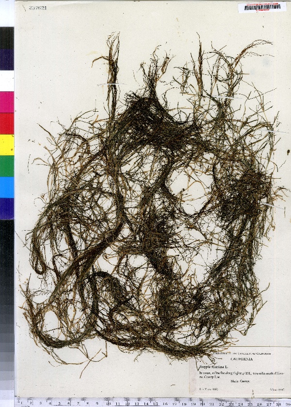
"dwc:specificEpithet": "maritima",
"dwc:countryCode": "US",
"dwc:county": "Marin County",
"dwc:recordedBy": "Leo Koch",
"dwc:georeferenceSources": "no date. USGS Geographic Names Information System (GNIS). U. S. Geological Survey.",
"dwc:order": "Najadales",
"dwc:habitat": "In water, saline flat.",
"dwc:occurrenceID": "urn:catalog:UConn:CONN:CONN00163191",
"dwc:verbatimElevation": "39 FT",
"dwc:stateProvince": "California",
"dwc:eventDate": "1940-06-05",
"dwc:country": "USA",
"dwc:collectionCode": "CONN",
"dwc:verbatimLatitude": "38°04' 00 N",
"dwc:kingdom": "Monocotyledonae",
"dwc:decimalLatitude": "38.06666",
"dwc:maximumElevationInMeters": "11",
"dwc:basisOfRecord": "Preserved Specimen",
"dwc:genus": "Ruppia",
"dwc:family": "Ruppiaceae",
"dwc:coordinateUncertaintyInMeters": "20000",
"dwc:previousIdentifications": "Ruppia maritima L.",
"dwc:locationAccordingTo": "seconds added from gazetteer",
"dwc:locality": "Along Highway 101, two miles souh of Sonoma County Line",
"dwc:institutionCode": "UConn",
"dwc:reproductiveCondition": "flowering",
"dwc:higherClassification": "Plantae; Monocotyledonae; Najadales; Ruppiaceae",
"dwc:catalogNumber": "CONN00163191",
"dwc:higherGeography": "USA; California; Marin County;",
"dwc:month": "6",
"dwc:decimalLongitude": "-122.52777",
"dwc:verbatimLongitude": "122°31' 40\" W",
"dwc:verbatimEventDate": "5 Jun 1940",
"dwc:recordNumber": "1005",
"dcterms:rights": "This work is licensed under a Creative Commons CCZero 1.0 License http://i.creativecommons.org/l/by-nc-sa/4.0/88x31.png",
"dwc:minimumElevationInMeters": "11",
"dcterms:modified": "2012-12-19T00:00-0500",
"dwc:scientificName": "Ruppia maritima L.",
"dwc:day": "5",
"dwc:datasetID": "168301",
"dwc:year": "1940"
},
"indexTerms": {
"geopoint": {
"lat": 38.06666,
"lon": -122.52777
},
"family": "ruppiaceae",
"recordset": "e70af26a-fb9e-43ab-96a0-d62a2df37e6d",
"dqs": 0.37681159420289856,
"stateprovince": "california",
"county": "marin county",
"catalognumber": "conn00163191",
"startdayofyear": 157,
"specificepithet": "maritima",
"continent": "north america",
"uuid": "78b2ce0b-eee8-458b-a813-aa598d63f41a",
"countrycode": "usa",
"basisofrecord": "preservedspecimen",
"collector": "leo koch",
"institutioncode": "uconn",
"mediarecords": [
"d40aae27-ba78-4f3f-8cc6-25edbd708d13"
],
"datecollected": "1940-06-05T00:00:00+00:00",
"etag": "ece90c217dd4eaede7c58f2e8b7b784412226c60",
"recordnumber": "1005",
"minelevation": 11,
"hasImage": true,
"kingdom": "monocotyledonae",
"maxelevation": 11,
"highertaxon": "plantae; monocotyledonae; najadales; ruppiaceae",
"scientificname": "ruppia maritima l.",
"indexData": {
"dwc:specificEpithet": "maritima",
"dwc:countryCode": "US",
"dwc:county": "Marin County",
"dwc:recordedBy": "Leo Koch",
"idigbio:uuid": "78b2ce0b-eee8-458b-a813-aa598d63f41a",
"dwc:locationAccordingTo": "seconds added from gazetteer",
"dwc:order": "Najadales",
"dwc:habitat": "In water, saline flat.",
"idigbio:isocountrycode": "usa",
"dwc:locality": "Along Highway 101, two miles souh of Sonoma County Line",
"idigbio:recordIds": [
"e70af26a-fb9e-43ab-96a0-d62a2df37e6d\\urn:catalog:uconn:conn:conn00163191"
],
"dwc:occurrenceID": "urn:catalog:UConn:CONN:CONN00163191",
"dwc:scientificName": "Ruppia maritima L.",
"dwc:verbatimElevation": "39 FT",
"idigbio:parent": "e70af26a-fb9e-43ab-96a0-d62a2df37e6d",
"dwc:stateProvince": "California",
"dwc:eventDate": "1940-06-05",
"dwc:country": "united states",
"idigbio:etag": "ece90c217dd4eaede7c58f2e8b7b784412226c60",
"dwc:collectionCode": "CONN",
"dwc:verbatimLatitude": "38°04' 00 N",
"dwc:kingdom": "Monocotyledonae",
"dwc:decimalLatitude": "38.06666",
"dwc:maximumElevationInMeters": "11",
"dwc:basisOfRecord": "Preserved Specimen",
"dwc:genus": "Ruppia",
"dwc:continent": "north america",
"dwc:family": "Ruppiaceae",
"flag_dwc_continent_added": true,
"flag_dwc_country_replaced": true,
"dwc:previousIdentifications": "Ruppia maritima L.",
"idigbio:siblings": {
"mediarecord": [
"d40aae27-ba78-4f3f-8cc6-25edbd708d13"
]
},
"flag_idigbio_isocountrycode_added": true,
"idigbio:dateModified": "2014-09-09T05:06:54.952000",
"dwc:georeferenceSources": "no date. USGS Geographic Names Information System (GNIS). U. S. Geological Survey.",
"dwc:institutionCode": "UConn",
"dwc:reproductiveCondition": "flowering",
"dwc:higherClassification": "Plantae; Monocotyledonae; Najadales; Ruppiaceae",
"dwc:catalogNumber": "CONN00163191",
"dwc:higherGeography": "USA; California; Marin County;",
"dwc:month": "6",
"dwc:decimalLongitude": "-122.52777",
"dwc:verbatimLongitude": "122°31' 40\" W",
"dwc:verbatimEventDate": "5 Jun 1940",
"dwc:recordNumber": "1005",
"dcterms:rights": "This work is licensed under a Creative Commons CCZero 1.0 License http://i.creativecommons.org/l/by-nc-sa/4.0/88x31.png",
"flag_taxon_match_failed": true,
"dwc:minimumElevationInMeters": "11",
"dcterms:modified": "2012-12-19T00:00-0500",
"dwc:coordinateUncertaintyInMeters": "20000",
"dwc:day": "5",
"dwc:datasetID": "168301",
"dwc:year": "1940"
},
"hasMedia": true,
"coordinateuncertainty": 20000,
"datemodified": "2014-09-09T05:06:54.952000+00:00",
"occurrenceid": "urn:catalog:uconn:conn:conn00163191",
"country": "united states",
"locality": "along highway 101, two miles souh of sonoma county line",
"collectioncode": "conn",
"eventdate": "1940-06-05",
"flags": [
"geopoint_datum_missing",
"dwc_continent_added",
"dwc_country_replaced",
"idigbio_isocountrycode_added",
"taxon_match_failed"
],
"verbatimeventdate": "5 jun 1940",
"recordids": [
"e70af26a-fb9e-43ab-96a0-d62a2df37e6d\\urn:catalog:uconn:conn:conn00163191"
],
"genus": "ruppia",
"order": "najadales",
"datasetid": "168301"
},
"attribution": {
"totalCount": 172098
}
}