{
"uuid": "690eb51d-6f88-4fda-b389-8f552a9b9f29",
"type": "records",
"etag": "86e77bd6222a9d95c2a272befb6f5088136ab924",
"data": {
"dwc:countryCode": "MX",
"dwc:kingdom": "Dicotyledonae",
"dwc:recordedBy": "H.W. Pfeifer & L.E. Skog",
"dwc:georeferenceSources": "National Geospatial Intelligence Agency no date. Geonames, the NGA Geonet Names Server (GNS).",
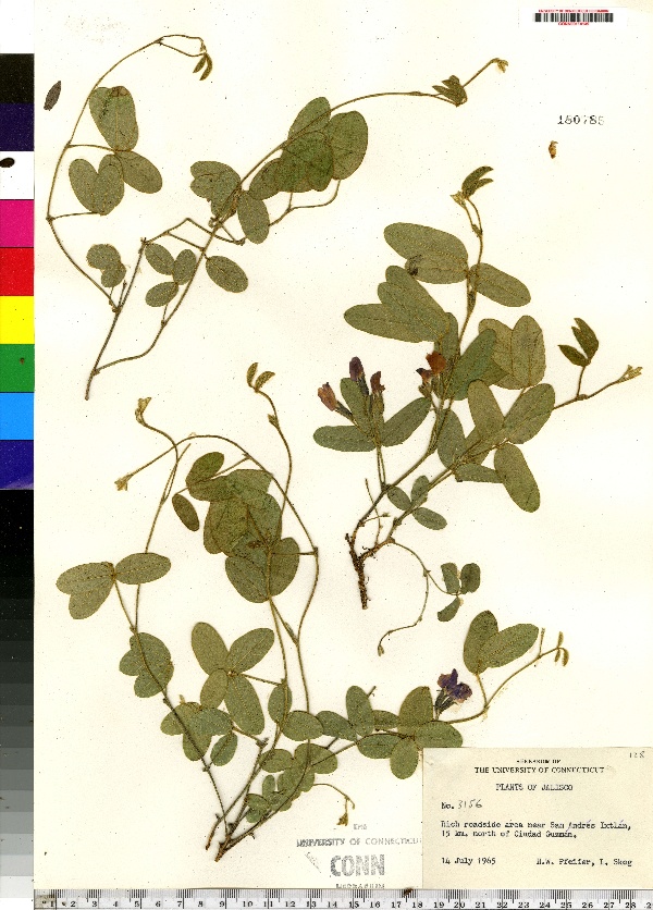
"dwc:habitat": "Rich roadside",
"dwc:occurrenceID": "urn:catalog:UConn:CONN:CONN00114149",
"dwc:stateProvince": "Jalisco",
"dwc:eventDate": "1965-07-14",
"dwc:country": "Mexico",
"dwc:collectionCode": "CONN",
"dwc:verbatimLatitude": "19°49' N",
"dwc:decimalLatitude": "19.81666",
"dwc:basisOfRecord": "Preserved Specimen",
"dwc:family": "Fabaceae",
"dwc:municipality": "San Andres Ixtlan",
"dwc:locationAccordingTo": "minutes added from gazetteer",
"dwc:locality": "Near San Andres Ixtlan, 15 km. north of Ciudad Guzman",
"dwc:institutionCode": "UConn",
"dwc:reproductiveCondition": "flowering",
"dwc:higherClassification": "Plantae; Dicotyledonae; ; Fabaceae",
"dwc:catalogNumber": "CONN00114149",
"dwc:higherGeography": "Mexico; Jalisco; ; San Andres Ixtlan",
"dwc:month": "7",
"dwc:decimalLongitude": "-103.46666",
"dwc:coordinateUncertaintyInMeters": "20000",
"dwc:verbatimEventDate": "14-Jul-65",
"dwc:recordNumber": "3156",
"dcterms:rights": "This work is licensed under a Creative Commons CCZero 1.0 License http://i.creativecommons.org/l/by-nc-sa/4.0/88x31.png",
"dcterms:modified": "2011-05-04T00:00-0500",
"dwc:verbatimLongitude": "103°28' W",
"dwc:day": "14",
"dwc:datasetID": "110101",
"dwc:year": "1965"
},
"indexTerms": {
"geopoint": {
"lat": 19.81666,
"lon": -103.46666
},
"family": "fabaceae",
"recordset": "e70af26a-fb9e-43ab-96a0-d62a2df37e6d",
"dqs": 0.3188405797101449,
"stateprovince": "jalisco",
"municipality": "san andres ixtlan",
"catalognumber": "conn00114149",
"startdayofyear": 195,
"collector": "h.w. pfeifer & l.e. skog",
"continent": "north america",
"uuid": "690eb51d-6f88-4fda-b389-8f552a9b9f29",
"countrycode": "mex",
"basisofrecord": "preservedspecimen",
"institutioncode": "uconn",
"mediarecords": [
"059ab25e-ace9-48df-b7af-6629c83bc9c3"
],
"datecollected": "1965-07-14T00:00:00+00:00",
"etag": "86e77bd6222a9d95c2a272befb6f5088136ab924",
"recordnumber": "3156",
"hasImage": true,
"kingdom": "dicotyledonae",
"highertaxon": "plantae; dicotyledonae; ; fabaceae",
"indexData": {
"dwc:countryCode": "MX",
"dwc:kingdom": "Dicotyledonae",
"dwc:recordedBy": "H.W. Pfeifer & L.E. Skog",
"idigbio:uuid": "690eb51d-6f88-4fda-b389-8f552a9b9f29",
"dwc:georeferenceSources": "National Geospatial Intelligence Agency no date. Geonames, the NGA Geonet Names Server (GNS).",
"dwc:habitat": "Rich roadside",
"idigbio:isocountrycode": "mex",
"dwc:locality": "Near San Andres Ixtlan, 15 km. north of Ciudad Guzman",
"idigbio:recordIds": [
"e70af26a-fb9e-43ab-96a0-d62a2df37e6d\\urn:catalog:uconn:conn:conn00114149"
],
"dwc:occurrenceID": "urn:catalog:UConn:CONN:CONN00114149",
"idigbio:parent": "e70af26a-fb9e-43ab-96a0-d62a2df37e6d",
"dwc:stateProvince": "Jalisco",
"dwc:eventDate": "1965-07-14",
"dwc:country": "Mexico",
"idigbio:etag": "86e77bd6222a9d95c2a272befb6f5088136ab924",
"dwc:collectionCode": "CONN",
"dwc:verbatimLatitude": "19°49' N",
"dwc:decimalLatitude": "19.81666",
"dwc:basisOfRecord": "Preserved Specimen",
"dwc:continent": "north america",
"dwc:family": "Fabaceae",
"flag_dwc_continent_added": true,
"dwc:municipality": "San Andres Ixtlan",
"idigbio:siblings": {
"mediarecord": [
"059ab25e-ace9-48df-b7af-6629c83bc9c3"
]
},
"flag_idigbio_isocountrycode_added": true,
"idigbio:dateModified": "2014-09-09T03:12:41.775000",
"dwc:locationAccordingTo": "minutes added from gazetteer",
"dwc:institutionCode": "UConn",
"dwc:reproductiveCondition": "flowering",
"dwc:higherClassification": "Plantae; Dicotyledonae; ; Fabaceae",
"dwc:catalogNumber": "CONN00114149",
"dwc:higherGeography": "Mexico; Jalisco; ; San Andres Ixtlan",
"dwc:month": "7",
"dwc:decimalLongitude": "-103.46666",
"dwc:verbatimLongitude": "103°28' W",
"dwc:verbatimEventDate": "14-Jul-65",
"dwc:recordNumber": "3156",
"dcterms:rights": "This work is licensed under a Creative Commons CCZero 1.0 License http://i.creativecommons.org/l/by-nc-sa/4.0/88x31.png",
"dcterms:modified": "2011-05-04T00:00-0500",
"dwc:coordinateUncertaintyInMeters": "20000",
"dwc:day": "14",
"dwc:datasetID": "110101",
"dwc:year": "1965"
},
"hasMedia": true,
"coordinateuncertainty": 20000,
"datemodified": "2014-09-09T03:12:41.775000+00:00",
"occurrenceid": "urn:catalog:uconn:conn:conn00114149",
"country": "mexico",
"locality": "near san andres ixtlan, 15 km. north of ciudad guzman",
"collectioncode": "conn",
"flags": [
"geopoint_datum_missing",
"dwc_continent_added",
"idigbio_isocountrycode_added"
],
"verbatimeventdate": "14-jul-65",
"recordids": [
"e70af26a-fb9e-43ab-96a0-d62a2df37e6d\\urn:catalog:uconn:conn:conn00114149"
],
"eventdate": "1965-07-14",
"datasetid": "110101"
},
"attribution": {
"totalCount": 172098
}
}