{
"uuid": "5fa6177c-c9ea-4b7f-a09b-33fc9cf737f7",
"type": "records",
"etag": "084a64bc4cbebd78a2990566dcee0cbf6698bc11",
"data": {
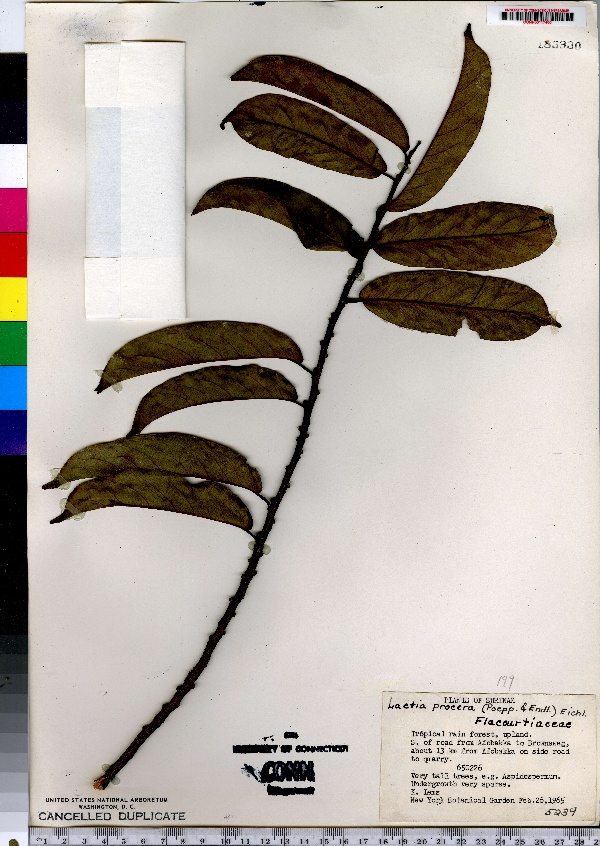
"dwc:specificEpithet": "procera",
"dwc:countryCode": "SR",
"dwc:county": "Brownsweg",
"dwc:recordedBy": "K. Lems",
"dwc:georeferenceSources": "no date. USGS Geographic Names Information System (GNIS). U. S. Geological Survey.",
"dwc:order": "Violales",
"dwc:habitat": "Tropical rain forest, upland. Roadside to quarry",
"dwc:occurrenceID": "urn:catalog:UConn:CONN:CONN00117400",
"dwc:stateProvince": "Brokopondo",
"dwc:eventDate": "1965-02-26",
"dwc:country": "Suriname",
"dwc:collectionCode": "CONN",
"dwc:verbatimLatitude": "5°1' N",
"dwc:kingdom": "Dicotyledonae",
"dwc:decimalLatitude": "5.01666",
"dwc:occurrenceRemarks": "Very tall trees, e.g. Aspidospermum. Undergrowth very sparse",
"dwc:basisOfRecord": "Preserved Specimen",
"dwc:genus": "Laetia",
"dwc:family": "Flacourtiaceae",
"dwc:coordinateUncertaintyInMeters": "20000",
"dwc:previousIdentifications": "Laetia procera (Poepp.) Eichl.",
"dwc:locationAccordingTo": "minutes added from gazetteer",
"dwc:locality": "S of the road from Afobakka to Brownsweg, about 13 km from Afobakka on side of road to quarry",
"dwc:institutionCode": "UConn",
"dwc:reproductiveCondition": "sterile/vegetative",
"dwc:higherClassification": "Plantae; Dicotyledonae; Violales; Flacourtiaceae",
"dwc:catalogNumber": "CONN00117400",
"dwc:higherGeography": "Suriname; Brokopondo; Brownsweg;",
"dwc:month": "2",
"dwc:decimalLongitude": "-55.16666",
"dwc:verbatimLongitude": "55°10' W",
"dwc:verbatimEventDate": "26-Feb-65",
"dwc:recordNumber": "5239",
"dcterms:rights": "This work is licensed under a Creative Commons CCZero 1.0 License http://i.creativecommons.org/l/by-nc-sa/4.0/88x31.png",
"dcterms:modified": "2011-07-11T00:00-0500",
"dwc:scientificName": "Laetia procera (Poepp.) Eichl.",
"dwc:day": "26",
"dwc:datasetID": "112232",
"dwc:year": "1965"
},
"indexTerms": {
"geopoint": {
"lat": 5.01666,
"lon": -55.16666
},
"family": "flacourtiaceae",
"recordset": "e70af26a-fb9e-43ab-96a0-d62a2df37e6d",
"dqs": 0.36231884057971014,
"stateprovince": "brokopondo",
"county": "brownsweg",
"catalognumber": "conn00117400",
"startdayofyear": 57,
"specificepithet": "procera",
"continent": "south america",
"uuid": "5fa6177c-c9ea-4b7f-a09b-33fc9cf737f7",
"countrycode": "sur",
"basisofrecord": "preservedspecimen",
"collector": "k. lems",
"institutioncode": "uconn",
"mediarecords": [
"fd8f1fc2-2e17-4942-bfe5-2de6bd561809"
],
"datecollected": "1965-02-26T00:00:00+00:00",
"etag": "084a64bc4cbebd78a2990566dcee0cbf6698bc11",
"recordnumber": "5239",
"hasImage": true,
"kingdom": "dicotyledonae",
"highertaxon": "plantae; dicotyledonae; violales; flacourtiaceae",
"scientificname": "laetia procera (poepp.) eichl.",
"indexData": {
"dwc:specificEpithet": "procera",
"dwc:countryCode": "SR",
"dwc:county": "Brownsweg",
"dwc:recordedBy": "K. Lems",
"idigbio:uuid": "5fa6177c-c9ea-4b7f-a09b-33fc9cf737f7",
"dwc:georeferenceSources": "no date. USGS Geographic Names Information System (GNIS). U. S. Geological Survey.",
"dwc:order": "Violales",
"dwc:habitat": "Tropical rain forest, upland. Roadside to quarry",
"idigbio:isocountrycode": "sur",
"dwc:locality": "S of the road from Afobakka to Brownsweg, about 13 km from Afobakka on side of road to quarry",
"idigbio:recordIds": [
"e70af26a-fb9e-43ab-96a0-d62a2df37e6d\\urn:catalog:uconn:conn:conn00117400"
],
"dwc:occurrenceID": "urn:catalog:UConn:CONN:CONN00117400",
"dwc:scientificName": "Laetia procera (Poepp.) Eichl.",
"idigbio:parent": "e70af26a-fb9e-43ab-96a0-d62a2df37e6d",
"dwc:stateProvince": "Brokopondo",
"dwc:eventDate": "1965-02-26",
"dwc:country": "Suriname",
"idigbio:etag": "084a64bc4cbebd78a2990566dcee0cbf6698bc11",
"dwc:collectionCode": "CONN",
"dwc:verbatimLatitude": "5°1' N",
"dwc:kingdom": "Dicotyledonae",
"dwc:decimalLatitude": "5.01666",
"dwc:occurrenceRemarks": "Very tall trees, e.g. Aspidospermum. Undergrowth very sparse",
"dwc:basisOfRecord": "Preserved Specimen",
"dwc:genus": "Laetia",
"dwc:continent": "south america",
"dwc:family": "Flacourtiaceae",
"flag_dwc_continent_added": true,
"dwc:previousIdentifications": "Laetia procera (Poepp.) Eichl.",
"idigbio:siblings": {
"mediarecord": [
"fd8f1fc2-2e17-4942-bfe5-2de6bd561809"
]
},
"flag_idigbio_isocountrycode_added": true,
"idigbio:dateModified": "2014-09-09T02:33:25.750000",
"dwc:locationAccordingTo": "minutes added from gazetteer",
"dwc:institutionCode": "UConn",
"dwc:reproductiveCondition": "sterile/vegetative",
"dwc:higherClassification": "Plantae; Dicotyledonae; Violales; Flacourtiaceae",
"dwc:catalogNumber": "CONN00117400",
"dwc:higherGeography": "Suriname; Brokopondo; Brownsweg;",
"dwc:month": "2",
"dwc:decimalLongitude": "-55.16666",
"dwc:verbatimLongitude": "55°10' W",
"dwc:verbatimEventDate": "26-Feb-65",
"dwc:recordNumber": "5239",
"dcterms:rights": "This work is licensed under a Creative Commons CCZero 1.0 License http://i.creativecommons.org/l/by-nc-sa/4.0/88x31.png",
"flag_taxon_match_failed": true,
"dcterms:modified": "2011-07-11T00:00-0500",
"dwc:coordinateUncertaintyInMeters": "20000",
"dwc:day": "26",
"dwc:datasetID": "112232",
"dwc:year": "1965"
},
"hasMedia": true,
"coordinateuncertainty": 20000,
"datemodified": "2014-09-09T02:33:25.750000+00:00",
"occurrenceid": "urn:catalog:uconn:conn:conn00117400",
"country": "suriname",
"locality": "s of the road from afobakka to brownsweg, about 13 km from afobakka on side of road to quarry",
"collectioncode": "conn",
"eventdate": "1965-02-26",
"flags": [
"geopoint_datum_missing",
"dwc_continent_added",
"idigbio_isocountrycode_added",
"taxon_match_failed"
],
"verbatimeventdate": "26-feb-65",
"recordids": [
"e70af26a-fb9e-43ab-96a0-d62a2df37e6d\\urn:catalog:uconn:conn:conn00117400"
],
"genus": "laetia",
"order": "violales",
"datasetid": "112232"
},
"attribution": {
"totalCount": 172098
}
}