{
"uuid": "431ff467-b7c6-4ca2-9d3f-8d36a061e1f8",
"type": "records",
"etag": "7859110847789a4284acf5a3e35a1fd8ea2e9723",
"data": {
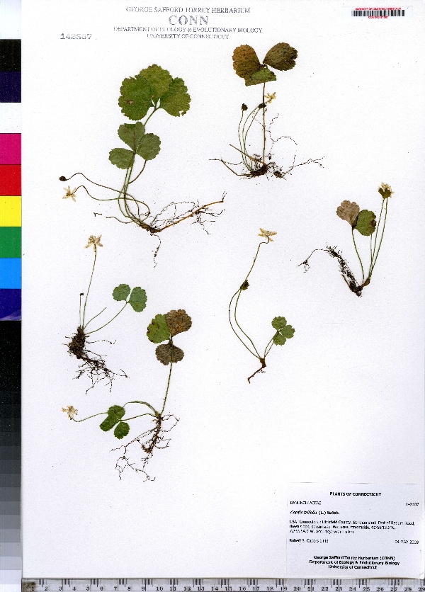
"dwc:specificEpithet": "trifolia",
"dwc:countryCode": "US",
"dwc:county": "Litchfield County",
"dwc:recordedBy": "Robert S. Capers",
"dwc:georeferenceSources": "no date. USGS Geographic Names Information System (GNIS). U. S. Geological Survey.",
"dwc:order": "Ranunculales",
"dwc:habitat": "Wet area, streamside",
"dwc:occurrenceID": "urn:catalog:UConn:CONN:CONN00071067",
"dwc:stateProvince": "Connecticut",
"dwc:eventDate": "2008-05-04",
"dwc:country": "USA",
"dwc:collectionCode": "CONN",
"dwc:verbatimLatitude": "41°55' 12.6\" N",
"dwc:kingdom": "Dicotyledonae",
"dwc:decimalLatitude": "41.92016",
"dwc:basisOfRecord": "Preserved Specimen",
"dwc:genus": "Coptis",
"dwc:family": "Ranunculaceae",
"dwc:coordinateUncertaintyInMeters": "5000",
"dwc:municipality": "Barkhamsted",
"dwc:previousIdentifications": "Coptis trifolia (L.) Salisb.",
"dwc:locationAccordingTo": "seconds added from gazetteer",
"dwc:locality": "East of Ratlum Road, down slope, streamside.",
"dwc:institutionCode": "UConn",
"dwc:reproductiveCondition": "flowering",
"dwc:higherClassification": "Plantae; Dicotyledonae; Ranunculales; Ranunculaceae",
"dwc:catalogNumber": "CONN00071067",
"dwc:higherGeography": "USA; Connecticut; Litchfield County; Barkhamsted",
"dwc:month": "5",
"dwc:decimalLongitude": "-72.93166",
"dwc:verbatimLongitude": "72°55' 54.0\" W",
"dwc:verbatimEventDate": "4 May 2008",
"dwc:recordNumber": "1443",
"dcterms:rights": "This work is licensed under a Creative Commons CCZero 1.0 License http://i.creativecommons.org/l/by-nc-sa/4.0/88x31.png",
"dcterms:modified": "2012-03-30T00:00-0500",
"dwc:scientificName": "Coptis trifolia (L.) Salisb.",
"dwc:day": "4",
"dwc:datasetID": "66028",
"dwc:year": "2008"
},
"indexTerms": {
"geopoint": {
"lat": 41.92016,
"lon": -72.93166
},
"family": "ranunculaceae",
"recordset": "e70af26a-fb9e-43ab-96a0-d62a2df37e6d",
"dqs": 0.36231884057971014,
"stateprovince": "connecticut",
"municipality": "barkhamsted",
"county": "litchfield county",
"catalognumber": "conn00071067",
"startdayofyear": 125,
"specificepithet": "trifolia",
"continent": "north america",
"uuid": "431ff467-b7c6-4ca2-9d3f-8d36a061e1f8",
"countrycode": "usa",
"basisofrecord": "preservedspecimen",
"collector": "robert s. capers",
"institutioncode": "uconn",
"mediarecords": [
"8b17a485-241b-415d-b19e-58c32e598848"
],
"datecollected": "2008-05-04T00:00:00+00:00",
"etag": "7859110847789a4284acf5a3e35a1fd8ea2e9723",
"recordnumber": "1443",
"hasImage": true,
"kingdom": "dicotyledonae",
"highertaxon": "plantae; dicotyledonae; ranunculales; ranunculaceae",
"scientificname": "coptis trifolia (l.) salisb.",
"indexData": {
"dwc:specificEpithet": "trifolia",
"dwc:countryCode": "US",
"dwc:county": "Litchfield County",
"dwc:recordedBy": "Robert S. Capers",
"idigbio:uuid": "431ff467-b7c6-4ca2-9d3f-8d36a061e1f8",
"dwc:georeferenceSources": "no date. USGS Geographic Names Information System (GNIS). U. S. Geological Survey.",
"dwc:order": "Ranunculales",
"dwc:habitat": "Wet area, streamside",
"idigbio:isocountrycode": "usa",
"dwc:locality": "East of Ratlum Road, down slope, streamside.",
"idigbio:recordIds": [
"e70af26a-fb9e-43ab-96a0-d62a2df37e6d\\urn:catalog:uconn:conn:conn00071067"
],
"dwc:occurrenceID": "urn:catalog:UConn:CONN:CONN00071067",
"dwc:scientificName": "Coptis trifolia (L.) Salisb.",
"idigbio:parent": "e70af26a-fb9e-43ab-96a0-d62a2df37e6d",
"dwc:stateProvince": "Connecticut",
"dwc:eventDate": "2008-05-04",
"dwc:country": "united states",
"idigbio:etag": "7859110847789a4284acf5a3e35a1fd8ea2e9723",
"dwc:collectionCode": "CONN",
"dwc:verbatimLatitude": "41°55' 12.6\" N",
"dwc:kingdom": "Dicotyledonae",
"dwc:decimalLatitude": "41.92016",
"dwc:basisOfRecord": "Preserved Specimen",
"dwc:genus": "Coptis",
"dwc:continent": "north america",
"dwc:family": "Ranunculaceae",
"flag_dwc_continent_added": true,
"flag_dwc_country_replaced": true,
"dwc:municipality": "Barkhamsted",
"dwc:previousIdentifications": "Coptis trifolia (L.) Salisb.",
"idigbio:siblings": {
"mediarecord": [
"8b17a485-241b-415d-b19e-58c32e598848"
]
},
"flag_idigbio_isocountrycode_added": true,
"idigbio:dateModified": "2014-09-09T03:56:27.048000",
"dwc:locationAccordingTo": "seconds added from gazetteer",
"dwc:institutionCode": "UConn",
"dwc:reproductiveCondition": "flowering",
"dwc:higherClassification": "Plantae; Dicotyledonae; Ranunculales; Ranunculaceae",
"dwc:catalogNumber": "CONN00071067",
"dwc:higherGeography": "USA; Connecticut; Litchfield County; Barkhamsted",
"dwc:month": "5",
"dwc:decimalLongitude": "-72.93166",
"dwc:verbatimLongitude": "72°55' 54.0\" W",
"dwc:verbatimEventDate": "4 May 2008",
"dwc:recordNumber": "1443",
"dcterms:rights": "This work is licensed under a Creative Commons CCZero 1.0 License http://i.creativecommons.org/l/by-nc-sa/4.0/88x31.png",
"flag_taxon_match_failed": true,
"dcterms:modified": "2012-03-30T00:00-0500",
"dwc:coordinateUncertaintyInMeters": "5000",
"dwc:day": "4",
"dwc:datasetID": "66028",
"dwc:year": "2008"
},
"hasMedia": true,
"coordinateuncertainty": 5000,
"datemodified": "2014-09-09T03:56:27.048000+00:00",
"occurrenceid": "urn:catalog:uconn:conn:conn00071067",
"country": "united states",
"locality": "east of ratlum road, down slope, streamside.",
"collectioncode": "conn",
"eventdate": "2008-05-04",
"flags": [
"geopoint_datum_missing",
"dwc_continent_added",
"dwc_country_replaced",
"idigbio_isocountrycode_added",
"taxon_match_failed"
],
"verbatimeventdate": "4 may 2008",
"recordids": [
"e70af26a-fb9e-43ab-96a0-d62a2df37e6d\\urn:catalog:uconn:conn:conn00071067"
],
"genus": "coptis",
"order": "ranunculales",
"datasetid": "66028"
},
"attribution": {
"totalCount": 172098
}
}