{
"uuid": "3c1fecef-d422-4b5a-9fa1-52f71111fa6e",
"type": "records",
"etag": "f4adfa5f8b8a231e675a014e2b858661702e723c",
"data": {
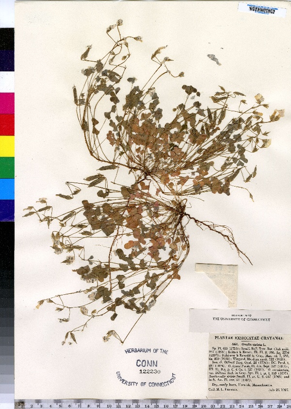
"dwc:specificEpithet": "stricta",
"dwc:countryCode": "US",
"dwc:county": "Barnstable County",
"dwc:recordedBy": "M.L. Fernald",
"dwc:georeferenceSources": "no date. Topozone. TopoZone.com © Maps a la carte, Inc. - All rights reserved.",
"dwc:order": "Geraniales",
"dwc:habitat": "Dry sandy loam",
"dwc:occurrenceID": "urn:catalog:UConn:CONN:CONN00046149",
"dwc:stateProvince": "Massachusetts",
"dwc:eventDate": "2027-07-26",
"dwc:country": "USA",
"dwc:collectionCode": "CONN",
"dwc:verbatimLatitude": "41°41' 10\" N",
"dwc:kingdom": "Dicotyledonae",
"dwc:decimalLatitude": "41.68611",
"dwc:basisOfRecord": "Preserved Specimen",
"dwc:genus": "Oxalis",
"dwc:family": "Oxalidaceae",
"dwc:coordinateUncertaintyInMeters": "5000",
"dwc:municipality": "Harwich",
"dwc:previousIdentifications": "Oxalis stricta L.",
"dwc:locationAccordingTo": "seconds added from gazetteer",
"dwc:locality": "Harwich",
"dwc:institutionCode": "UConn",
"dwc:reproductiveCondition": "flowering/fruiting",
"dwc:higherClassification": "Plantae; Dicotyledonae; Geraniales; Oxalidaceae",
"dwc:catalogNumber": "CONN00046149",
"dwc:higherGeography": "USA; Massachusetts; Barnstable County; Harwich",
"dwc:month": "7",
"dwc:decimalLongitude": "-70.07638",
"dwc:verbatimLongitude": "70°04' 35\" W",
"dwc:verbatimEventDate": "26-Jul-27",
"dwc:recordNumber": "464",
"dcterms:rights": "This work is licensed under a Creative Commons CCZero 1.0 License http://i.creativecommons.org/l/by-nc-sa/4.0/88x31.png",
"dcterms:modified": "2012-05-14T00:00-0500",
"dwc:scientificName": "Oxalis stricta L.",
"dwc:day": "26",
"dwc:datasetID": "24691",
"dwc:year": "1927"
},
"indexTerms": {
"geopoint": {
"lat": 41.68611,
"lon": -70.07638
},
"family": "oxalidaceae",
"recordset": "e70af26a-fb9e-43ab-96a0-d62a2df37e6d",
"dqs": 0.34782608695652173,
"stateprovince": "massachusetts",
"municipality": "harwich",
"county": "barnstable county",
"catalognumber": "conn00046149",
"startdayofyear": 207,
"specificepithet": "stricta",
"continent": "north america",
"uuid": "3c1fecef-d422-4b5a-9fa1-52f71111fa6e",
"countrycode": "usa",
"basisofrecord": "preservedspecimen",
"collector": "m.l. fernald",
"institutioncode": "uconn",
"mediarecords": [
"4d33edc4-1412-4d96-a427-d07a66313629"
],
"datecollected": "2027-07-26T00:00:00+00:00",
"etag": "f4adfa5f8b8a231e675a014e2b858661702e723c",
"recordnumber": "464",
"hasImage": true,
"kingdom": "dicotyledonae",
"highertaxon": "plantae; dicotyledonae; geraniales; oxalidaceae",
"scientificname": "oxalis stricta l.",
"indexData": {
"dwc:specificEpithet": "stricta",
"dwc:countryCode": "US",
"dwc:county": "Barnstable County",
"dwc:recordedBy": "M.L. Fernald",
"idigbio:uuid": "3c1fecef-d422-4b5a-9fa1-52f71111fa6e",
"dwc:georeferenceSources": "no date. Topozone. TopoZone.com © Maps a la carte, Inc. - All rights reserved.",
"dwc:order": "Geraniales",
"dwc:habitat": "Dry sandy loam",
"idigbio:isocountrycode": "usa",
"dwc:locality": "Harwich",
"idigbio:recordIds": [
"e70af26a-fb9e-43ab-96a0-d62a2df37e6d\\urn:catalog:uconn:conn:conn00046149"
],
"dwc:occurrenceID": "urn:catalog:UConn:CONN:CONN00046149",
"dwc:scientificName": "Oxalis stricta L.",
"idigbio:parent": "e70af26a-fb9e-43ab-96a0-d62a2df37e6d",
"dwc:stateProvince": "Massachusetts",
"dwc:eventDate": "2027-07-26",
"dwc:country": "united states",
"idigbio:etag": "f4adfa5f8b8a231e675a014e2b858661702e723c",
"dwc:collectionCode": "CONN",
"dwc:verbatimLatitude": "41°41' 10\" N",
"dwc:kingdom": "Dicotyledonae",
"dwc:decimalLatitude": "41.68611",
"dwc:basisOfRecord": "Preserved Specimen",
"dwc:genus": "Oxalis",
"dwc:continent": "north america",
"dwc:family": "Oxalidaceae",
"flag_dwc_continent_added": true,
"flag_dwc_country_replaced": true,
"dwc:municipality": "Harwich",
"dwc:previousIdentifications": "Oxalis stricta L.",
"idigbio:siblings": {
"mediarecord": [
"4d33edc4-1412-4d96-a427-d07a66313629"
]
},
"flag_idigbio_isocountrycode_added": true,
"idigbio:dateModified": "2014-09-09T04:51:24.761000",
"dwc:locationAccordingTo": "seconds added from gazetteer",
"dwc:institutionCode": "UConn",
"dwc:reproductiveCondition": "flowering/fruiting",
"dwc:higherClassification": "Plantae; Dicotyledonae; Geraniales; Oxalidaceae",
"dwc:catalogNumber": "CONN00046149",
"dwc:higherGeography": "USA; Massachusetts; Barnstable County; Harwich",
"dwc:month": "7",
"dwc:decimalLongitude": "-70.07638",
"dwc:verbatimLongitude": "70°04' 35\" W",
"dwc:verbatimEventDate": "26-Jul-27",
"dwc:recordNumber": "464",
"dcterms:rights": "This work is licensed under a Creative Commons CCZero 1.0 License http://i.creativecommons.org/l/by-nc-sa/4.0/88x31.png",
"flag_taxon_match_failed": true,
"dcterms:modified": "2012-05-14T00:00-0500",
"dwc:coordinateUncertaintyInMeters": "5000",
"dwc:day": "26",
"dwc:datasetID": "24691",
"dwc:year": "1927"
},
"hasMedia": true,
"coordinateuncertainty": 5000,
"datemodified": "2014-09-09T04:51:24.761000+00:00",
"occurrenceid": "urn:catalog:uconn:conn:conn00046149",
"country": "united states",
"locality": "harwich",
"collectioncode": "conn",
"eventdate": "2027-07-26",
"flags": [
"datecollected_bounds",
"geopoint_datum_missing",
"dwc_continent_added",
"dwc_country_replaced",
"idigbio_isocountrycode_added",
"taxon_match_failed"
],
"verbatimeventdate": "26-jul-27",
"recordids": [
"e70af26a-fb9e-43ab-96a0-d62a2df37e6d\\urn:catalog:uconn:conn:conn00046149"
],
"genus": "oxalis",
"order": "geraniales",
"datasetid": "24691"
},
"attribution": {
"totalCount": 172098
}
}