{
"uuid": "2a2cbb43-4282-4458-bb37-f86acada244b",
"type": "records",
"etag": "29efbbd11fb4e88061175665ec29c2c9d5192b18",
"data": {
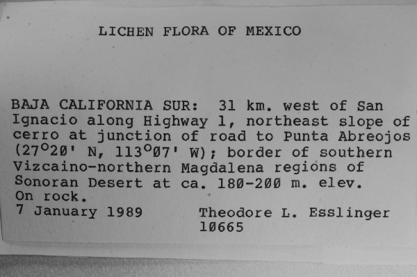
"dwc:verbatimCoordinates": "27°20'N, 113°07'W",
"dwc:recordedBy": "T.L. Esslinger",
"dwc:habitat": "On rock.",
"dwc:occurrenceID": "1567086",
"dwc:verbatimElevation": "180-200 m.",
"symbiota:recordEnteredBy": "zaalexander",
"dwc:stateProvince": "Baja California Sur",
"dwc:eventDate": "1989-01-07",
"dwc:collectionID": "8f07e9fb-8d26-49c1-8ce4-de648c7e7c0a",
"dwc:country": "Mexico",
"idigbio:recordId": "urn:uuid:25550120-cc79-4aaf-bde5-86c6d2ecc8ed",
"dwc:decimalLatitude": "27.33333",
"dwc:maximumElevationInMeters": "200",
"dwc:basisOfRecord": "PreservedSpecimen",
"dwc:genus": "Undetermined",
"dc:rights": "http://creativecommons.org/licenses/by-nc/3.0/",
"dcterms:references": "http://lichenportal.org/portal/collections/individual/index.php?occid=1567086",
"dwc:locality": "31 km. west of San. Ignacio along Highway 1, northeast slope of cerro at junction of road to Punta Abreojos; border of southern Vizcaino-northern Magdalena regions of Sonoran Desert at ca.",
"dwc:institutionCode": "TLE",
"dwc:catalogNumber": "0024315",
"dwc:decimalLongitude": "-113.11667",
"dwc:recordNumber": "10665",
"dwc:minimumElevationInMeters": "180",
"dcterms:modified": "2015-08-11 12:57:11",
"dwc:scientificName": "Undetermined"
},
"indexTerms": {
"recordset": "dfd53a42-8f63-4040-93a5-3f1347ce7686",
"dqs": 0.2608695652173913,
"stateprovince": "baja california sur",
"catalognumber": "0024315",
"startdayofyear": 7,
"collector": "t.l. esslinger",
"continent": "north america",
"uuid": "2a2cbb43-4282-4458-bb37-f86acada244b",
"countrycode": "mex",
"basisofrecord": "preservedspecimen",
"institutioncode": "tle",
"mediarecords": [
"cc406859-b1dc-4665-8932-ac6f5208bba8"
],
"datecollected": "1989-01-07T00:00:00+00:00",
"etag": "29efbbd11fb4e88061175665ec29c2c9d5192b18",
"recordnumber": "10665",
"minelevation": 180,
"hasImage": true,
"maxelevation": 200,
"collectionid": "8f07e9fb-8d26-49c1-8ce4-de648c7e7c0a",
"scientificname": "undetermined",
"locality": "31 km. west of san. ignacio along highway 1, northeast slope of cerro at junction of road to punta abreojos; border of southern vizcaino-northern magdalena regions of sonoran desert at ca.",
"hasMedia": true,
"datemodified": "2015-09-30T14:33:12.072129+00:00",
"occurrenceid": "1567086",
"country": "mexico",
"geopoint": {
"lat": 27.33333,
"lon": -113.11667
},
"flags": [
"geopoint_datum_missing",
"idigbio_isocountrycode_added",
"dwc_continent_added",
"taxon_match_failed"
],
"recordids": [
"urn:uuid:25550120-cc79-4aaf-bde5-86c6d2ecc8ed",
"dfd53a42-8f63-4040-93a5-3f1347ce7686\\1567086"
],
"genus": "undetermined",
"eventdate": "1989-01-07",
"indexData": {
"dwc:verbatimCoordinates": "27°20'N, 113°07'W",
"dwc:recordedBy": "T.L. Esslinger",
"idigbio:uuid": "2a2cbb43-4282-4458-bb37-f86acada244b",
"dwc:habitat": "On rock.",
"idigbio:recordIds": [
"urn:uuid:25550120-cc79-4aaf-bde5-86c6d2ecc8ed",
"dfd53a42-8f63-4040-93a5-3f1347ce7686\\1567086"
],
"dwc:occurrenceID": "1567086",
"dwc:verbatimElevation": "180-200 m.",
"symbiota:recordEnteredBy": "zaalexander",
"idigbio:parent": "dfd53a42-8f63-4040-93a5-3f1347ce7686",
"dwc:stateProvince": "Baja California Sur",
"dwc:eventDate": "1989-01-07",
"dwc:collectionID": "8f07e9fb-8d26-49c1-8ce4-de648c7e7c0a",
"dwc:country": "Mexico",
"idigbio:recordId": "urn:uuid:25550120-cc79-4aaf-bde5-86c6d2ecc8ed",
"idigbio:etag": "29efbbd11fb4e88061175665ec29c2c9d5192b18",
"dwc:decimalLatitude": "27.33333",
"dwc:maximumElevationInMeters": "200",
"dwc:basisOfRecord": "PreservedSpecimen",
"dwc:genus": "Undetermined",
"dwc:continent": "north america",
"dc:rights": "http://creativecommons.org/licenses/by-nc/3.0/",
"idigbio:siblings": {
"mediarecord": [
"cc406859-b1dc-4665-8932-ac6f5208bba8"
]
},
"flag_idigbio_isocountrycode_added": true,
"dcterms:references": "http://lichenportal.org/portal/collections/individual/index.php?occid=1567086",
"idigbio:dateModified": "2015-09-30T14:33:12.072129",
"dwc:locality": "31 km. west of San. Ignacio along Highway 1, northeast slope of cerro at junction of road to Punta Abreojos; border of southern Vizcaino-northern Magdalena regions of Sonoran Desert at ca.",
"dwc:institutionCode": "TLE",
"dwc:catalogNumber": "0024315",
"dwc:decimalLongitude": "-113.11667",
"flag_dwc_continent_added": true,
"dwc:recordNumber": "10665",
"idigbio:isocountrycode": "mex",
"flag_taxon_match_failed": true,
"dwc:minimumElevationInMeters": "180",
"dcterms:modified": "2015-08-11 12:57:11",
"dwc:scientificName": "Undetermined"
}
},
"attribution": {
"totalCount": 26072
}
}