{
"uuid": "27c89e21-14b6-4d2a-a21c-06c39822d32b",
"type": "records",
"etag": "b046b0e9611f0360f4b14bc8b19fee0bfe28249f",
"data": {
"dwc:startDayOfYear": "179",
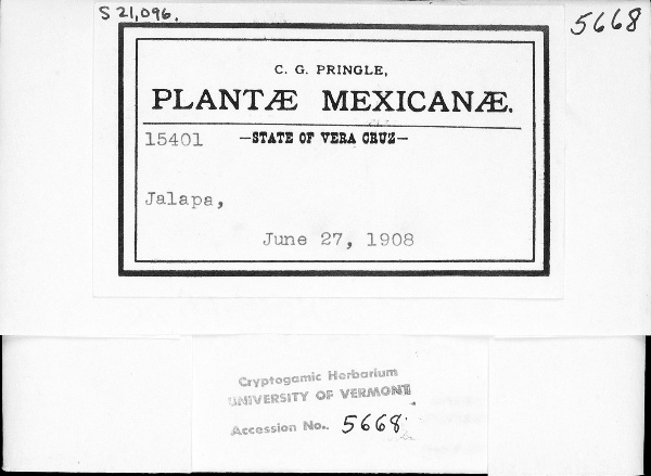
"dwc:recordedBy": "C. G. Pringle",
"dcterms:references": "https://lichenportal.org/cnalh/collections/individual/index.php?occid=1318690",
"dwc:occurrenceID": "27c89e21-14b6-4d2a-a21c-06c39822d32b",
"id": "1318690",
"symbiota:recordEnteredBy": "bmlyons",
"dwc:stateProvince": "Veracruz",
"dwc:eventDate": "1908-06-27",
"dwc:collectionID": "41350160-ae9d-4102-929d-be342457c1af",
"dwc:institutionCode": "VT",
"dwc:country": "Mexico",
"dwc:georeferenceRemarks": "Georeferenced to approximate center of Jalapa [Xalapa], Mexico.",
"dcterms:rightsHolder": "University of Vermont",
"dwc:decimalLatitude": "19.53745",
"dwc:georeferenceVerificationStatus": "Unreviewed",
"dwc:basisOfRecord": "PreservedSpecimen",
"dc:rights": "http://creativecommons.org/licenses/by-nc/3.0/",
"dwc:municipality": "Jalapa",
"symbiota:recordID": "27c89e21-14b6-4d2a-a21c-06c39822d32b",
"dwc:georeferenceSources": "Google Maps",
"dwc:geodeticDatum": "WGS84",
"dwc:catalogNumber": "UVMVT022647",
"dwc:month": "6",
"dwc:decimalLongitude": "-96.913848",
"dwc:coordinateUncertaintyInMeters": "6320",
"dwc:otherCatalogNumbers": "S21096",
"dwc:georeferencedBy": "Katie Webster",
"dwc:recordNumber": "15401",
"dwc:georeferenceProtocol": "GBIF Best Practices",
"dcterms:modified": "2016-05-25 10:46:12",
"dwc:scientificName": "unidentified",
"dwc:day": "27",
"dwc:year": "1908"
},
"indexTerms": {
"recordset": "fd14095c-3658-4e00-8cec-729a89459e92",
"dqs": 0.2463768115942029,
"stateprovince": "veracruz",
"municipality": "jalapa",
"catalognumber": "uvmvt022647",
"startdayofyear": 179,
"collector": "c. g. pringle",
"continent": "north america",
"uuid": "27c89e21-14b6-4d2a-a21c-06c39822d32b",
"countrycode": "mex",
"basisofrecord": "preservedspecimen",
"institutioncode": "vt",
"mediarecords": [
"8d1430e7-22aa-4f50-8892-270876eded04"
],
"datecollected": "1908-06-27T00:00:00+00:00",
"etag": "b046b0e9611f0360f4b14bc8b19fee0bfe28249f",
"recordnumber": "15401",
"hasImage": true,
"collectionid": "41350160-ae9d-4102-929d-be342457c1af",
"scientificname": "unidentified",
"indexData": {
"dwc:startDayOfYear": "179",
"dwc:recordedBy": "C. G. Pringle",
"idigbio:uuid": "27c89e21-14b6-4d2a-a21c-06c39822d32b",
"dcterms:references": "https://lichenportal.org/cnalh/collections/individual/index.php?occid=1318690",
"idigbio:recordIds": [
"urn:uuid:27c89e21-14b6-4d2a-a21c-06c39822d32b",
"fd14095c-3658-4e00-8cec-729a89459e92\\1318690",
"fd14095c-3658-4e00-8cec-729a89459e92\\27c89e21-14b6-4d2a-a21c-06c39822d32b"
],
"dwc:occurrenceID": "27c89e21-14b6-4d2a-a21c-06c39822d32b",
"id": "1318690",
"symbiota:recordEnteredBy": "bmlyons",
"idigbio:parent": "fd14095c-3658-4e00-8cec-729a89459e92",
"dwc:stateProvince": "Veracruz",
"dwc:eventDate": "1908-06-27",
"dwc:collectionID": "41350160-ae9d-4102-929d-be342457c1af",
"dwc:institutionCode": "VT",
"dwc:country": "Mexico",
"idigbio:etag": "b046b0e9611f0360f4b14bc8b19fee0bfe28249f",
"dwc:georeferenceRemarks": "Georeferenced to approximate center of Jalapa [Xalapa], Mexico.",
"dcterms:rightsHolder": "University of Vermont",
"dwc:decimalLatitude": "19.53745",
"dwc:georeferenceVerificationStatus": "Unreviewed",
"dwc:basisOfRecord": "PreservedSpecimen",
"dwc:continent": "north america",
"dc:rights": "http://creativecommons.org/licenses/by-nc/3.0/",
"dwc:municipality": "Jalapa",
"idigbio:siblings": {
"mediarecord": [
"8d1430e7-22aa-4f50-8892-270876eded04"
]
},
"symbiota:recordID": "27c89e21-14b6-4d2a-a21c-06c39822d32b",
"flag_idigbio_isocountrycode_added": true,
"idigbio:dateModified": "2023-01-11T04:00:09.531096",
"dwc:georeferenceSources": "Google Maps",
"dwc:geodeticDatum": "WGS84",
"dwc:catalogNumber": "UVMVT022647",
"dwc:month": "6",
"dwc:decimalLongitude": "-96.913848",
"dwc:scientificName": "unidentified",
"dwc:otherCatalogNumbers": "S21096",
"dwc:georeferencedBy": "Katie Webster",
"flag_dwc_continent_added": true,
"dwc:recordNumber": "15401",
"idigbio:isocountrycode": "mex",
"flag_taxon_match_failed": true,
"dwc:georeferenceProtocol": "GBIF Best Practices",
"dcterms:modified": "2016-05-25 10:46:12",
"dwc:coordinateUncertaintyInMeters": "6320",
"dwc:day": "27",
"dwc:year": "1908"
},
"hasMedia": true,
"coordinateuncertainty": 6320,
"datemodified": "2023-01-11T04:00:09.531096+00:00",
"occurrenceid": "27c89e21-14b6-4d2a-a21c-06c39822d32b",
"country": "mexico",
"geopoint": {
"lat": 19.53745,
"lon": -96.913848
},
"flags": [
"idigbio_isocountrycode_added",
"dwc_continent_added",
"taxon_match_failed"
],
"recordids": [
"urn:uuid:27c89e21-14b6-4d2a-a21c-06c39822d32b",
"fd14095c-3658-4e00-8cec-729a89459e92\\1318690",
"fd14095c-3658-4e00-8cec-729a89459e92\\27c89e21-14b6-4d2a-a21c-06c39822d32b"
],
"eventdate": "1908-06-27"
},
"attribution": {
"totalCount": 5161
}
}