{
"uuid": "119e9617-fb05-4195-b6b5-6ee4d18a11d7",
"type": "records",
"etag": "d46098ec6586160f82855f80e5d755988329987c",
"data": {
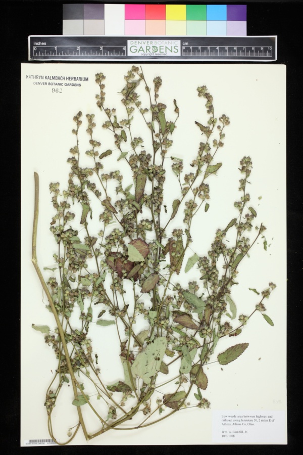
"dwc:startDayOfYear": "277",
"dwc:county": "Athens",
"dwc:recordedBy": "Wm. G. Gambill Jr.",
"dwc:georeferenceSources": "Google Earth",
"dcterms:references": "https://intermountainbiota.org/portal/collections/individual/index.php?occid=3817578",
"dcterms:accessRights": "Public Domain",
"dwc:occurrenceID": "6820ce70-2646-487b-9d63-37c83204496e",
"id": "3817578",
"symbiota:recordEnteredBy": "Michael Yost",
"dwc:stateProvince": "Ohio",
"dwc:eventDate": "1968-10-03",
"dwc:collectionID": "ca77be98-2a59-4aa9-bfc1-5ea615f2e6b7",
"dwc:institutionCode": "DBG",
"dwc:country": "USA",
"dwc:collectionCode": "KHD",
"dcterms:rightsHolder": "Public Domain",
"dwc:decimalLatitude": "39.33272",
"dwc:occurrenceRemarks": "No scientific name provided.",
"dwc:basisOfRecord": "PreservedSpecimen",
"dwc:georeferenceRemarks": "Highway 50. The railroad has been converted to a hiking trail.",
"dc:rights": "http://creativecommons.org/publicdomain/zero/1.0/",
"symbiota:recordID": "6820ce70-2646-487b-9d63-37c83204496e",
"dwc:habitat": "Low weedy area",
"dwc:locality": "Between highway and railroad along interstate 50, 2 mi. E of Athens.",
"dwc:geodeticDatum": "WGS84",
"dwc:catalogNumber": "KHD00050830",
"dwc:month": "10",
"dwc:decimalLongitude": "-82.044",
"dwc:otherCatalogNumbers": "962",
"dwc:georeferencedBy": "Sue Janssen",
"dwc:recordNumber": "s.n.",
"dcterms:modified": "2020-11-29 16:04:04",
"dwc:coordinateUncertaintyInMeters": "1000",
"dwc:day": "3",
"dwc:year": "1968"
},
"indexTerms": {
"recordset": "5835f642-2560-4e3e-9c25-741a12cc3fe8",
"dqs": 0.2608695652173913,
"stateprovince": "ohio",
"county": "athens",
"catalognumber": "khd00050830",
"startdayofyear": 277,
"collector": "wm. g. gambill jr.",
"continent": "north america",
"uuid": "119e9617-fb05-4195-b6b5-6ee4d18a11d7",
"countrycode": "usa",
"basisofrecord": "preservedspecimen",
"institutioncode": "dbg",
"mediarecords": [
"049d744c-e90d-4ea4-8b67-3308d95dd081"
],
"datecollected": "1968-10-03T00:00:00+00:00",
"etag": "d46098ec6586160f82855f80e5d755988329987c",
"recordnumber": "s.n.",
"hasImage": true,
"collectionid": "ca77be98-2a59-4aa9-bfc1-5ea615f2e6b7",
"locality": "between highway and railroad along interstate 50, 2 mi. e of athens.",
"hasMedia": true,
"coordinateuncertainty": 1000,
"datemodified": "2023-01-11T01:13:22.936454+00:00",
"occurrenceid": "6820ce70-2646-487b-9d63-37c83204496e",
"country": "united states",
"geopoint": {
"lat": 39.33272,
"lon": -82.044
},
"collectioncode": "khd",
"flags": [
"dwc_country_replaced",
"idigbio_isocountrycode_added",
"dwc_continent_added"
],
"recordids": [
"urn:uuid:6820ce70-2646-487b-9d63-37c83204496e",
"5835f642-2560-4e3e-9c25-741a12cc3fe8\\3817578",
"5835f642-2560-4e3e-9c25-741a12cc3fe8\\urn:uuid:6820ce70-2646-487b-9d63-37c83204496e",
"5835f642-2560-4e3e-9c25-741a12cc3fe8\\6820ce70-2646-487b-9d63-37c83204496e"
],
"eventdate": "1968-10-03",
"indexData": {
"dwc:startDayOfYear": "277",
"dwc:geodeticDatum": "WGS84",
"dwc:county": "Athens",
"dwc:recordedBy": "Wm. G. Gambill Jr.",
"idigbio:uuid": "119e9617-fb05-4195-b6b5-6ee4d18a11d7",
"dwc:locality": "Between highway and railroad along interstate 50, 2 mi. E of Athens.",
"dcterms:references": "https://intermountainbiota.org/portal/collections/individual/index.php?occid=3817578",
"dcterms:accessRights": "Public Domain",
"idigbio:recordIds": [
"urn:uuid:6820ce70-2646-487b-9d63-37c83204496e",
"5835f642-2560-4e3e-9c25-741a12cc3fe8\\3817578",
"5835f642-2560-4e3e-9c25-741a12cc3fe8\\urn:uuid:6820ce70-2646-487b-9d63-37c83204496e",
"5835f642-2560-4e3e-9c25-741a12cc3fe8\\6820ce70-2646-487b-9d63-37c83204496e"
],
"dwc:occurrenceID": "6820ce70-2646-487b-9d63-37c83204496e",
"id": "3817578",
"symbiota:recordEnteredBy": "Michael Yost",
"idigbio:parent": "5835f642-2560-4e3e-9c25-741a12cc3fe8",
"dwc:stateProvince": "Ohio",
"dwc:eventDate": "1968-10-03",
"dwc:collectionID": "ca77be98-2a59-4aa9-bfc1-5ea615f2e6b7",
"dwc:country": "united states",
"idigbio:etag": "d46098ec6586160f82855f80e5d755988329987c",
"dwc:collectionCode": "KHD",
"dcterms:rightsHolder": "Public Domain",
"dwc:decimalLatitude": "39.33272",
"dwc:occurrenceRemarks": "No scientific name provided.",
"dwc:basisOfRecord": "PreservedSpecimen",
"dwc:georeferenceRemarks": "Highway 50. The railroad has been converted to a hiking trail.",
"dwc:continent": "north america",
"dc:rights": "http://creativecommons.org/publicdomain/zero/1.0/",
"flag_dwc_country_replaced": true,
"idigbio:siblings": {
"mediarecord": [
"049d744c-e90d-4ea4-8b67-3308d95dd081"
]
},
"symbiota:recordID": "6820ce70-2646-487b-9d63-37c83204496e",
"flag_idigbio_isocountrycode_added": true,
"dwc:habitat": "Low weedy area",
"idigbio:dateModified": "2023-01-11T01:13:22.936454",
"dwc:georeferenceSources": "Google Earth",
"dwc:institutionCode": "DBG",
"dwc:catalogNumber": "KHD00050830",
"dwc:month": "10",
"dwc:decimalLongitude": "-82.044",
"dwc:otherCatalogNumbers": "962",
"dwc:georeferencedBy": "Sue Janssen",
"flag_dwc_continent_added": true,
"dwc:recordNumber": "s.n.",
"idigbio:isocountrycode": "usa",
"dcterms:modified": "2020-11-29 16:04:04",
"dwc:coordinateUncertaintyInMeters": "1000",
"dwc:day": "3",
"dwc:year": "1968"
}
},
"attribution": {
"totalCount": 78349
}
}