{
"uuid": "0e26ac1e-0cfd-4f5c-9e11-249e8511dc08",
"type": "records",
"etag": "2aca41a1a878951063ffcf46c75860ceb64e420c",
"data": {
"dwc:startDayOfYear": "112",
"dwc:verbatimCoordinates": "34d 12m 17.3s N; 111d 53m 8.9s W",
"dwc:county": "Yavapai County",
"dwc:recordedBy": "Wendy C. Hodgson",
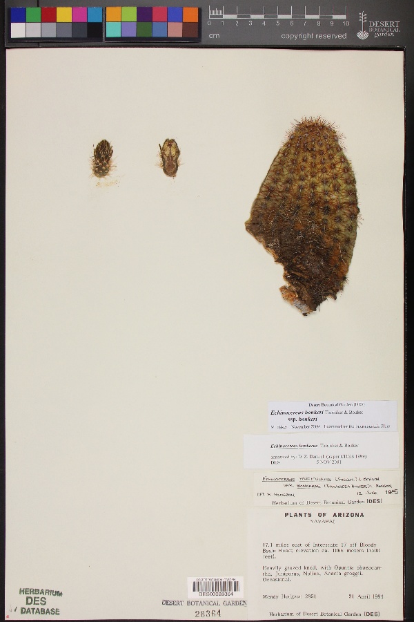
"dwc:habitat": "Heavily grazed knoll.",
"dwc:occurrenceID": "25c3ab5c-54a2-4cee-a61e-cca3b1c154bd",
"dwc:verbatimElevation": "3496ft.",
"id": "2040767",
"dwc:taxonID": "5571",
"dwc:stateProvince": "Arizona",
"dwc:eventDate": "1984-04-21",
"dwc:collectionID": "edb9860c-c481-4d19-88cc-224a536ebcd4",
"dwc:country": "USA",
"dwc:kingdom": "Plantae",
"dwc:decimalLatitude": "34.204806",
"dwc:basisOfRecord": "PreservedSpecimen",
"dc:rights": "http://creativecommons.org/licenses/by-nc/3.0/",
"dwc:identifiedBy": "D. Z. Damrel",
"symbiota:recordID": "25c3ab5c-54a2-4cee-a61e-cca3b1c154bd",
"dcterms:references": "https://swbiodiversity.org/seinet/collections/individual/index.php?occid=2040767",
"dwc:locality": "17.1 miles east of Interstate 17 off Bloody Basin Road.",
"dwc:institutionCode": "DES",
"dwc:taxonRank": "Kingdom",
"dwc:higherClassification": "Plantae",
"dwc:catalogNumber": "DES00028364",
"dwc:Identification": [
{
"coreid": "2040767",
"dwc:identifiedBy": "D. Z. Damrel",
"dcterms:modified": "2011-08-17 15:37:24",
"idigbio:recordID": "urn:uuid:a4cb416c-8b00-428c-9449-5e8525208dd0",
"dwc:scientificName": "Plantae"
}
],
"dwc:month": "4",
"dwc:decimalLongitude": "-111.885806",
"dwc:scientificName": "Plantae",
"dwc:recordNumber": "2851",
"dwc:minimumElevationInMeters": "1066",
"dcterms:modified": "2015-01-06 12:31:47",
"dwc:associatedTaxa": "Opuntia phaeacantha, Juniperus, Nolina, Acacia greggii.",
"dwc:day": "21",
"dwc:year": "1984"
},
"indexTerms": {
"recordset": "c569e530-7322-40b8-9b66-1e0ed96fefcb",
"dqs": 0.30434782608695654,
"stateprovince": "arizona",
"county": "yavapai county",
"catalognumber": "des00028364",
"startdayofyear": 112,
"taxonrank": "kingdom",
"collector": "wendy c. hodgson",
"continent": "north america",
"uuid": "0e26ac1e-0cfd-4f5c-9e11-249e8511dc08",
"countrycode": "usa",
"basisofrecord": "preservedspecimen",
"institutioncode": "des",
"mediarecords": [
"d09d3d24-522d-4d68-af7e-cbe01c5a678f"
],
"datecollected": "1984-04-21T00:00:00+00:00",
"etag": "2aca41a1a878951063ffcf46c75860ceb64e420c",
"recordnumber": "2851",
"minelevation": 1066,
"hasImage": true,
"kingdom": "plantae",
"highertaxon": "plantae",
"collectionid": "edb9860c-c481-4d19-88cc-224a536ebcd4",
"taxonid": "5571",
"scientificname": "plantae",
"locality": "17.1 miles east of interstate 17 off bloody basin road.",
"hasMedia": true,
"datemodified": "2022-12-06T22:03:37.426550+00:00",
"occurrenceid": "25c3ab5c-54a2-4cee-a61e-cca3b1c154bd",
"country": "united states",
"geopoint": {
"lat": 34.204806,
"lon": -111.885806
},
"flags": [
"geopoint_datum_missing",
"dwc_country_replaced",
"idigbio_isocountrycode_added",
"dwc_continent_added"
],
"recordids": [
"urn:uuid:25c3ab5c-54a2-4cee-a61e-cca3b1c154bd",
"c569e530-7322-40b8-9b66-1e0ed96fefcb\\2040767",
"c569e530-7322-40b8-9b66-1e0ed96fefcb\\urn:uuid:25c3ab5c-54a2-4cee-a61e-cca3b1c154bd",
"c569e530-7322-40b8-9b66-1e0ed96fefcb\\25c3ab5c-54a2-4cee-a61e-cca3b1c154bd"
],
"eventdate": "1984-04-21",
"indexData": {
"dwc:startDayOfYear": "112",
"flag_dwc_country_replaced": true,
"dwc:verbatimCoordinates": "34d 12m 17.3s N; 111d 53m 8.9s W",
"dwc:county": "Yavapai County",
"dwc:recordedBy": "Wendy C. Hodgson",
"idigbio:uuid": "0e26ac1e-0cfd-4f5c-9e11-249e8511dc08",
"dwc:habitat": "Heavily grazed knoll.",
"idigbio:recordIds": [
"urn:uuid:25c3ab5c-54a2-4cee-a61e-cca3b1c154bd",
"c569e530-7322-40b8-9b66-1e0ed96fefcb\\2040767",
"c569e530-7322-40b8-9b66-1e0ed96fefcb\\urn:uuid:25c3ab5c-54a2-4cee-a61e-cca3b1c154bd",
"c569e530-7322-40b8-9b66-1e0ed96fefcb\\25c3ab5c-54a2-4cee-a61e-cca3b1c154bd"
],
"dwc:occurrenceID": "25c3ab5c-54a2-4cee-a61e-cca3b1c154bd",
"dwc:verbatimElevation": "3496ft.",
"id": "2040767",
"dwc:taxonID": "5571",
"idigbio:parent": "c569e530-7322-40b8-9b66-1e0ed96fefcb",
"dwc:stateProvince": "Arizona",
"dwc:eventDate": "1984-04-21",
"dwc:collectionID": "edb9860c-c481-4d19-88cc-224a536ebcd4",
"dwc:country": "united states",
"idigbio:etag": "2aca41a1a878951063ffcf46c75860ceb64e420c",
"dwc:kingdom": "Plantae",
"dwc:decimalLatitude": "34.204806",
"dwc:basisOfRecord": "PreservedSpecimen",
"dwc:continent": "north america",
"dc:rights": "http://creativecommons.org/licenses/by-nc/3.0/",
"dwc:identifiedBy": "D. Z. Damrel",
"idigbio:siblings": {
"mediarecord": [
"d09d3d24-522d-4d68-af7e-cbe01c5a678f"
]
},
"symbiota:recordID": "25c3ab5c-54a2-4cee-a61e-cca3b1c154bd",
"flag_idigbio_isocountrycode_added": true,
"dcterms:references": "https://swbiodiversity.org/seinet/collections/individual/index.php?occid=2040767",
"idigbio:dateModified": "2022-12-06T22:03:37.426550",
"dwc:locality": "17.1 miles east of Interstate 17 off Bloody Basin Road.",
"dwc:institutionCode": "DES",
"dwc:taxonRank": "Kingdom",
"dwc:higherClassification": "Plantae",
"dwc:catalogNumber": "DES00028364",
"dwc:Identification": [
{
"coreid": "2040767",
"dwc:identifiedBy": "D. Z. Damrel",
"dcterms:modified": "2011-08-17 15:37:24",
"idigbio:recordID": "urn:uuid:a4cb416c-8b00-428c-9449-5e8525208dd0",
"dwc:scientificName": "Plantae"
}
],
"dwc:month": "4",
"dwc:decimalLongitude": "-111.885806",
"dwc:associatedTaxa": "Opuntia phaeacantha, Juniperus, Nolina, Acacia greggii.",
"flag_dwc_continent_added": true,
"dwc:recordNumber": "2851",
"idigbio:isocountrycode": "usa",
"dwc:minimumElevationInMeters": "1066",
"dcterms:modified": "2015-01-06 12:31:47",
"dwc:scientificName": "Plantae",
"dwc:day": "21",
"dwc:year": "1984"
}
},
"attribution": {
"totalCount": 94693
}
}