{
"uuid": "078a852d-963d-4fae-951a-cf4cf58fd7d2",
"type": "records",
"etag": "75e05b4b75ac1a1665c528a4240a51609354d732",
"data": {
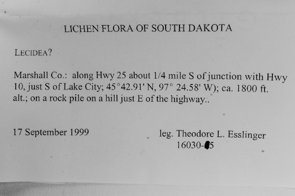
"dwc:verbatimCoordinates": "45° 42.91' N 97° 24.58' W",
"dwc:county": "Marshall",
"dwc:recordedBy": "Theodore L. Esslineer",
"dwc:order": "Lecanoromycetidae, families incertae sedis",
"dcterms:references": "http://lichenportal.org/portal/collections/individual/index.php?occid=1553226",
"dwc:scientificNameAuthorship": "Ach.",
"dwc:occurrenceID": "1553226",
"dwc:verbatimElevation": "ca. 1800 ft.",
"symbiota:recordEnteredBy": "tnash",
"dwc:stateProvince": "South Dakota",
"dwc:eventDate": "1999-09-17",
"dwc:collectionID": "8f07e9fb-8d26-49c1-8ce4-de648c7e7c0a",
"dwc:country": "United States",
"idigbio:recordId": "urn:uuid:e2f4e55d-d80a-4c0a-a85c-e493bcd43e11",
"dwc:kingdom": "Fungi",
"dwc:decimalLatitude": "45.715167",
"dwc:basisOfRecord": "PreservedSpecimen",
"dwc:genus": "Lecidea",
"dwc:family": "Lecideaceae",
"dc:rights": "http://creativecommons.org/licenses/by-nc/3.0/",
"dwc:phylum": "Ascomycota",
"dwc:habitat": "on a hill just E of the highway; rock pile",
"dwc:locality": "along Hwy 25 about 1/4 mile S of junction with Hwy 10, just S of Lake City",
"dwc:institutionCode": "TLE",
"dwc:class": "Lecanoromycetes",
"dwc:catalogNumber": "0015061",
"dwc:decimalLongitude": "-97.409667",
"dwc:recordNumber": "16030-5",
"dwc:identificationQualifier": "cf",
"dwc:minimumElevationInMeters": "549",
"dcterms:modified": "2015-08-11 12:57:11",
"dwc:scientificName": "Lecidea"
},
"indexTerms": {
"geopoint": {
"lat": 45.715167,
"lon": -97.409667
},
"family": "lecideaceae",
"recordset": "dfd53a42-8f63-4040-93a5-3f1347ce7686",
"dqs": 0.2463768115942029,
"stateprovince": "south dakota",
"county": "marshall",
"phylum": "ascomycota",
"catalognumber": "0015061",
"startdayofyear": 260,
"taxonrank": "genus",
"collector": "theodore l. esslineer",
"continent": "north america",
"uuid": "078a852d-963d-4fae-951a-cf4cf58fd7d2",
"countrycode": "usa",
"basisofrecord": "preservedspecimen",
"institutioncode": "tle",
"mediarecords": [
"c046abfe-6392-4fad-b3d6-a915789ebf02"
],
"datemodified": "2015-09-30T14:33:12.072129+00:00",
"datecollected": "1999-09-17T00:00:00+00:00",
"etag": "75e05b4b75ac1a1665c528a4240a51609354d732",
"recordnumber": "16030-5",
"minelevation": 549,
"hasImage": true,
"kingdom": "fungi",
"collectionid": "8f07e9fb-8d26-49c1-8ce4-de648c7e7c0a",
"taxonid": "2569865",
"scientificname": "lecidea",
"indexData": {
"flag_dwc_taxonrank_added": true,
"dwc:multimedia": [
{
"dcterms:license": "creative commons attribution share alike 3.0 unported",
"dcterms:title": "lecidea fuscoatra",
"dcterms:references": "http://commons.wikimedia.org/wiki/file:lecidea_fuscoatra_98284.jpg",
"coreid": "2569865",
"dcterms:identifier": "http://upload.wikimedia.org/wikipedia/commons/3/3e/lecidea_fuscoatra_98284.jpg",
"dcterms:source": "english wikipedia - species pages",
"dcterms:description": "english: the lichen lecidea fuscoatra (l.) ach. specimen photographed in mount wilson, san gabriel mountains, los angeles co., california, usa. notes: \"on shaded granitic outcrop in forest near top of ridge around 4500’\"",
"dcterms:creator": "jason hollinger",
"dcterms:publisher": "wikimedia commons"
}
],
"dwc:verbatimCoordinates": "45° 42.91' N 97° 24.58' W",
"idigbio:dateModified": "2015-09-30T14:33:12.072129",
"dwc:county": "Marshall",
"dwc:recordedBy": "Theodore L. Esslineer",
"idigbio:uuid": "078a852d-963d-4fae-951a-cf4cf58fd7d2",
"flag_dwc_multimedia_added": true,
"dwc:order": "lecanorales",
"dcterms:references": "http://lichenportal.org/portal/collections/individual/index.php?occid=1553226",
"dwc:scientificNameAuthorship": "Ach.",
"idigbio:recordIds": [
"urn:uuid:e2f4e55d-d80a-4c0a-a85c-e493bcd43e11",
"dfd53a42-8f63-4040-93a5-3f1347ce7686\\1553226"
],
"dwc:occurrenceID": "1553226",
"flag_gbif_canonicalname_added": true,
"dwc:verbatimElevation": "ca. 1800 ft.",
"flag_dwc_taxonomicstatus_added": true,
"flag_gbif_genericname_added": true,
"symbiota:recordEnteredBy": "tnash",
"flag_dwc_datasetid_added": true,
"idigbio:parent": "dfd53a42-8f63-4040-93a5-3f1347ce7686",
"dwc:stateProvince": "South Dakota",
"dwc:datasetid": "7ddf754f-d193-4cc9-b351-99906754a03b",
"dwc:eventDate": "1999-09-17",
"dwc:collectionID": "8f07e9fb-8d26-49c1-8ce4-de648c7e7c0a",
"dwc:country": "United States",
"idigbio:recordId": "urn:uuid:e2f4e55d-d80a-4c0a-a85c-e493bcd43e11",
"idigbio:etag": "75e05b4b75ac1a1665c528a4240a51609354d732",
"flag_gbif_vernacularname_added": true,
"dwc:kingdom": "Fungi",
"dwc:decimalLatitude": "45.715167",
"dwc:basisOfRecord": "PreservedSpecimen",
"dwc:taxonomicstatus": "accepted",
"dwc:genus": "Lecidea",
"dwc:continent": "north america",
"dwc:family": "Lecideaceae",
"dc:rights": "http://creativecommons.org/licenses/by-nc/3.0/",
"flag_dwc_parentnameusageid_added": true,
"flag_dwc_taxonid_added": true,
"idigbio:isocountrycode": "usa",
"idigbio:siblings": {
"mediarecord": [
"c046abfe-6392-4fad-b3d6-a915789ebf02"
]
},
"flag_idigbio_isocountrycode_added": true,
"gbif:canonicalname": "lecidea",
"dwc:phylum": "Ascomycota",
"dwc:habitat": "on a hill just E of the highway; rock pile",
"gbif:genericname": "lecidea",
"dwc:locality": "along Hwy 25 about 1/4 mile S of junction with Hwy 10, just S of Lake City",
"dwc:institutionCode": "TLE",
"flag_gbif_taxon_corrected": true,
"dwc:parentnameusageid": "8296",
"dwc:class": "Lecanoromycetes",
"dwc:catalogNumber": "0015061",
"dwc:taxonid": "2569865",
"dwc:taxonrank": "genus",
"dwc:decimalLongitude": "-97.409667",
"flag_dwc_order_replaced": true,
"flag_dwc_continent_added": true,
"dwc:recordNumber": "16030-5",
"dwc:identificationQualifier": "cf",
"flag_taxon_match_failed": true,
"dwc:minimumElevationInMeters": "549",
"dcterms:modified": "2015-08-11 12:57:11",
"dwc:scientificName": "Lecidea",
"gbif:vernacularname": [
{
"dwc:countrycode": "be",
"dwc:country": "belgium",
"dwc:vernacularname": "granietkorst",
"coreid": "2569865",
"dcterms:source": "belgian species list",
"dcterms:language": "nl"
}
]
},
"hasMedia": true,
"class": "lecanoromycetes",
"occurrenceid": "1553226",
"country": "united states",
"locality": "along hwy 25 about 1/4 mile s of junction with hwy 10, just s of lake city",
"canonicalname": "lecidea",
"eventdate": "1999-09-17",
"flags": [
"geopoint_datum_missing",
"dwc_taxonrank_added",
"dwc_multimedia_added",
"gbif_canonicalname_added",
"dwc_taxonomicstatus_added",
"gbif_genericname_added",
"dwc_datasetid_added",
"gbif_vernacularname_added",
"dwc_parentnameusageid_added",
"dwc_taxonid_added",
"idigbio_isocountrycode_added",
"gbif_taxon_corrected",
"dwc_order_replaced",
"dwc_continent_added",
"taxon_match_failed"
],
"taxonomicstatus": "accepted",
"recordids": [
"urn:uuid:e2f4e55d-d80a-4c0a-a85c-e493bcd43e11",
"dfd53a42-8f63-4040-93a5-3f1347ce7686\\1553226"
],
"genus": "lecidea",
"order": "lecanorales",
"datasetid": "7ddf754f-d193-4cc9-b351-99906754a03b"
},
"attribution": {
"totalCount": 26072
}
}