{
"uuid": "0399b13f-a2e8-43f5-9ef9-17e3ab96e781",
"type": "records",
"etag": "1c89d4206679d8fdf8fc218bfca3ab32a97d5497",
"data": {
"dwc:startDayOfYear": "96",
"dwc:recordedBy": "A. Liston; A. Danin",
"dwc:georeferenceSources": "georef batch tool 2013-09-09; GeoLocate",
"dcterms:references": "https://swbiodiversity.org/seinet/collections/individual/index.php?occid=3081329",
"dwc:occurrenceID": "8b51409a-5877-40ca-a87a-f17470595738",
"id": "3081329",
"dwc:eventDate": "1983-04-06",
"dwc:collectionID": "edb9860c-c481-4d19-88cc-224a536ebcd4",
"dwc:country": "Israel",
"symbiota:recordEnteredBy": "Jmurphy",
"dwc:decimalLatitude": "30.69033",
"dwc:georeferenceVerificationStatus": "reviewed - high confidence",
"dwc:basisOfRecord": "PreservedSpecimen",
"dc:rights": "http://creativecommons.org/licenses/by-nc/3.0/",
"symbiota:recordID": "8b51409a-5877-40ca-a87a-f17470595738",
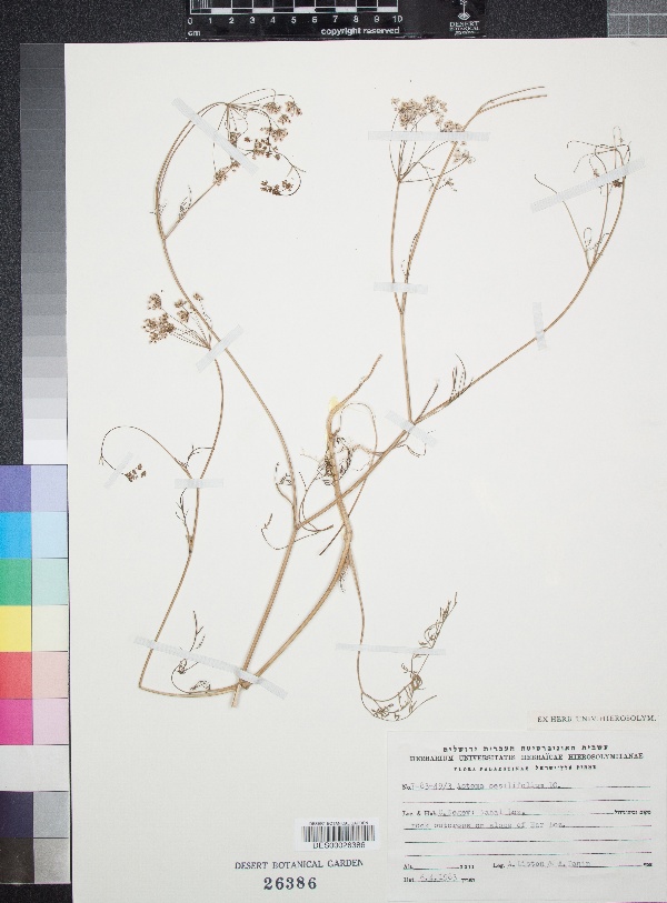
"dwc:habitat": "Rock outcrops on slope of Har Loz.",
"dwc:locality": "C. Negev: Nahal Loz.",
"dwc:institutionCode": "DES",
"dwc:reproductiveCondition": "Flowering",
"dwc:catalogNumber": "DES00026386",
"dwc:month": "4",
"dwc:decimalLongitude": "34.614687",
"dwc:georeferencedBy": "Velia M",
"dwc:recordNumber": "7-83-49/3",
"dcterms:modified": "2017-05-06 14:21:13",
"dwc:coordinateUncertaintyInMeters": "10000",
"dwc:day": "6",
"dwc:year": "1983"
},
"indexTerms": {
"recordset": "c569e530-7322-40b8-9b66-1e0ed96fefcb",
"dqs": 0.21739130434782608,
"catalognumber": "des00026386",
"startdayofyear": 96,
"collector": "a. liston; a. danin",
"continent": "asia",
"uuid": "0399b13f-a2e8-43f5-9ef9-17e3ab96e781",
"countrycode": "isr",
"basisofrecord": "preservedspecimen",
"institutioncode": "des",
"mediarecords": [
"fbe0e157-75b1-4c32-8dd6-20e0e872fa46"
],
"datecollected": "1983-04-06T00:00:00+00:00",
"etag": "1c89d4206679d8fdf8fc218bfca3ab32a97d5497",
"recordnumber": "7-83-49/3",
"hasImage": true,
"collectionid": "edb9860c-c481-4d19-88cc-224a536ebcd4",
"locality": "c. negev: nahal loz.",
"hasMedia": true,
"coordinateuncertainty": 10000,
"datemodified": "2022-12-06T22:03:37.426550+00:00",
"occurrenceid": "8b51409a-5877-40ca-a87a-f17470595738",
"country": "israel",
"geopoint": {
"lat": 30.69033,
"lon": 34.614687
},
"flags": [
"geopoint_datum_missing",
"idigbio_isocountrycode_added",
"dwc_continent_added"
],
"recordids": [
"urn:uuid:8b51409a-5877-40ca-a87a-f17470595738",
"c569e530-7322-40b8-9b66-1e0ed96fefcb\\3081329",
"c569e530-7322-40b8-9b66-1e0ed96fefcb\\urn:uuid:8b51409a-5877-40ca-a87a-f17470595738",
"c569e530-7322-40b8-9b66-1e0ed96fefcb\\8b51409a-5877-40ca-a87a-f17470595738"
],
"eventdate": "1983-04-06",
"indexData": {
"dwc:startDayOfYear": "96",
"dwc:recordedBy": "A. Liston; A. Danin",
"idigbio:uuid": "0399b13f-a2e8-43f5-9ef9-17e3ab96e781",
"dwc:locality": "C. Negev: Nahal Loz.",
"dwc:habitat": "Rock outcrops on slope of Har Loz.",
"idigbio:recordIds": [
"urn:uuid:8b51409a-5877-40ca-a87a-f17470595738",
"c569e530-7322-40b8-9b66-1e0ed96fefcb\\3081329",
"c569e530-7322-40b8-9b66-1e0ed96fefcb\\urn:uuid:8b51409a-5877-40ca-a87a-f17470595738",
"c569e530-7322-40b8-9b66-1e0ed96fefcb\\8b51409a-5877-40ca-a87a-f17470595738"
],
"dwc:occurrenceID": "8b51409a-5877-40ca-a87a-f17470595738",
"symbiota:recordEnteredBy": "Jmurphy",
"idigbio:parent": "c569e530-7322-40b8-9b66-1e0ed96fefcb",
"dwc:eventDate": "1983-04-06",
"dwc:collectionID": "edb9860c-c481-4d19-88cc-224a536ebcd4",
"dwc:country": "Israel",
"idigbio:etag": "1c89d4206679d8fdf8fc218bfca3ab32a97d5497",
"id": "3081329",
"dwc:decimalLatitude": "30.69033",
"dwc:georeferenceVerificationStatus": "reviewed - high confidence",
"dwc:basisOfRecord": "PreservedSpecimen",
"dwc:continent": "asia",
"dc:rights": "http://creativecommons.org/licenses/by-nc/3.0/",
"idigbio:siblings": {
"mediarecord": [
"fbe0e157-75b1-4c32-8dd6-20e0e872fa46"
]
},
"symbiota:recordID": "8b51409a-5877-40ca-a87a-f17470595738",
"flag_idigbio_isocountrycode_added": true,
"dcterms:references": "https://swbiodiversity.org/seinet/collections/individual/index.php?occid=3081329",
"idigbio:dateModified": "2022-12-06T22:03:37.426550",
"dwc:georeferenceSources": "georef batch tool 2013-09-09; GeoLocate",
"dwc:institutionCode": "DES",
"dwc:reproductiveCondition": "Flowering",
"dwc:catalogNumber": "DES00026386",
"dwc:month": "4",
"dwc:decimalLongitude": "34.614687",
"dwc:georeferencedBy": "Velia M",
"flag_dwc_continent_added": true,
"dwc:recordNumber": "7-83-49/3",
"idigbio:isocountrycode": "isr",
"dcterms:modified": "2017-05-06 14:21:13",
"dwc:coordinateUncertaintyInMeters": "10000",
"dwc:day": "6",
"dwc:year": "1983"
}
},
"attribution": {
"totalCount": 94693
}
}